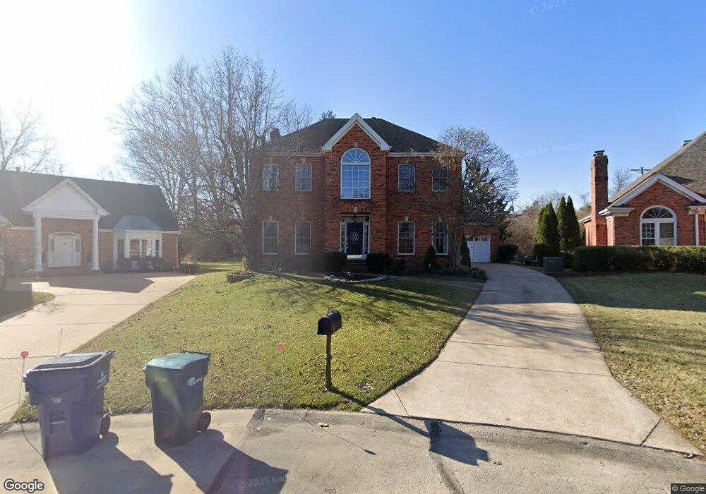
1300 Bansbach Rd Saint Louis, MO 63131
Estimated Value: $804,000 - $1,016,000
4
Beds
3
Baths
3,028
Sq Ft
$304/Sq Ft
Est. Value
About This Home
This home is located at 1300 Bansbach Rd, Saint Louis, MO 63131 and is currently estimated at $921,593, approximately $304 per square foot. 1300 Bansbach Rd is a home located in St. Louis County with nearby schools including Westchester Elementary School, North Kirkwood Middle School, and Kirkwood Senior High School.
Ownership History
Date
Name
Owned For
Owner Type
Purchase Details
Closed on
Aug 26, 2022
Sold by
Mccartney Michael P
Bought by
Mccartney Margaret M
Current Estimated Value
Purchase Details
Closed on
Nov 27, 2002
Sold by
Nashed Rafat S and Nashed Rayanne A
Bought by
Mccartney Michael P and Mccartney Margaret M
Home Financials for this Owner
Home Financials are based on the most recent Mortgage that was taken out on this home.
Original Mortgage
$406,400
Interest Rate
5.37%
Purchase Details
Closed on
Sep 17, 1997
Sold by
Radley Jeffrey and Radley Marisa
Bought by
Nashed Rafat S and Nashed Rayanne A
Home Financials for this Owner
Home Financials are based on the most recent Mortgage that was taken out on this home.
Original Mortgage
$297,500
Interest Rate
7.23%
Mortgage Type
Assumption
Create a Home Valuation Report for This Property
The Home Valuation Report is an in-depth analysis detailing your home's value as well as a comparison with similar homes in the area
Home Values in the Area
Average Home Value in this Area
Purchase History
| Date | Buyer | Sale Price | Title Company |
|---|---|---|---|
| Mccartney Margaret M | -- | None Listed On Document | |
| Mccartney Michael P | $508,000 | -- | |
| Nashed Rafat S | -- | -- |
Source: Public Records
Mortgage History
| Date | Status | Borrower | Loan Amount |
|---|---|---|---|
| Previous Owner | Mccartney Michael P | $406,400 | |
| Previous Owner | Nashed Rafat S | $297,500 | |
| Closed | Mccartney Michael P | $76,200 |
Source: Public Records
Tax History Compared to Growth
Tax History
| Year | Tax Paid | Tax Assessment Tax Assessment Total Assessment is a certain percentage of the fair market value that is determined by local assessors to be the total taxable value of land and additions on the property. | Land | Improvement |
|---|---|---|---|---|
| 2025 | $8,447 | $170,850 | $60,860 | $109,990 |
| 2024 | $8,447 | $146,190 | $43,170 | $103,020 |
| 2023 | $8,316 | $146,190 | $43,170 | $103,020 |
| 2022 | $7,615 | $124,760 | $43,170 | $81,590 |
| 2021 | $7,533 | $124,760 | $43,170 | $81,590 |
| 2020 | $7,614 | $121,240 | $39,860 | $81,380 |
| 2019 | $7,624 | $121,240 | $39,860 | $81,380 |
| 2018 | $7,270 | $103,720 | $24,340 | $79,380 |
| 2017 | $7,289 | $103,720 | $24,340 | $79,380 |
| 2016 | $5,883 | $84,720 | $20,860 | $63,860 |
| 2015 | $5,890 | $84,720 | $20,860 | $63,860 |
| 2014 | $5,289 | $74,310 | $8,270 | $66,040 |
Source: Public Records
Map
Nearby Homes
- 1090 Kinstern Dr
- 1029 Kinstern Dr
- 1126 Bopp Rd
- 918 N Ballas Rd
- 11913 Lillian Ave
- 12006 Montour Dr
- 11909 Lillian Ave
- 12224 TBB Roger Ln
- 8 Briarbrook Trail
- 1345 Woodgate Dr
- 1238 Woodgate Dr
- 811 Cherry St
- 12439 Springdale Ln Unit TBB
- 1710 Lynkirk Ln
- 1001 Dovergate Dr
- 2000 Trailcrest Ln Unit 3
- 723 Oak Valley Dr
- 1728 Folkstone Dr
- 2037 Trailcrest Ln Unit 7
- 12213 Brook Springs Ct
- 1304 Bansbach Rd
- 1301 Christine Ave
- 1308 Bansbach Rd
- 1300 Christine Ave
- 1303 Bansbach Rd
- 1312 Bansbach Rd
- 1304 Christine Ave
- 1305 Christine Ave
- 5 Woodbridge Park Rd
- 1315 Christine Ave
- 11948 Paradise Ln
- 11952 Paradise Ln
- 1322 Bansbach Rd
- 6 Woodbridge Park Rd
- 12030 Manchester Rd
- 1318 Christine Ave
- 4 Woodbridge Park Rd
- 11944 Paradise Ln
- 11949 Paradise Ln
- 1323 Christine Ave