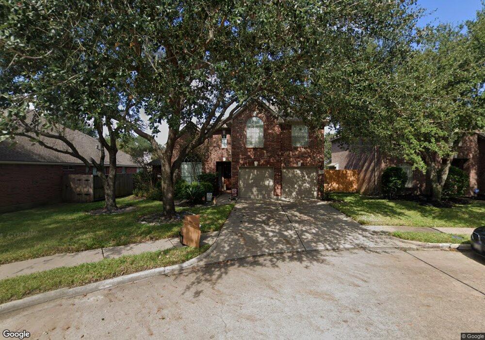
13006 Bretford Ct Unit 1 Houston, TX 77065
Estimated Value: $334,339 - $347,000
4
Beds
3
Baths
2,547
Sq Ft
$133/Sq Ft
Est. Value
About This Home
This home is located at 13006 Bretford Ct Unit 1, Houston, TX 77065 and is currently estimated at $339,335, approximately $133 per square foot. 13006 Bretford Ct Unit 1 is a home located in Harris County with nearby schools including Adam Elementary School, Arnold Middle School, and Cy-Fair High School.
Ownership History
Date
Name
Owned For
Owner Type
Purchase Details
Closed on
Jun 14, 2004
Sold by
Weo Andrea J Wies and Wies John G
Bought by
Zavala Marco A and Zavala Emily
Current Estimated Value
Home Financials for this Owner
Home Financials are based on the most recent Mortgage that was taken out on this home.
Original Mortgage
$128,950
Outstanding Balance
$63,542
Interest Rate
6.12%
Mortgage Type
Purchase Money Mortgage
Estimated Equity
$275,793
Purchase Details
Closed on
Jul 27, 2001
Sold by
Mhi Partnership Ltd
Bought by
Wilson Andrea J
Home Financials for this Owner
Home Financials are based on the most recent Mortgage that was taken out on this home.
Original Mortgage
$157,250
Interest Rate
7.07%
Create a Home Valuation Report for This Property
The Home Valuation Report is an in-depth analysis detailing your home's value as well as a comparison with similar homes in the area
Home Values in the Area
Average Home Value in this Area
Purchase History
| Date | Buyer | Sale Price | Title Company |
|---|---|---|---|
| Zavala Marco A | -- | Startex Title Company | |
| Wilson Andrea J | -- | Millennium Title |
Source: Public Records
Mortgage History
| Date | Status | Borrower | Loan Amount |
|---|---|---|---|
| Open | Zavala Marco A | $128,950 | |
| Previous Owner | Wilson Andrea J | $157,250 |
Source: Public Records
Tax History Compared to Growth
Tax History
| Year | Tax Paid | Tax Assessment Tax Assessment Total Assessment is a certain percentage of the fair market value that is determined by local assessors to be the total taxable value of land and additions on the property. | Land | Improvement |
|---|---|---|---|---|
| 2025 | $3,835 | $317,724 | $67,445 | $250,279 |
| 2024 | $3,835 | $292,594 | $58,648 | $233,946 |
| 2023 | $3,835 | $323,775 | $58,648 | $265,127 |
| 2022 | $5,483 | $269,113 | $48,873 | $220,240 |
| 2021 | $5,214 | $234,761 | $48,873 | $185,888 |
| 2020 | $5,000 | $217,391 | $34,863 | $182,528 |
| 2019 | $4,732 | $184,064 | $23,785 | $160,279 |
| 2018 | $2,089 | $212,616 | $23,785 | $188,831 |
| 2017 | $5,531 | $212,616 | $23,785 | $188,831 |
| 2016 | $5,143 | $203,957 | $23,785 | $180,172 |
| 2015 | $3,345 | $182,355 | $23,785 | $158,570 |
| 2014 | $3,345 | $174,397 | $21,504 | $152,893 |
Source: Public Records
Map
Nearby Homes
- 10702 Fallsbridge Dr
- 10602 S Belmont Ct
- 13134 Durbridge Trail Dr
- 13138 Durbridge Trail Dr
- 10411 Thornhurn Ct
- 13414 Durbridge Trail Dr
- 10314 Den Oak Dr
- 13518 Durbridge Trail Dr
- 13114 Oak Ledge Dr
- 12819 Orchard Hollow Way
- 13107 Walnut Lake Rd
- 12918 Azalea Creek Trail
- 13403 Splintered Oak Dr
- 13507 White Cliff Dr
- 13002 Timberland Trace
- 9847 Bestin Ln
- 11203 Chestnut Woods Trail
- 13602 Piney Oaks Dr
- 13023 Dogwood Blossom Trail
- 13210 Sycamore Heights St
- 13006 Bretford Ct
- 13010 Bretford Ct
- 13002 Bretford Ct
- 13007 Durbridge Trail Dr
- 13003 Durbridge Trail Dr
- 13014 Bretford Ct
- 13011 Durbridge Trail Dr
- 13018 Bretford Ct
- 13011 Bretford Ct
- 10602 Durbridge Ct
- 13007 Bretford Ct
- 13015 Durbridge Trail Dr
- 13015 Bretford Ct
- 13003 Bretford Ct
- 13022 Bretford Ct
- 13019 Bretford Ct
- 10606 Durbridge Ct
- 13019 Durbridge Trail Dr
- 13023 Bretford Ct
- 13026 Bretford Ct