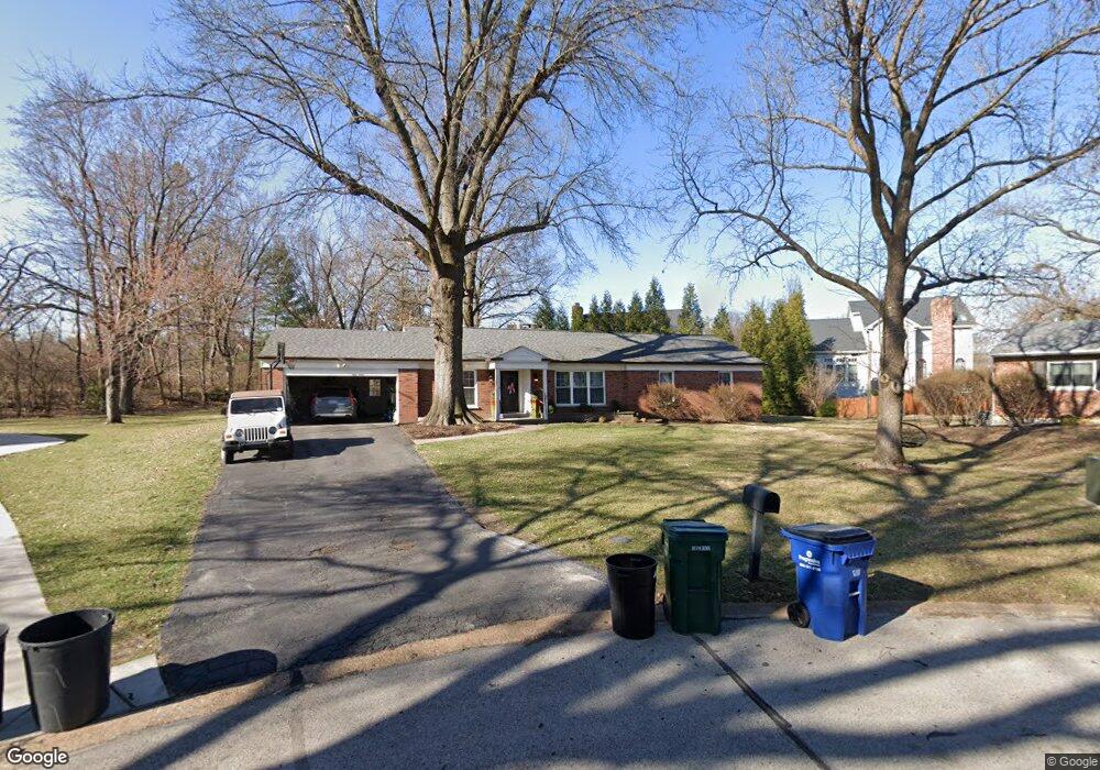
1301 Christine Ave Saint Louis, MO 63131
Estimated Value: $498,000 - $594,000
3
Beds
3
Baths
1,724
Sq Ft
$324/Sq Ft
Est. Value
About This Home
This home is located at 1301 Christine Ave, Saint Louis, MO 63131 and is currently estimated at $557,903, approximately $323 per square foot. 1301 Christine Ave is a home located in St. Louis County with nearby schools including Westchester Elementary School, North Kirkwood Middle School, and Kirkwood Senior High School.
Ownership History
Date
Name
Owned For
Owner Type
Purchase Details
Closed on
Jun 21, 2022
Sold by
1301 Christine Avenue Llc
Bought by
Amy P Lamia Revocable Trust
Current Estimated Value
Home Financials for this Owner
Home Financials are based on the most recent Mortgage that was taken out on this home.
Original Mortgage
$200,000
Outstanding Balance
$190,350
Interest Rate
5.3%
Mortgage Type
New Conventional
Estimated Equity
$367,553
Purchase Details
Closed on
Jun 17, 2022
Sold by
Matt Morrison
Bought by
1301 Christine Avenue Llc
Home Financials for this Owner
Home Financials are based on the most recent Mortgage that was taken out on this home.
Original Mortgage
$200,000
Outstanding Balance
$190,350
Interest Rate
5.3%
Mortgage Type
New Conventional
Estimated Equity
$367,553
Purchase Details
Closed on
May 24, 2022
Sold by
Matt Morrison
Bought by
1301 Christine Avenue Llc
Home Financials for this Owner
Home Financials are based on the most recent Mortgage that was taken out on this home.
Original Mortgage
$200,000
Outstanding Balance
$190,350
Interest Rate
5.3%
Mortgage Type
New Conventional
Estimated Equity
$367,553
Purchase Details
Closed on
May 14, 2021
Sold by
1301 Christine Avenue Llc
Bought by
Morrison Matthew and Morrison Jennifer
Home Financials for this Owner
Home Financials are based on the most recent Mortgage that was taken out on this home.
Original Mortgage
$202,800
Interest Rate
2.9%
Mortgage Type
New Conventional
Purchase Details
Closed on
Jul 11, 2017
Sold by
Morrison Matt and Morrison Jennifer
Bought by
1301 Christine Avenue Llc and Morrison Tim
Purchase Details
Closed on
May 18, 2017
Sold by
Ferry Mary J
Bought by
Morrison Matthew J and Morrison Jennifer
Purchase Details
Closed on
Sep 26, 2008
Sold by
Twellman Mary C
Bought by
Ferry Mary J
Home Financials for this Owner
Home Financials are based on the most recent Mortgage that was taken out on this home.
Original Mortgage
$238,950
Interest Rate
6.52%
Mortgage Type
FHA
Create a Home Valuation Report for This Property
The Home Valuation Report is an in-depth analysis detailing your home's value as well as a comparison with similar homes in the area
Home Values in the Area
Average Home Value in this Area
Purchase History
| Date | Buyer | Sale Price | Title Company |
|---|---|---|---|
| Amy P Lamia Revocable Trust | -- | None Listed On Document | |
| 1301 Christine Avenue Llc | -- | None Listed On Document | |
| 1301 Christine Avenue Llc | -- | None Listed On Document | |
| 1301 Christine Avenue Llc | -- | None Listed On Document | |
| Morrison Matthew | -- | Boston National Ttl Agcy Llc | |
| 1301 Christine Avenue Llc | -- | None Available | |
| Morrison Matthew J | -- | Investors Title Co Clayton | |
| Ferry Mary J | $250,000 | Investors Title Company |
Source: Public Records
Mortgage History
| Date | Status | Borrower | Loan Amount |
|---|---|---|---|
| Open | Amy P Lamia Revocable Trust | $200,000 | |
| Previous Owner | Morrison Matthew | $202,800 | |
| Previous Owner | Ferry Mary J | $238,950 |
Source: Public Records
Tax History Compared to Growth
Tax History
| Year | Tax Paid | Tax Assessment Tax Assessment Total Assessment is a certain percentage of the fair market value that is determined by local assessors to be the total taxable value of land and additions on the property. | Land | Improvement |
|---|---|---|---|---|
| 2025 | $4,709 | $90,750 | $69,220 | $21,530 |
| 2024 | $4,709 | $81,280 | $50,520 | $30,760 |
| 2023 | $4,636 | $81,280 | $50,520 | $30,760 |
| 2022 | $4,529 | $74,020 | $50,520 | $23,500 |
| 2021 | $4,481 | $74,020 | $50,520 | $23,500 |
| 2020 | $4,281 | $67,970 | $46,630 | $21,340 |
| 2019 | $4,286 | $67,970 | $46,630 | $21,340 |
| 2018 | $4,118 | $58,580 | $27,060 | $31,520 |
| 2017 | $4,129 | $58,580 | $27,060 | $31,520 |
| 2016 | $3,837 | $55,120 | $23,240 | $31,880 |
| 2015 | $3,842 | $55,120 | $23,240 | $31,880 |
| 2014 | $3,802 | $53,300 | $10,110 | $43,190 |
Source: Public Records
Map
Nearby Homes
- 1090 Kinstern Dr
- 1029 Kinstern Dr
- 1126 Bopp Rd
- 918 N Ballas Rd
- 11913 Lillian Ave
- 11909 Lillian Ave
- 12006 Montour Dr
- 8 Briarbrook Trail
- 12224 TBB Roger Ln
- 1345 Woodgate Dr
- 1238 Woodgate Dr
- 811 Cherry St
- 12439 Springdale Ln Unit TBB
- 723 Oak Valley Dr
- 1728 Folkstone Dr
- 1001 Dovergate Dr
- 1710 Lynkirk Ln
- 1741 Pine Hill Dr
- 2000 Trailcrest Ln Unit 3
- 12213 Brook Springs Ct
- 1308 Bansbach Rd
- 1300 Christine Ave
- 1304 Bansbach Rd
- 1305 Christine Ave
- 1312 Bansbach Rd
- 1304 Christine Ave
- 1315 Christine Ave
- 1300 Bansbach Rd
- 1303 Bansbach Rd
- 1322 Bansbach Rd
- 1318 Christine Ave
- 5 Woodbridge Park Rd
- 1323 Christine Ave
- 6 Woodbridge Park Rd
- 1328 Bansbach Rd
- 1326 Christine Ave
- 12006 Sandalwood Ct
- 1331 Christine Ave
- 12100 Georgian Trail
- 4 Woodbridge Park Rd