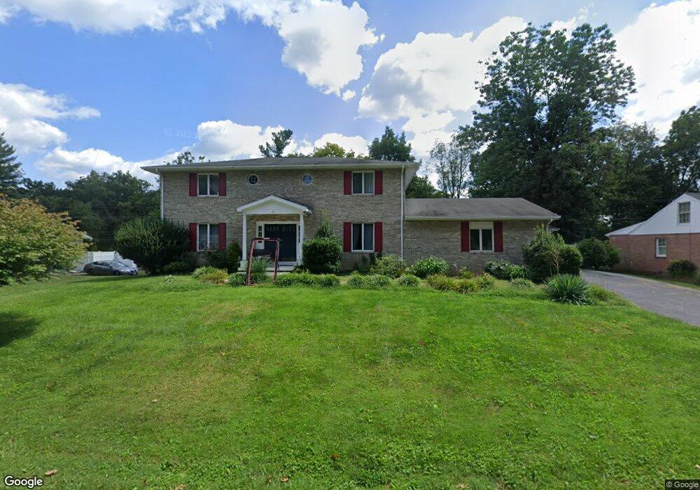
13011 Blue Ridge Rd Hagerstown, MD 21742
Estimated Value: $399,000 - $494,000
4
Beds
3
Baths
3,370
Sq Ft
$136/Sq Ft
Est. Value
About This Home
This home is located at 13011 Blue Ridge Rd, Hagerstown, MD 21742 and is currently estimated at $457,338, approximately $135 per square foot. 13011 Blue Ridge Rd is a home located in Washington County with nearby schools including Paramount Elementary School, Otsego West Campus High School, and Northern Middle School.
Ownership History
Date
Name
Owned For
Owner Type
Purchase Details
Closed on
Sep 20, 2006
Sold by
Aldo Dellamea
Bought by
Rowe Ronald F and Rowe Sheila S
Current Estimated Value
Home Financials for this Owner
Home Financials are based on the most recent Mortgage that was taken out on this home.
Original Mortgage
$230,000
Outstanding Balance
$138,425
Interest Rate
6.71%
Mortgage Type
Purchase Money Mortgage
Estimated Equity
$318,913
Purchase Details
Closed on
Aug 30, 2006
Sold by
Aldo Dellamea
Bought by
Rowe Ronald F and Rowe Sheila S
Home Financials for this Owner
Home Financials are based on the most recent Mortgage that was taken out on this home.
Original Mortgage
$230,000
Outstanding Balance
$138,425
Interest Rate
6.71%
Mortgage Type
Purchase Money Mortgage
Estimated Equity
$318,913
Create a Home Valuation Report for This Property
The Home Valuation Report is an in-depth analysis detailing your home's value as well as a comparison with similar homes in the area
Home Values in the Area
Average Home Value in this Area
Purchase History
| Date | Buyer | Sale Price | Title Company |
|---|---|---|---|
| Rowe Ronald F | $330,000 | -- | |
| Rowe Ronald F | $330,000 | -- |
Source: Public Records
Mortgage History
| Date | Status | Borrower | Loan Amount |
|---|---|---|---|
| Open | Rowe Ronald F | $230,000 | |
| Closed | Rowe Ronald F | $230,000 |
Source: Public Records
Tax History Compared to Growth
Tax History
| Year | Tax Paid | Tax Assessment Tax Assessment Total Assessment is a certain percentage of the fair market value that is determined by local assessors to be the total taxable value of land and additions on the property. | Land | Improvement |
|---|---|---|---|---|
| 2025 | $3,673 | $394,667 | $0 | $0 |
| 2024 | $3,673 | $354,800 | $89,100 | $265,700 |
| 2023 | $3,449 | $333,100 | $0 | $0 |
| 2022 | $3,224 | $311,400 | $0 | $0 |
| 2021 | $3,071 | $289,700 | $89,100 | $200,600 |
| 2020 | $2,950 | $279,567 | $0 | $0 |
| 2019 | $2,856 | $269,433 | $0 | $0 |
| 2018 | $2,749 | $259,300 | $89,100 | $170,200 |
| 2017 | $2,749 | $259,300 | $0 | $0 |
| 2016 | -- | $259,300 | $0 | $0 |
| 2015 | $3,290 | $283,400 | $0 | $0 |
| 2014 | $3,290 | $283,400 | $0 | $0 |
Source: Public Records
Map
Nearby Homes
- 13101 Fountain Head Rd
- 13028 Woodburn Dr
- 13116 Blue Ridge Rd
- 13001 Sturbridge Ct
- 12930 Oak Hill Ave
- 12819 Fountain Head Rd
- 18902 Preston Rd
- 670 Northern Ave
- 13209 Briarcliff Dr
- 13105 Little Hayden Cir Unit AREA BLOCK ELEVEN
- 19703 Portsmouth Dr
- 13336 Keener Rd
- 13314 Newport Ct
- 13335 Keener Rd
- 13001 Little Hayden Cir Unit 42
- 18827 Preston Rd
- 19702 Portsmouth Dr
- 13238 Club Rd
- 12993 Little Hayden Cir
- 13343 Keener Rd
- 13007 Blue Ridge Rd
- 13015 Blue Ridge Rd
- 13008 Blue Ridge Rd
- 13012 Blue Ridge Rd
- 13001 Blue Ridge Rd
- 13004 Blue Ridge Rd
- 13016 Blue Ridge Rd
- 13023 Blue Ridge Rd
- 13020 Blue Ridge Rd
- 13007 Woodburn Dr
- 13011 Woodburn Dr
- 13003 Woodburn Dr
- 19110 Woodburn Ct
- 13015 Woodburn Dr
- 13024 Blue Ridge Rd
- 13019 Woodburn Dr
- 19106 Woodburn Ct
- 19111 Woodburn Ct
- 12929 Woodburn Dr
- 0 Woodburn Dr