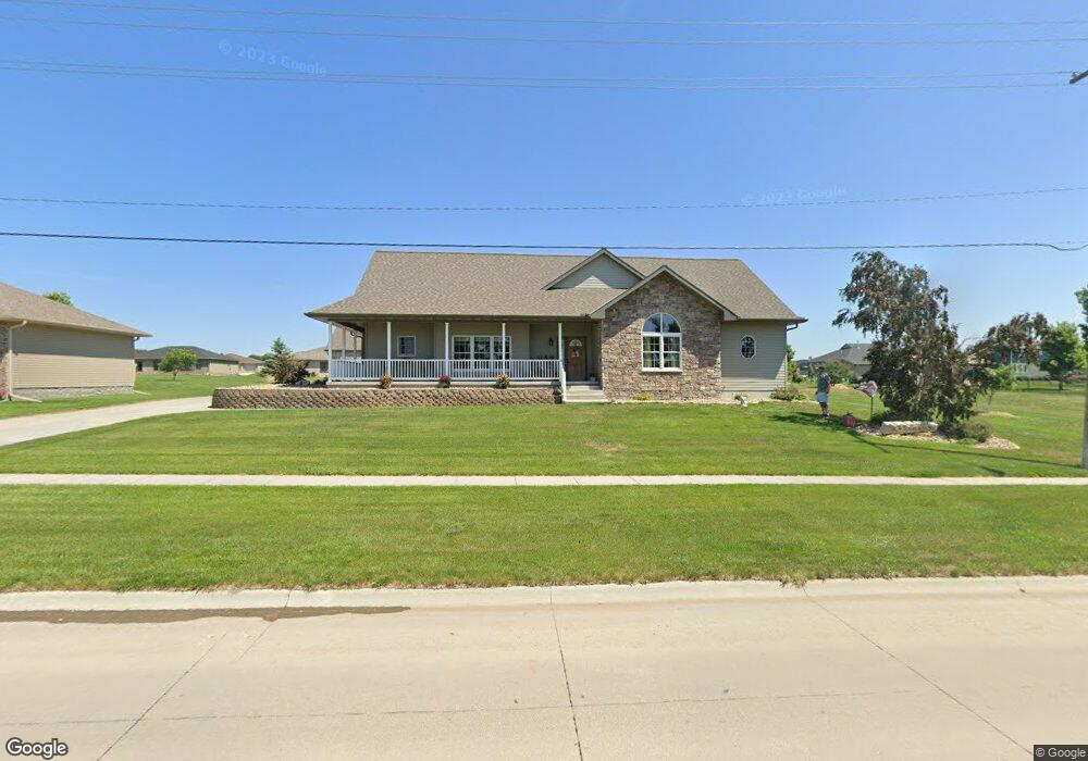
1302 N Shore Dr Hastings, NE 68901
Estimated Value: $466,000 - $599,372
3
Beds
3
Baths
2,335
Sq Ft
$234/Sq Ft
Est. Value
About This Home
This home is located at 1302 N Shore Dr, Hastings, NE 68901 and is currently estimated at $546,343, approximately $233 per square foot. 1302 N Shore Dr is a home located in Adams County with nearby schools including Adams County 15, Wallace School, and Adams Central Elementary School.
Ownership History
Date
Name
Owned For
Owner Type
Purchase Details
Closed on
Mar 24, 2009
Sold by
Westbrook Village Llc
Bought by
Anderson Christopher B and Anderson Neile J
Current Estimated Value
Home Financials for this Owner
Home Financials are based on the most recent Mortgage that was taken out on this home.
Original Mortgage
$33,600
Interest Rate
5.21%
Mortgage Type
New Conventional
Purchase Details
Closed on
Mar 30, 2006
Sold by
Westbrook Village Llc
Bought by
Ahmad Saleem and Saleen Shazia
Home Financials for this Owner
Home Financials are based on the most recent Mortgage that was taken out on this home.
Original Mortgage
$46,931
Interest Rate
6.24%
Mortgage Type
New Conventional
Create a Home Valuation Report for This Property
The Home Valuation Report is an in-depth analysis detailing your home's value as well as a comparison with similar homes in the area
Home Values in the Area
Average Home Value in this Area
Purchase History
| Date | Buyer | Sale Price | Title Company |
|---|---|---|---|
| Anderson Christopher B | $38,700 | None Available | |
| Ahmad Saleem | $51,000 | None Available |
Source: Public Records
Mortgage History
| Date | Status | Borrower | Loan Amount |
|---|---|---|---|
| Closed | Anderson Christopher B | $33,600 | |
| Previous Owner | Ahmad Saleem | $46,931 |
Source: Public Records
Tax History Compared to Growth
Tax History
| Year | Tax Paid | Tax Assessment Tax Assessment Total Assessment is a certain percentage of the fair market value that is determined by local assessors to be the total taxable value of land and additions on the property. | Land | Improvement |
|---|---|---|---|---|
| 2024 | $5,692 | $481,253 | $85,140 | $396,113 |
| 2023 | $8,114 | $513,124 | $85,140 | $427,984 |
| 2022 | $7,730 | $455,657 | $85,140 | $370,517 |
| 2021 | $7,143 | $434,085 | $74,360 | $359,725 |
| 2020 | $6,683 | $416,955 | $74,360 | $342,595 |
| 2019 | $6,516 | $416,955 | $74,360 | $342,595 |
| 2018 | $6,169 | $388,665 | $46,070 | $342,595 |
| 2017 | $6,121 | $388,665 | $0 | $0 |
| 2016 | $5,999 | $392,310 | $46,070 | $346,240 |
| 2011 | -- | $0 | $23,850 | $346,240 |
Source: Public Records
Map
Nearby Homes
- 1314 N Shore Dr
- 1106 Lakeridge Dr
- 2900 Wendell Dr
- 2907 Lakeview Cove
- 3202 Lake Park Ln
- 602 Dockside Cove
- 3610 Wendell Dr
- 1401 Heritage Dr
- 1407 N Denver Ave
- 514 W 14th St
- 1330 Heritage Dr
- 1402 N Saint Joseph Ave
- 1223 Westwood Terrace
- 1500 Apache Ave
- 1334 W 12th St
- 1331 Crane Ave
- 1127 N Bellevue Ave
- 3107 W Laux Dr
- 3109 W Laux Dr
- 1123-1125 N Bellevue Ave
- 1306 N Shore Dr
- 1217 Lakeridge Dr
- 1310 N Shore Dr
- 1213 Lakeridge Dr
- 1210 N Shore Dr
- 1301 Lakeridge Dr
- 1305 Lakeridge Dr
- 1209 Lakeridge Dr
- 2606 Merle Ave
- 1206 N Shore Dr
- 2610 Merle Ave
- 1218 Lakeridge Dr
- 2614 Merle Ave
- 1205 Lakeridge Dr
- 1214 Lakeridge Dr
- 1202 N Shore Dr
- 1300 Lakeridge Dr
- 1210 Lakeridge Dr
- 1201 Lakeridge Dr
- 1308 Lakeridge Dr