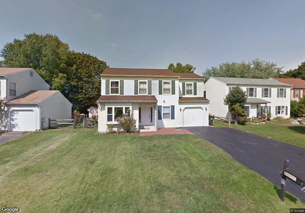
1305 Lawson Ln Downingtown, PA 19335
Estimated Value: $477,000 - $512,448
4
Beds
3
Baths
1,872
Sq Ft
$267/Sq Ft
Est. Value
About This Home
This home is located at 1305 Lawson Ln, Downingtown, PA 19335 and is currently estimated at $499,112, approximately $266 per square foot. 1305 Lawson Ln is a home located in Chester County with nearby schools including West Bradford Elementary School, Downingtown Middle School, and Downingtown High School West.
Ownership History
Date
Name
Owned For
Owner Type
Purchase Details
Closed on
Jul 29, 2009
Sold by
Hsbc Bank Usa National Association
Bought by
Lakhanpal Ajay
Current Estimated Value
Home Financials for this Owner
Home Financials are based on the most recent Mortgage that was taken out on this home.
Original Mortgage
$152,000
Interest Rate
4.85%
Mortgage Type
New Conventional
Purchase Details
Closed on
Mar 5, 2009
Sold by
Simmons Evelyn
Bought by
Hsbc Bank Usa National Association
Purchase Details
Closed on
Jul 31, 1996
Sold by
Divirgilio Anthony and Divirgilio Jennie
Bought by
Shockley Craig S and Shockley Hazel V
Home Financials for this Owner
Home Financials are based on the most recent Mortgage that was taken out on this home.
Original Mortgage
$116,000
Interest Rate
12.12%
Create a Home Valuation Report for This Property
The Home Valuation Report is an in-depth analysis detailing your home's value as well as a comparison with similar homes in the area
Home Values in the Area
Average Home Value in this Area
Purchase History
| Date | Buyer | Sale Price | Title Company |
|---|---|---|---|
| Lakhanpal Ajay | $190,000 | North American Title Agency | |
| Hsbc Bank Usa National Association | $2,000 | None Available | |
| Shockley Craig S | $145,500 | Manito Title Insurance Compa |
Source: Public Records
Mortgage History
| Date | Status | Borrower | Loan Amount |
|---|---|---|---|
| Previous Owner | Lakhanpal Ajay | $152,000 | |
| Previous Owner | Shockley Craig S | $116,000 |
Source: Public Records
Tax History Compared to Growth
Tax History
| Year | Tax Paid | Tax Assessment Tax Assessment Total Assessment is a certain percentage of the fair market value that is determined by local assessors to be the total taxable value of land and additions on the property. | Land | Improvement |
|---|---|---|---|---|
| 2025 | $4,760 | $143,300 | $31,210 | $112,090 |
| 2024 | $4,760 | $137,540 | $31,210 | $106,330 |
| 2023 | $4,623 | $137,540 | $31,210 | $106,330 |
| 2022 | $4,508 | $137,540 | $31,210 | $106,330 |
| 2021 | $4,433 | $137,540 | $31,210 | $106,330 |
| 2020 | $4,408 | $137,540 | $31,210 | $106,330 |
| 2019 | $4,340 | $137,540 | $31,210 | $106,330 |
| 2018 | $4,340 | $137,540 | $31,210 | $106,330 |
| 2017 | $4,340 | $137,540 | $31,210 | $106,330 |
| 2016 | $4,018 | $137,540 | $31,210 | $106,330 |
| 2015 | $4,018 | $137,540 | $31,210 | $106,330 |
| 2014 | $4,018 | $137,540 | $31,210 | $106,330 |
Source: Public Records
Map
Nearby Homes
- 1667 Beacon Hill Rd
- 1614 Barbara Dr
- 0 Glenside Rd Unit PACT2071490
- 0 Glenside Rd Unit PACT2071466
- 1522 Doyle Dr
- 1624 Shadyside Rd
- 1128 Isabella Ct
- 1418 Gallagherville Rd
- 1843 Honeysuckle Ct
- 1500 Federal Dr
- 1737 Shadyside Rd
- 1737 Shadyside Rd Unit AP
- 1737 Shadyside Rd Unit BP
- 1331 Piedmont Dr
- 1815 Boulder Dr
- 1888 Boulder Dr
- 1832 Boulder Dr
- 1846 Boulder Dr
- 1617 S Glenside Rd
- 27 Fox Farm Ln
- 1307 Lawson Ln
- 1303 Lawson Ln
- 1309 Lawson Ln
- 1301 Lawson Ln
- 1314 Lawson Ln
- 1301 Decatur Ct
- 1311 Lawson Ln
- 1316 Lawson Ln
- 1303 Decatur Ct
- 1313 Lawson Ln
- 1308 Kerwood Ln
- 1306 Kerwood Ln
- 1304 Kerwood Ln
- 1315 Lawson Ln
- 1300 Decatur Ct
- 1318 Lawson Ln
- 1310 Kerwood Ln
- 1317 Lawson Ln
- 1305 Decatur Ct
- 1301 Walker Dr