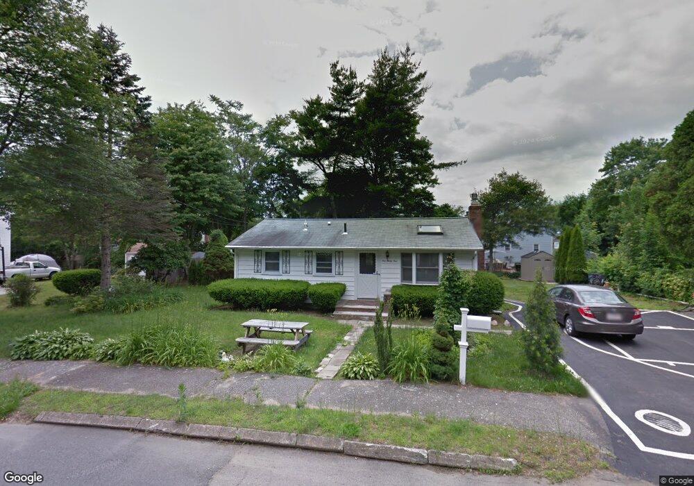
131 Huggins Rd Rockland, MA 02370
Estimated Value: $439,000 - $479,000
2
Beds
1
Bath
864
Sq Ft
$528/Sq Ft
Est. Value
About This Home
This home is located at 131 Huggins Rd, Rockland, MA 02370 and is currently estimated at $456,615, approximately $528 per square foot. 131 Huggins Rd is a home located in Plymouth County with nearby schools including Rockland Senior High School, Calvary Chapel Academy, and Holy Family Elementary School.
Ownership History
Date
Name
Owned For
Owner Type
Purchase Details
Closed on
Dec 4, 2019
Sold by
Ebersole James Francis
Bought by
White Angela
Current Estimated Value
Home Financials for this Owner
Home Financials are based on the most recent Mortgage that was taken out on this home.
Original Mortgage
$152,000
Outstanding Balance
$133,833
Interest Rate
3.75%
Mortgage Type
New Conventional
Estimated Equity
$322,782
Purchase Details
Closed on
Dec 13, 2018
Sold by
Ebersole James F
Bought by
Ebersole James Francis
Purchase Details
Closed on
Apr 11, 2017
Sold by
Ebersole James F and Ebersole Alice A
Bought by
Ebersole James F
Purchase Details
Closed on
Jul 22, 1968
Bought by
Ebersole James F and Ebersole Alice A
Create a Home Valuation Report for This Property
The Home Valuation Report is an in-depth analysis detailing your home's value as well as a comparison with similar homes in the area
Home Values in the Area
Average Home Value in this Area
Purchase History
| Date | Buyer | Sale Price | Title Company |
|---|---|---|---|
| White Angela | $195,000 | None Available | |
| Ebersole James Francis | -- | -- | |
| Ebersole James F | -- | -- | |
| Ebersole James F | -- | -- |
Source: Public Records
Mortgage History
| Date | Status | Borrower | Loan Amount |
|---|---|---|---|
| Open | White Angela | $152,000 | |
| Previous Owner | Ebersole James F | $219,200 |
Source: Public Records
Tax History Compared to Growth
Tax History
| Year | Tax Paid | Tax Assessment Tax Assessment Total Assessment is a certain percentage of the fair market value that is determined by local assessors to be the total taxable value of land and additions on the property. | Land | Improvement |
|---|---|---|---|---|
| 2025 | $5,158 | $377,300 | $224,400 | $152,900 |
| 2024 | $5,005 | $356,000 | $211,700 | $144,300 |
| 2023 | $4,972 | $326,700 | $194,200 | $132,500 |
| 2022 | $4,760 | $284,200 | $168,800 | $115,400 |
| 2021 | $4,387 | $253,900 | $153,500 | $100,400 |
| 2020 | $4,233 | $241,900 | $146,200 | $95,700 |
| 2019 | $4,132 | $230,600 | $139,300 | $91,300 |
| 2018 | $3,855 | $211,600 | $139,300 | $72,300 |
| 2017 | $3,790 | $205,100 | $139,300 | $65,800 |
| 2016 | $3,772 | $204,000 | $133,900 | $70,100 |
| 2015 | $3,614 | $189,900 | $125,200 | $64,700 |
| 2014 | $3,413 | $186,100 | $122,700 | $63,400 |
Source: Public Records
Map
Nearby Homes