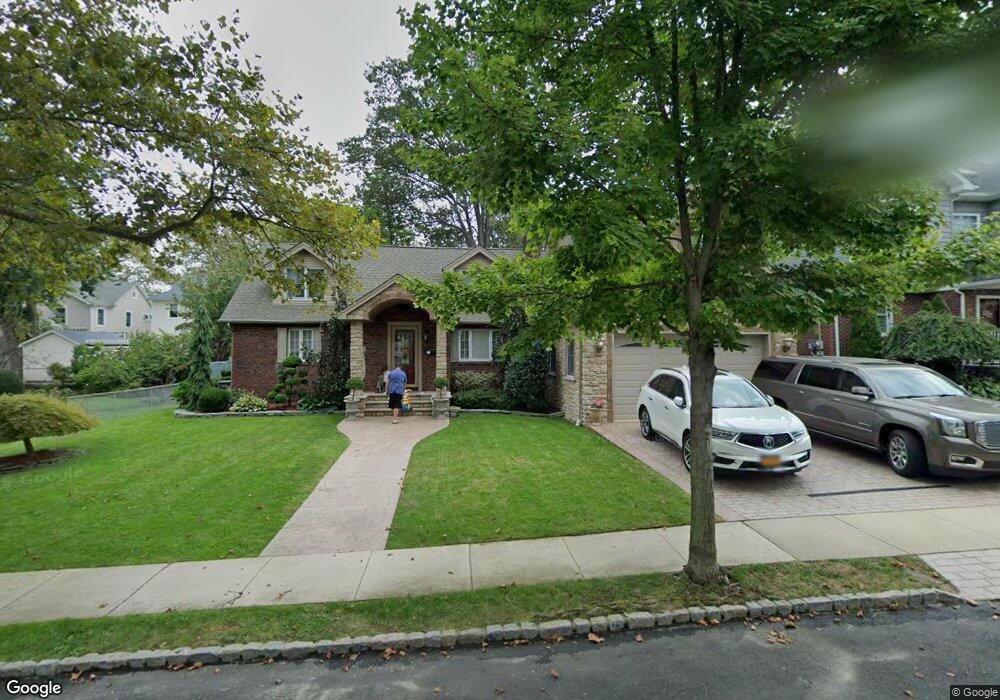
131 Lawrence Ave Staten Island, NY 10310
West Brighton NeighborhoodEstimated Value: $1,265,066 - $1,666,000
--
Bed
4
Baths
2,844
Sq Ft
$507/Sq Ft
Est. Value
About This Home
This home is located at 131 Lawrence Ave, Staten Island, NY 10310 and is currently estimated at $1,442,689, approximately $507 per square foot. 131 Lawrence Ave is a home located in Richmond County with nearby schools including P.S. 45 John Tyler, Is 61 William A Morris, and Curtis High School.
Ownership History
Date
Name
Owned For
Owner Type
Purchase Details
Closed on
Jul 22, 1998
Sold by
Maran Andrew Howard
Bought by
Rotunno Joseph F and Rotunno Donna M
Current Estimated Value
Home Financials for this Owner
Home Financials are based on the most recent Mortgage that was taken out on this home.
Original Mortgage
$165,000
Outstanding Balance
$33,356
Interest Rate
6.86%
Estimated Equity
$1,409,333
Create a Home Valuation Report for This Property
The Home Valuation Report is an in-depth analysis detailing your home's value as well as a comparison with similar homes in the area
Home Values in the Area
Average Home Value in this Area
Purchase History
| Date | Buyer | Sale Price | Title Company |
|---|---|---|---|
| Rotunno Joseph F | $264,500 | -- |
Source: Public Records
Mortgage History
| Date | Status | Borrower | Loan Amount |
|---|---|---|---|
| Open | Rotunno Joseph F | $165,000 |
Source: Public Records
Tax History Compared to Growth
Tax History
| Year | Tax Paid | Tax Assessment Tax Assessment Total Assessment is a certain percentage of the fair market value that is determined by local assessors to be the total taxable value of land and additions on the property. | Land | Improvement |
|---|---|---|---|---|
| 2025 | $11,221 | $95,100 | $13,960 | $81,140 |
| 2024 | $11,233 | $77,700 | $16,760 | $60,940 |
| 2023 | $10,688 | $54,025 | $17,134 | $36,891 |
| 2022 | $9,968 | $58,320 | $22,740 | $35,580 |
| 2021 | $9,935 | $61,440 | $22,740 | $38,700 |
| 2020 | $10,002 | $64,800 | $22,740 | $42,060 |
| 2019 | $9,690 | $57,600 | $22,740 | $34,860 |
| 2018 | $8,880 | $45,021 | $17,811 | $27,210 |
| 2017 | $8,427 | $42,810 | $19,201 | $23,609 |
| 2016 | $7,795 | $40,542 | $18,557 | $21,985 |
| 2015 | $7,327 | $40,542 | $19,550 | $20,992 |
| 2014 | $7,327 | $39,769 | $23,024 | $16,745 |
Source: Public Records
Map
Nearby Homes
- 34 Harvest Ave
- 100 Lawrence Ave
- 605 Bard Ave
- 1 Whitewood Ave
- 145 Norma Place
- 54 City Blvd
- 152 Harvest Ave
- 20 Baker Place
- 1 Sunset Hill Dr
- 677 Bement Ave
- 372 Sharon Ave
- 710 Oakland Ave
- 751 Oakland Ave
- 244 Delafield Ave
- 64 Greenway Dr
- 432 Pelton Ave
- 215 Hart Blvd Unit 3L
- 40 Greenway Dr
- 58-62 University Place
- 72 Gregg Place