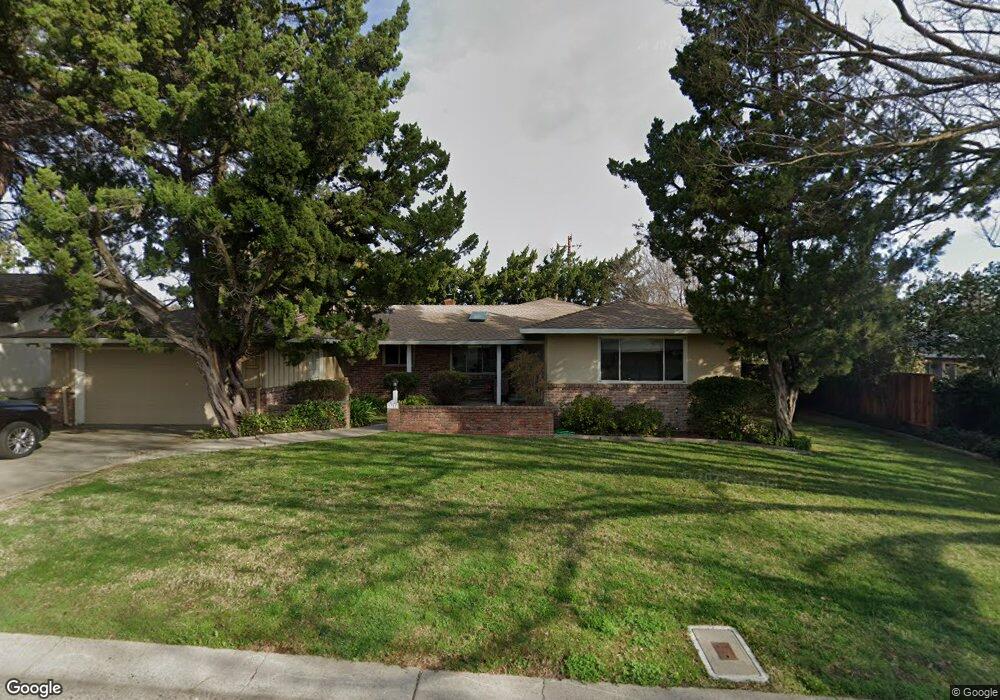
1311 Noonan Dr Sacramento, CA 95822
South Land Park NeighborhoodEstimated Value: $838,000 - $973,000
3
Beds
3
Baths
2,353
Sq Ft
$381/Sq Ft
Est. Value
About This Home
This home is located at 1311 Noonan Dr, Sacramento, CA 95822 and is currently estimated at $897,547, approximately $381 per square foot. 1311 Noonan Dr is a home located in Sacramento County with nearby schools including Sutterville Elementary School, California Middle, and C. K. McClatchy High.
Ownership History
Date
Name
Owned For
Owner Type
Purchase Details
Closed on
May 21, 2020
Sold by
Stewart Philip L and Stewart Sabrina L
Bought by
Stewart Philip L and Stewart Sabrina L
Current Estimated Value
Purchase Details
Closed on
Mar 15, 2016
Sold by
Stewart Philip L and Stewart Sabrina L
Bought by
Stewart Philip L and Stewart Sabrina L
Home Financials for this Owner
Home Financials are based on the most recent Mortgage that was taken out on this home.
Original Mortgage
$384,000
Outstanding Balance
$303,934
Interest Rate
3.65%
Mortgage Type
New Conventional
Estimated Equity
$593,613
Purchase Details
Closed on
Jul 8, 2002
Sold by
Kirkaldie Joan and Estate Of Regona Kirkaldie
Bought by
Stewart Philip L and Stewart Sabrina L
Home Financials for this Owner
Home Financials are based on the most recent Mortgage that was taken out on this home.
Original Mortgage
$300,700
Interest Rate
6.71%
Create a Home Valuation Report for This Property
The Home Valuation Report is an in-depth analysis detailing your home's value as well as a comparison with similar homes in the area
Home Values in the Area
Average Home Value in this Area
Purchase History
| Date | Buyer | Sale Price | Title Company |
|---|---|---|---|
| Stewart Philip L | -- | None Available | |
| Stewart Philip L | -- | Wfg Title Company | |
| Stewart Philip L | $381,000 | Fidelity National Title Co |
Source: Public Records
Mortgage History
| Date | Status | Borrower | Loan Amount |
|---|---|---|---|
| Open | Stewart Philip L | $384,000 | |
| Closed | Stewart Philip L | $300,700 | |
| Closed | Stewart Philip L | $52,200 |
Source: Public Records
Tax History Compared to Growth
Tax History
| Year | Tax Paid | Tax Assessment Tax Assessment Total Assessment is a certain percentage of the fair market value that is determined by local assessors to be the total taxable value of land and additions on the property. | Land | Improvement |
|---|---|---|---|---|
| 2025 | $6,336 | $551,793 | $152,788 | $399,005 |
| 2024 | $6,336 | $540,975 | $149,793 | $391,182 |
| 2023 | $6,176 | $530,368 | $146,856 | $383,512 |
| 2022 | $8,901 | $519,970 | $143,977 | $375,993 |
| 2021 | $8,601 | $509,775 | $141,154 | $368,621 |
| 2020 | $8,648 | $504,549 | $139,707 | $364,842 |
| 2019 | $8,521 | $494,657 | $136,968 | $357,689 |
| 2018 | $8,370 | $484,959 | $134,283 | $350,676 |
| 2017 | $8,287 | $475,450 | $131,650 | $343,800 |
| 2016 | $5,395 | $466,128 | $129,069 | $337,059 |
| 2015 | $5,309 | $459,128 | $127,131 | $331,997 |
| 2014 | $5,168 | $450,135 | $124,641 | $325,494 |
Source: Public Records
Map
Nearby Homes
- 5200 Pleasant Dr
- 5440 Pleasant Dr
- 1428 Tradewinds Ave
- 1432 Oregon Dr
- 1220 Lucio Ln
- 1224 Nevis Ct
- 1433 32nd Ave
- 4500 Crestwood Way
- 4801 da Rosa Dr
- 1621 Fruitridge Rd
- 1122 28th Ave
- 5081 Karbet Way
- 5779 Gloria Dr
- 1810 Opper Ave
- 4271 Warren Ave
- 5531 Michael Way
- 1436 Sterling St
- 4400 Capri Way
- 5716 Lonsdale Dr
- 1050 Appollo Way
- 5131 Pleasant Dr
- 5130 Del Rio Rd
- 5111 Pleasant Dr
- 5110 Del Rio Rd
- 1310 Noonan Dr
- 5201 Pleasant Dr
- 5200 Del Rio Rd
- 4833 Crestwood Way
- 5130 Pleasant Dr
- 4837 Crestwood Way
- 5100 Del Rio Rd
- 5131 Del Rio Rd
- 5151 Del Rio Rd
- 5211 Pleasant Dr
- 5210 Del Rio Rd
- 5201 Del Rio Rd
- 4829 Crestwood Way
- 1295 Noonan Dr
- 5211 Del Rio Rd
- 5221 Pleasant Dr