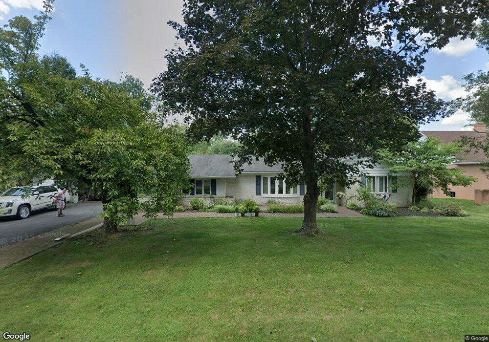
13112 Blue Ridge Rd Hagerstown, MD 21742
Estimated Value: $425,000 - $532,000
4
Beds
3
Baths
2,830
Sq Ft
$167/Sq Ft
Est. Value
About This Home
This home is located at 13112 Blue Ridge Rd, Hagerstown, MD 21742 and is currently estimated at $472,736, approximately $167 per square foot. 13112 Blue Ridge Rd is a home located in Washington County with nearby schools including Paramount Elementary School, Otsego West Campus High School, and Northern Middle School.
Ownership History
Date
Name
Owned For
Owner Type
Purchase Details
Closed on
Mar 3, 2003
Sold by
Albright James H and Albright Kibby I
Bought by
Rockwell Richard E and Rockwell Kathy J
Current Estimated Value
Purchase Details
Closed on
Oct 30, 1980
Sold by
Defibaugh Charles S
Bought by
Albright James H
Home Financials for this Owner
Home Financials are based on the most recent Mortgage that was taken out on this home.
Original Mortgage
$70,000
Interest Rate
13.85%
Create a Home Valuation Report for This Property
The Home Valuation Report is an in-depth analysis detailing your home's value as well as a comparison with similar homes in the area
Home Values in the Area
Average Home Value in this Area
Purchase History
| Date | Buyer | Sale Price | Title Company |
|---|---|---|---|
| Rockwell Richard E | $279,000 | -- | |
| Albright James H | $74,000 | -- |
Source: Public Records
Mortgage History
| Date | Status | Borrower | Loan Amount |
|---|---|---|---|
| Previous Owner | Albright James H | $70,000 | |
| Closed | Rockwell Richard E | -- |
Source: Public Records
Tax History Compared to Growth
Tax History
| Year | Tax Paid | Tax Assessment Tax Assessment Total Assessment is a certain percentage of the fair market value that is determined by local assessors to be the total taxable value of land and additions on the property. | Land | Improvement |
|---|---|---|---|---|
| 2025 | $3,594 | $384,833 | $0 | $0 |
| 2024 | $3,594 | $352,400 | $86,700 | $265,700 |
| 2023 | $3,422 | $334,700 | $0 | $0 |
| 2022 | $3,257 | $317,000 | $0 | $0 |
| 2021 | $3,051 | $299,300 | $86,700 | $212,600 |
| 2020 | $3,051 | $289,133 | $0 | $0 |
| 2019 | $2,957 | $278,967 | $0 | $0 |
| 2018 | $2,849 | $268,800 | $86,700 | $182,100 |
| 2017 | $2,849 | $268,800 | $0 | $0 |
| 2016 | -- | $268,800 | $0 | $0 |
| 2015 | -- | $295,400 | $0 | $0 |
| 2014 | $3,338 | $295,400 | $0 | $0 |
Source: Public Records
Map
Nearby Homes
- 13116 Blue Ridge Rd
- 13028 Woodburn Dr
- 13101 Fountain Head Rd
- 13001 Sturbridge Ct
- 13209 Briarcliff Dr
- 13336 Keener Rd
- 13335 Keener Rd
- 12930 Oak Hill Ave
- 13314 Newport Ct
- 19703 Portsmouth Dr
- 13343 Keener Rd
- 13347 Keener Rd
- 19702 Portsmouth Dr
- 12819 Fountain Head Rd
- 13238 Club Rd
- 18902 Preston Rd
- 19446 Sapphire Dr
- 13336 Marquise Dr
- 18735 Briarwood Dr
- 13407 Cherry Tree Cir
- 13108 Blue Ridge Rd
- 13111 Woodburn Dr
- 13107 Woodburn Dr
- 13115 Woodburn Dr
- 19108 Stoney Ln
- 13120 Blue Ridge Rd
- 13111 Blue Ridge Rd
- 13103 Woodburn Dr
- 13119 Woodburn Dr
- 13115 Blue Ridge Rd
- 13119 Blue Ridge Rd
- 13107 Blue Ridge Rd
- 13103 Blue Ridge Rd
- 13124 Blue Ridge Rd
- 13106 Woodburn Dr
- 13123 Blue Ridge Rd
- 13114 Woodburn Dr
- 19109 Stoney Ln
- 13123 Woodburn Dr
- 13027 Woodburn Dr