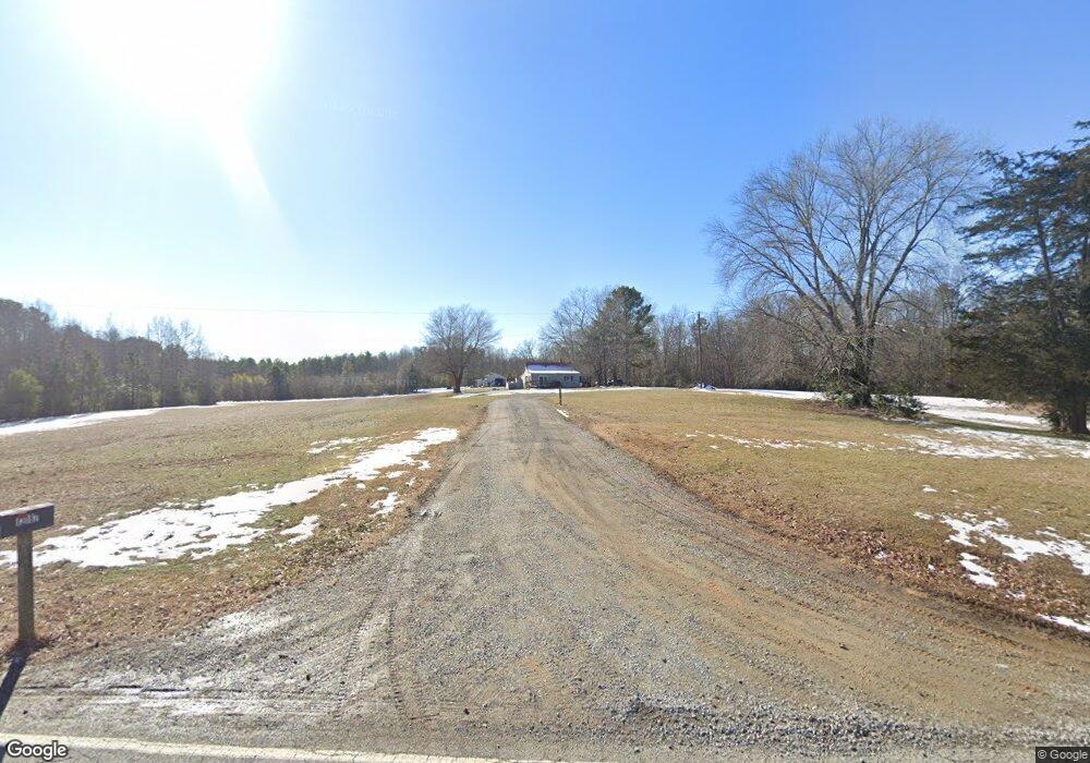
13187 Cedar Ln Ashland, VA 23005
Estimated Value: $368,000 - $505,797
2
Beds
2
Baths
1,467
Sq Ft
$302/Sq Ft
Est. Value
About This Home
This home is located at 13187 Cedar Ln, Ashland, VA 23005 and is currently estimated at $442,449, approximately $301 per square foot. 13187 Cedar Ln is a home located in Hanover County with nearby schools including Elmont Elementary School, Liberty Middle School, and Patrick Henry High School.
Ownership History
Date
Name
Owned For
Owner Type
Purchase Details
Closed on
Apr 15, 1999
Sold by
Adams Elizabeth
Bought by
Webb John
Current Estimated Value
Home Financials for this Owner
Home Financials are based on the most recent Mortgage that was taken out on this home.
Original Mortgage
$65,000
Outstanding Balance
$16,459
Interest Rate
7.04%
Estimated Equity
$425,990
Create a Home Valuation Report for This Property
The Home Valuation Report is an in-depth analysis detailing your home's value as well as a comparison with similar homes in the area
Home Values in the Area
Average Home Value in this Area
Purchase History
| Date | Buyer | Sale Price | Title Company |
|---|---|---|---|
| Webb John | $120,000 | -- |
Source: Public Records
Mortgage History
| Date | Status | Borrower | Loan Amount |
|---|---|---|---|
| Open | Webb John | $65,000 |
Source: Public Records
Tax History Compared to Growth
Tax History
| Year | Tax Paid | Tax Assessment Tax Assessment Total Assessment is a certain percentage of the fair market value that is determined by local assessors to be the total taxable value of land and additions on the property. | Land | Improvement |
|---|---|---|---|---|
| 2025 | $3,052 | $376,800 | $232,400 | $144,400 |
| 2024 | $3,052 | $376,800 | $232,400 | $144,400 |
| 2023 | $1,767 | $358,700 | $223,300 | $135,400 |
| 2022 | $32 | $319,200 | $203,300 | $115,900 |
| 2021 | $31 | $285,500 | $178,200 | $107,300 |
| 2020 | $32 | $285,500 | $178,200 | $107,300 |
| 2019 | $1,236 | $243,300 | $162,500 | $80,800 |
| 2018 | $1,236 | $243,300 | $162,500 | $80,800 |
| 2017 | $1,223 | $243,300 | $162,500 | $80,800 |
| 2016 | $1,221 | $243,300 | $162,500 | $80,800 |
| 2015 | $1,149 | $234,000 | $157,500 | $76,500 |
| 2014 | $1,132 | $234,000 | $157,500 | $76,500 |
Source: Public Records
Map
Nearby Homes
- 9573 Seven Sisters Dr
- 12235 Kenton Ridge Rd
- 12215 Kenton Ridge Rd
- 12449 Lily Pad Ln
- 13320 Farm View Dr
- 11435 New Farrington Ct
- 12257 Cedar Ln
- 465 Burden Dr
- 12220 Marsett Ct Unit 101
- 12216 Marsett Ct Unit 101
- 9489 Pinkman Rd
- 9479 Pinkman Rd
- 459 Burden Dr
- 9477 Pinkman Rd
- 449 Burden Dr
- 12220 Marsett Ct Unit 201
- 9484 Pinkman Rd
- 9450 Belladdie Way
- 12216 Marsett Ct Unit 202
- 9873 Tuco St Unit A
- 13223 Cedar Ln
- 13163 Cedar Ln
- 13345 Ashland Rd
- 12110 Grassy Creek Ln
- 12088 Grassy Creek Ln
- 13261 Ashland Rd
- 13244 Ashland Rd
- 13121 Cedar Ln
- 13130 Cedar Ln
- 13175 Ashland Rd
- 12054 Grassy Creek Ln
- 13170 Ashland Rd
- 13291 Ashland Rd
- 13156 Ashland Rd
- 13093 Cedar Ln
- 13104 Crowfoot Ln
- 13125 Crowfoot Ln
- 13077 Cedar Ln
- 12042 Grassy Creek Ln
- 12228 Kenton Ridge Rd
