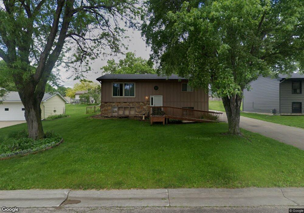
132 Peggy Ln Eagle Lake, MN 56024
Estimated Value: $260,272 - $318,000
3
Beds
2
Baths
1,824
Sq Ft
$154/Sq Ft
Est. Value
About This Home
This home is located at 132 Peggy Ln, Eagle Lake, MN 56024 and is currently estimated at $280,818, approximately $153 per square foot. 132 Peggy Ln is a home located in Blue Earth County with nearby schools including Eagle Lake Elementary School, Prairie Winds Middle School, and Mankato East Senior High School.
Ownership History
Date
Name
Owned For
Owner Type
Purchase Details
Closed on
Sep 19, 2011
Sold by
Schuelke Ewald and Schuelke Dorothy
Bought by
Grausam Charles J
Current Estimated Value
Home Financials for this Owner
Home Financials are based on the most recent Mortgage that was taken out on this home.
Original Mortgage
$124,755
Outstanding Balance
$84,940
Interest Rate
4.14%
Mortgage Type
FHA
Estimated Equity
$195,878
Create a Home Valuation Report for This Property
The Home Valuation Report is an in-depth analysis detailing your home's value as well as a comparison with similar homes in the area
Home Values in the Area
Average Home Value in this Area
Purchase History
| Date | Buyer | Sale Price | Title Company |
|---|---|---|---|
| Grausam Charles J | $128,000 | -- |
Source: Public Records
Mortgage History
| Date | Status | Borrower | Loan Amount |
|---|---|---|---|
| Open | Grausam Charles J | $124,755 |
Source: Public Records
Tax History Compared to Growth
Tax History
| Year | Tax Paid | Tax Assessment Tax Assessment Total Assessment is a certain percentage of the fair market value that is determined by local assessors to be the total taxable value of land and additions on the property. | Land | Improvement |
|---|---|---|---|---|
| 2025 | $2,418 | $242,700 | $27,000 | $215,700 |
| 2024 | $2,418 | $219,800 | $27,000 | $192,800 |
| 2023 | $2,030 | $225,900 | $27,000 | $198,900 |
| 2022 | $1,950 | $188,400 | $27,000 | $161,400 |
| 2021 | $1,816 | $170,300 | $27,000 | $143,300 |
| 2020 | $1,876 | $166,500 | $28,800 | $137,700 |
| 2019 | $1,818 | $333,000 | $57,600 | $275,400 |
| 2018 | $1,662 | $326,000 | $57,600 | $268,400 |
| 2017 | $1,476 | $303,400 | $50,400 | $253,000 |
| 2016 | $1,470 | $272,600 | $50,400 | $222,200 |
| 2015 | $14 | $272,600 | $50,400 | $222,200 |
| 2014 | $1,274 | $128,800 | $25,200 | $103,600 |
Source: Public Records
Map
Nearby Homes
- 513 Linda Dr
- 220 Connie Ln
- 212 Blace Ave
- 112 S 3rd St
- 101 Hawk Ave
- 409 Owl Ln
- 104 Blace Ave
- 106 Connie Ln Unit 106 Connie Lane E
- 309 Falcon Run
- 306 Falcon Run
- 121 Hawk Ave
- 205 Peregrine Ave
- 105 Gray Fox Path
- 225 Oak Dr
- 0 Tbd Oak Dr
- 60451 211th St
- 21xxx 594th Ave Unit co rd 86 or ktoe rd
- 21xxx 594th Ave
- XXX 602nd Ave
- 602nd Avenue