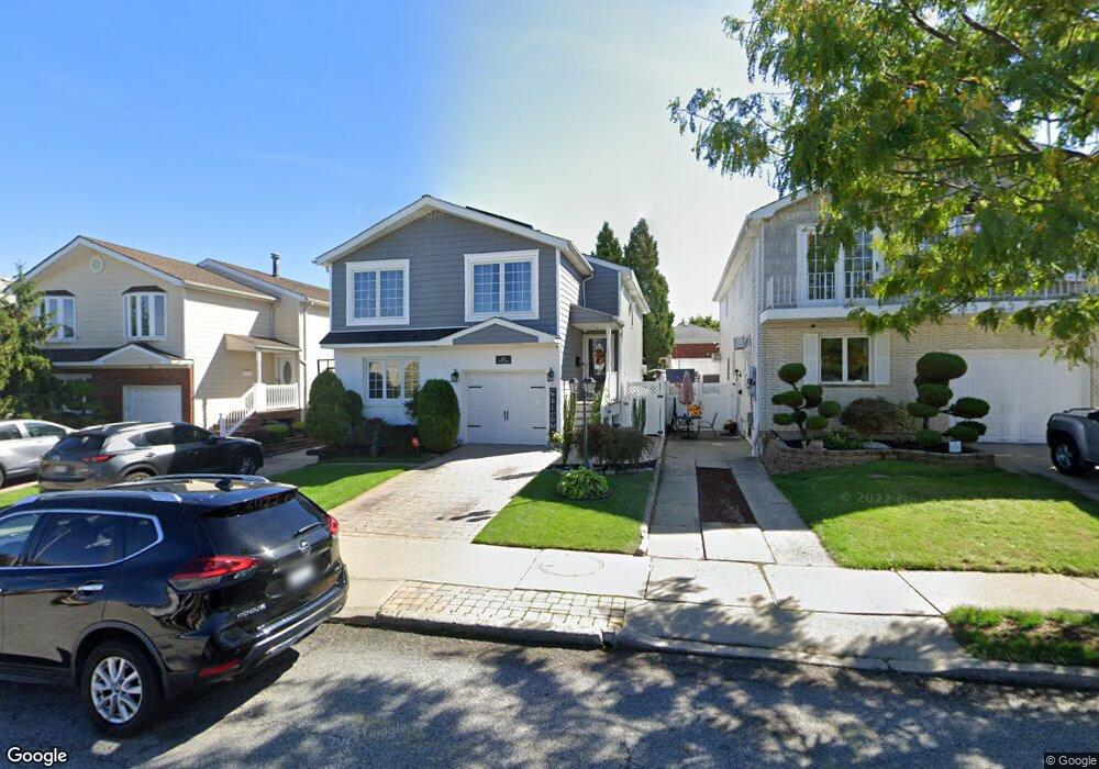
132 Vineland Ave Staten Island, NY 10312
Arden Heights NeighborhoodEstimated Value: $835,409 - $1,049,000
--
Bed
--
Bath
2,488
Sq Ft
$379/Sq Ft
Est. Value
About This Home
This home is located at 132 Vineland Ave, Staten Island, NY 10312 and is currently estimated at $943,602, approximately $379 per square foot. 132 Vineland Ave is a home located in Richmond County with nearby schools including P.S. 36 - J.C. Drumgoole, I.S. 075 Frank D. Paulo, and Tottenville High School.
Ownership History
Date
Name
Owned For
Owner Type
Purchase Details
Closed on
Mar 24, 2003
Sold by
Orlando Joseph and Orlando Virginia
Bought by
Alesi Michael P and Alesi Danielle T
Current Estimated Value
Home Financials for this Owner
Home Financials are based on the most recent Mortgage that was taken out on this home.
Original Mortgage
$314,000
Interest Rate
5.86%
Mortgage Type
Purchase Money Mortgage
Create a Home Valuation Report for This Property
The Home Valuation Report is an in-depth analysis detailing your home's value as well as a comparison with similar homes in the area
Home Values in the Area
Average Home Value in this Area
Purchase History
| Date | Buyer | Sale Price | Title Company |
|---|---|---|---|
| Alesi Michael P | $393,000 | -- |
Source: Public Records
Mortgage History
| Date | Status | Borrower | Loan Amount |
|---|---|---|---|
| Previous Owner | Alesi Michael P | $314,000 |
Source: Public Records
Tax History Compared to Growth
Tax History
| Year | Tax Paid | Tax Assessment Tax Assessment Total Assessment is a certain percentage of the fair market value that is determined by local assessors to be the total taxable value of land and additions on the property. | Land | Improvement |
|---|---|---|---|---|
| 2025 | $9,131 | $51,180 | $11,586 | $39,594 |
| 2024 | $9,143 | $52,320 | $11,016 | $41,304 |
| 2023 | $5,990 | $44,208 | $10,310 | $33,898 |
| 2022 | $5,745 | $48,660 | $12,300 | $36,360 |
| 2021 | $8,384 | $41,280 | $12,300 | $28,980 |
| 2020 | $5,504 | $44,940 | $12,300 | $32,640 |
| 2019 | $7,876 | $46,320 | $12,300 | $34,020 |
| 2018 | $7,212 | $36,840 | $12,300 | $24,540 |
| 2017 | $7,369 | $37,617 | $11,845 | $25,772 |
| 2016 | $6,785 | $35,488 | $11,297 | $24,191 |
| 2015 | $6,051 | $33,480 | $10,260 | $23,220 |
| 2014 | $6,051 | $33,120 | $10,260 | $22,860 |
Source: Public Records
Map
Nearby Homes
- 34 Crown Ct
- 610 Woodrow Rd
- 387 Woodrow Rd
- 535 Carlton Blvd
- 9 Sinclair Ave
- 0 Sheldon Ave
- 75/79/83 Halpin Ave
- 79 Halpin Ave
- 83 Halpin Ave
- 75 Halpin Ave
- 40 Susanna Ln
- 149 Rensselaer Ave
- 48 Linda Ln
- 191 Rensselaer Ave Unit 198
- 352 Grantwood Ave
- 41 Halpin Ave
- 16 Linda Ln
- 244 Woehrle Ave
- 716 Woodrow Rd
- 62 Ruxton Ave
- 136 Vineland Ave
- 128 Vineland Ave
- 142 Vineland Ave
- 124 Vineland Ave
- 111 Stafford Ave
- 107 Stafford Ave
- 115 Stafford Ave
- 103 Stafford Ave
- 146 Vineland Ave
- 99 Stafford Ave
- 118 Vineland Ave
- 139 Vineland Ave
- 150 Vineland Ave
- 135 Vineland Ave
- 143 Vineland Ave
- 95 Stafford Ave
- 123 Stafford Ave
- 131 Vineland Ave
- 147 Vineland Ave
- 154 Vineland Ave