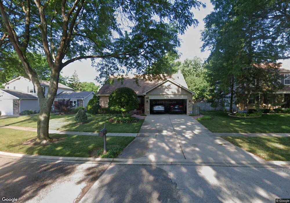
1321 Rose Ct E Buffalo Grove, IL 60089
South Buffalo Grove NeighborhoodEstimated Value: $528,969 - $584,000
4
Beds
3
Baths
1,962
Sq Ft
$286/Sq Ft
Est. Value
About This Home
This home is located at 1321 Rose Ct E, Buffalo Grove, IL 60089 and is currently estimated at $560,992, approximately $285 per square foot. 1321 Rose Ct E is a home located in Cook County with nearby schools including Henry W Longfellow Elementary School, Cooper Middle School, and Buffalo Grove High School.
Ownership History
Date
Name
Owned For
Owner Type
Purchase Details
Closed on
Dec 5, 2016
Sold by
Stadler G Thomas and Stadler Lisa G
Bought by
Stailer George Thomas and Stadler Lisa G
Current Estimated Value
Purchase Details
Closed on
Jul 11, 2002
Sold by
Marks Robert W and Marks Donna R
Bought by
Stadler G Thomas and Stadler Lisa G
Home Financials for this Owner
Home Financials are based on the most recent Mortgage that was taken out on this home.
Original Mortgage
$205,000
Interest Rate
6.79%
Purchase Details
Closed on
Nov 29, 1994
Sold by
Shipley Robert A and Shipley Denise L
Bought by
Marks Robert W and Marks Donna R
Home Financials for this Owner
Home Financials are based on the most recent Mortgage that was taken out on this home.
Original Mortgage
$175,000
Interest Rate
8.91%
Create a Home Valuation Report for This Property
The Home Valuation Report is an in-depth analysis detailing your home's value as well as a comparison with similar homes in the area
Home Values in the Area
Average Home Value in this Area
Purchase History
| Date | Buyer | Sale Price | Title Company |
|---|---|---|---|
| Stailer George Thomas | -- | None Available | |
| Stadler G Thomas | $352,000 | -- | |
| Marks Robert W | $246,000 | -- |
Source: Public Records
Mortgage History
| Date | Status | Borrower | Loan Amount |
|---|---|---|---|
| Previous Owner | Stadler G Thomas | $205,000 | |
| Previous Owner | Marks Robert W | $175,000 |
Source: Public Records
Tax History Compared to Growth
Tax History
| Year | Tax Paid | Tax Assessment Tax Assessment Total Assessment is a certain percentage of the fair market value that is determined by local assessors to be the total taxable value of land and additions on the property. | Land | Improvement |
|---|---|---|---|---|
| 2024 | $10,211 | $37,873 | $8,973 | $28,900 |
| 2023 | $10,608 | $37,873 | $8,973 | $28,900 |
| 2022 | $10,608 | $37,873 | $8,973 | $28,900 |
| 2021 | $10,513 | $33,088 | $5,098 | $27,990 |
| 2020 | $10,309 | $33,088 | $5,098 | $27,990 |
| 2019 | $10,359 | $36,888 | $5,098 | $31,790 |
| 2018 | $11,038 | $35,486 | $4,486 | $31,000 |
| 2017 | $10,855 | $35,486 | $4,486 | $31,000 |
| 2016 | $11,236 | $38,272 | $4,486 | $33,786 |
| 2015 | $10,343 | $33,068 | $3,874 | $29,194 |
| 2014 | $10,190 | $33,068 | $3,874 | $29,194 |
| 2013 | $9,765 | $34,246 | $3,874 | $30,372 |
Source: Public Records
Map
Nearby Homes
- 705 Grove Dr Unit 101
- 715 W Whiting Ln
- 751 W Happfield Dr Unit 30
- 715 W Happfield Dr
- 812 W Whiting Ln
- 811 W Nichols Rd
- 921 Bernard Dr
- 720 Weidner Rd Unit 302
- 859 Beechwood Rd
- 571 Estate Dr
- 535 Estate Dr
- 813 Stradford Cir Unit 21B2
- 820 Weidner Rd Unit 4013
- 820 Weidner Rd Unit 409
- 6 Villa Verde Dr Unit 103
- 18 E Heritage Ct
- 665 Thornwood Dr
- 3227 N Heritage Ln
- 1115 Miller Ln Unit 104
- 3222 N Heritage Ln