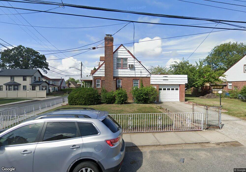
13245 217th St Springfield Gardens, NY 11413
Laurelton NeighborhoodEstimated Value: $705,109 - $795,000
--
Bed
--
Bath
1,449
Sq Ft
$520/Sq Ft
Est. Value
About This Home
This home is located at 13245 217th St, Springfield Gardens, NY 11413 and is currently estimated at $753,277, approximately $519 per square foot. 13245 217th St is a home located in Queens County with nearby schools including P.S. 132 - Ralph Bunche, Is 59 Springfield Gardens, and Success Academy Springfield Gardens.
Ownership History
Date
Name
Owned For
Owner Type
Purchase Details
Closed on
Oct 14, 1997
Sold by
Jones Kenneth D and Jones Marjorie
Bought by
Peterson Schlonzo and Peterson Glenda D
Current Estimated Value
Home Financials for this Owner
Home Financials are based on the most recent Mortgage that was taken out on this home.
Original Mortgage
$177,650
Outstanding Balance
$27,892
Interest Rate
7.19%
Estimated Equity
$725,385
Create a Home Valuation Report for This Property
The Home Valuation Report is an in-depth analysis detailing your home's value as well as a comparison with similar homes in the area
Home Values in the Area
Average Home Value in this Area
Purchase History
| Date | Buyer | Sale Price | Title Company |
|---|---|---|---|
| Peterson Schlonzo | $187,000 | Stewart Title Insurance Co |
Source: Public Records
Mortgage History
| Date | Status | Borrower | Loan Amount |
|---|---|---|---|
| Open | Peterson Schlonzo | $177,650 |
Source: Public Records
Tax History Compared to Growth
Tax History
| Year | Tax Paid | Tax Assessment Tax Assessment Total Assessment is a certain percentage of the fair market value that is determined by local assessors to be the total taxable value of land and additions on the property. | Land | Improvement |
|---|---|---|---|---|
| 2025 | $6,591 | $36,266 | $14,090 | $22,176 |
| 2024 | $6,603 | $34,214 | $14,649 | $19,565 |
| 2023 | $6,591 | $34,214 | $13,504 | $20,710 |
| 2022 | $6,328 | $37,740 | $17,880 | $19,860 |
| 2021 | $4,969 | $31,260 | $17,880 | $13,380 |
| 2020 | $4,788 | $32,220 | $17,880 | $14,340 |
| 2019 | $4,358 | $32,580 | $17,880 | $14,700 |
| 2018 | $5,515 | $28,512 | $15,118 | $13,394 |
| 2017 | $5,469 | $28,297 | $16,092 | $12,205 |
| 2016 | $5,027 | $28,297 | $16,092 | $12,205 |
| 2015 | $3,082 | $25,185 | $14,824 | $10,361 |
| 2014 | $3,082 | $23,760 | $16,140 | $7,620 |
Source: Public Records
Map
Nearby Homes
- 218-36 133rd Rd
- 21931 133rd Ave
- 21608 Merrick Blvd
- 21917 132nd Rd
- 133-15 220th St
- 187-01 Ridgedale St
- 12512 Nepton St
- 21611 135th Ave
- 134-16 221st St
- 220-27 134th Rd
- 134-15 221st St
- 13049 217th St
- 220-24 134th Rd
- 21924 130th Dr
- 131-35 222nd St
- 187-16 Williamson Ave
- 187-04 Williamson Ave
- 130-25 217th St
- 130-45 220th St
- 22126 134th Rd
- 21709 133rd Ave
- 217-09 133rd Ave
- 13239 217th St
- 13237 217th St
- 21615 133rd Ave
- 21715 133rd Ave
- 21715 133rd Ave
- 13242 218th St
- 13242 218th St
- 13242 217th St
- 13238 218th St
- 132-33 217th St
- 13233 217th St
- 21702 133rd Ave
- 132-37 217th St
- 13240 217th St
- 21710 133rd Ave
- 21620 133rd Ave
- 21714 133rd Ave
- 13234 218th St