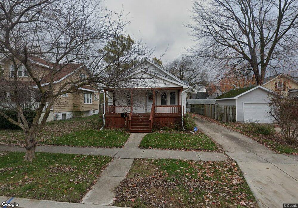
1326 12th St Port Huron, MI 48060
Estimated Value: $120,000 - $140,000
2
Beds
1
Bath
840
Sq Ft
$155/Sq Ft
Est. Value
About This Home
This home is located at 1326 12th St, Port Huron, MI 48060 and is currently estimated at $129,980, approximately $154 per square foot. 1326 12th St is a home located in St. Clair County with nearby schools including Woodrow Wilson Elementary School, Central Middle School, and Port Huron High School.
Ownership History
Date
Name
Owned For
Owner Type
Purchase Details
Closed on
Feb 2, 2022
Sold by
Sheppard Kathleen M
Bought by
Kathleen M Sheppard Trust
Current Estimated Value
Purchase Details
Closed on
Sep 16, 2005
Sold by
Cameron Michael F
Bought by
Sheppard Jerome W and Sheppard Kathleen M
Home Financials for this Owner
Home Financials are based on the most recent Mortgage that was taken out on this home.
Original Mortgage
$93,758
Interest Rate
5.82%
Mortgage Type
FHA
Create a Home Valuation Report for This Property
The Home Valuation Report is an in-depth analysis detailing your home's value as well as a comparison with similar homes in the area
Home Values in the Area
Average Home Value in this Area
Purchase History
| Date | Buyer | Sale Price | Title Company |
|---|---|---|---|
| Kathleen M Sheppard Trust | -- | Wallace Law Firm Pc | |
| Sheppard Jerome W | $94,000 | Devon Title Agency |
Source: Public Records
Mortgage History
| Date | Status | Borrower | Loan Amount |
|---|---|---|---|
| Previous Owner | Sheppard Jerome W | $93,758 |
Source: Public Records
Tax History Compared to Growth
Tax History
| Year | Tax Paid | Tax Assessment Tax Assessment Total Assessment is a certain percentage of the fair market value that is determined by local assessors to be the total taxable value of land and additions on the property. | Land | Improvement |
|---|---|---|---|---|
| 2025 | $1,488 | $56,300 | $0 | $0 |
| 2024 | $1,225 | $54,400 | $0 | $0 |
| 2023 | $1,157 | $51,100 | $0 | $0 |
| 2022 | $1,167 | $44,500 | $0 | $0 |
| 2021 | $1,108 | $37,900 | $0 | $0 |
| 2020 | $1,120 | $33,300 | $33,300 | $0 |
| 2019 | $1,101 | $24,800 | $0 | $0 |
| 2018 | $1,077 | $24,800 | $0 | $0 |
| 2017 | $962 | $23,900 | $0 | $0 |
| 2016 | $815 | $23,900 | $0 | $0 |
| 2015 | $800 | $23,400 | $23,400 | $0 |
| 2014 | $800 | $22,300 | $22,300 | $0 |
| 2013 | -- | $22,600 | $0 | $0 |
Source: Public Records
Map
Nearby Homes
- 1322 12th St
- 1133 Chestnut St
- 1129 Chestnut St
- 1123 Chestnut St
- 1314 12th St
- 1300 12th St
- 1300 12th St
- 1300/1314 12th St Unit Vacant Lot 12th Ave
- 1325 12th St
- 1319 12th St
- 1117 Chestnut St
- 1203 Chestnut St
- 1128 Union St
- 1209 Chestnut St
- 1404 12th St
- 1130 Chestnut St
- 1136 Union St
- 1304 12th St
- 1113 Chestnut St
- 1311 12th St