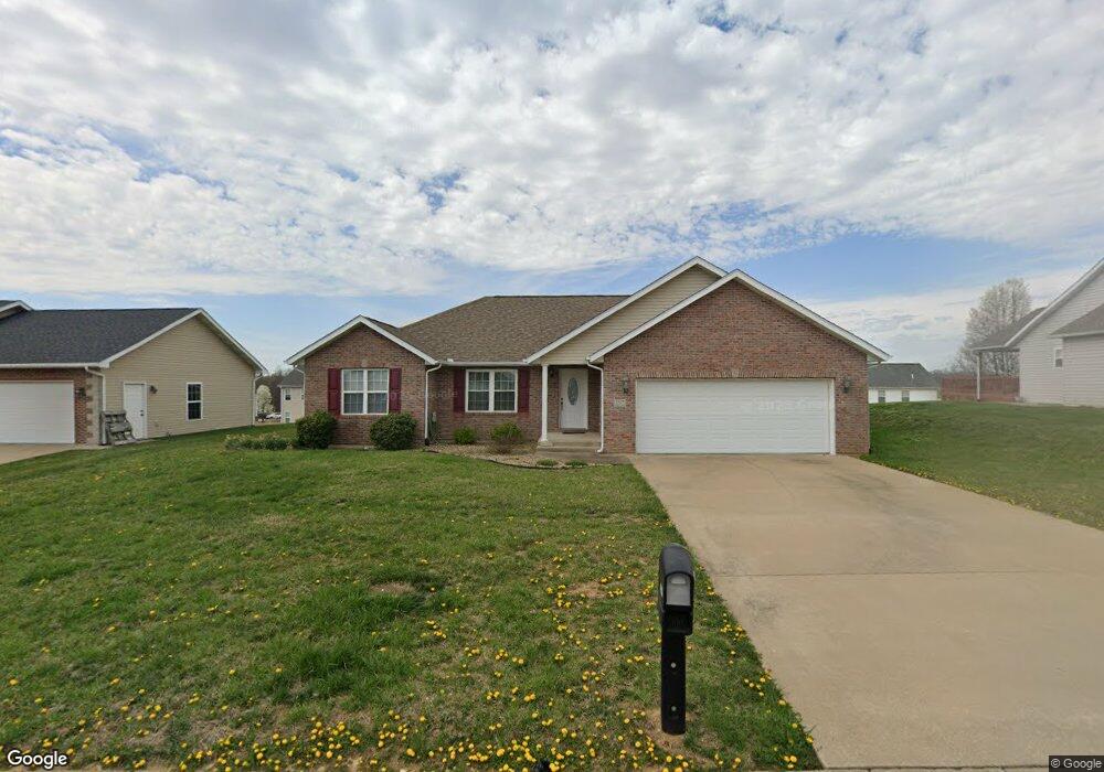
1327 Holly Dr Cape Girardeau, MO 63701
Estimated Value: $277,000 - $329,000
3
Beds
2
Baths
1,593
Sq Ft
$188/Sq Ft
Est. Value
About This Home
This home is located at 1327 Holly Dr, Cape Girardeau, MO 63701 and is currently estimated at $299,495, approximately $188 per square foot. 1327 Holly Dr is a home with nearby schools including Clippard Elementary School, Central Middle School, and Central Junior High School.
Ownership History
Date
Name
Owned For
Owner Type
Purchase Details
Closed on
Mar 8, 2019
Sold by
Kenner Kay A
Bought by
Hellman Lynn E and Kenner Family Protection Trust
Current Estimated Value
Purchase Details
Closed on
Jan 27, 2006
Sold by
Semo Land Llc
Bought by
Kenner Kay A
Home Financials for this Owner
Home Financials are based on the most recent Mortgage that was taken out on this home.
Original Mortgage
$140,000
Interest Rate
6.22%
Mortgage Type
Future Advance Clause Open End Mortgage
Create a Home Valuation Report for This Property
The Home Valuation Report is an in-depth analysis detailing your home's value as well as a comparison with similar homes in the area
Home Values in the Area
Average Home Value in this Area
Purchase History
| Date | Buyer | Sale Price | Title Company |
|---|---|---|---|
| Hellman Lynn E | -- | None Available | |
| Kenner Kay A | -- | None Available |
Source: Public Records
Mortgage History
| Date | Status | Borrower | Loan Amount |
|---|---|---|---|
| Previous Owner | Kenner Kay A | $140,000 |
Source: Public Records
Tax History Compared to Growth
Tax History
| Year | Tax Paid | Tax Assessment Tax Assessment Total Assessment is a certain percentage of the fair market value that is determined by local assessors to be the total taxable value of land and additions on the property. | Land | Improvement |
|---|---|---|---|---|
| 2025 | $20 | $39,890 | $5,330 | $34,560 |
| 2024 | $20 | $37,990 | $5,080 | $32,910 |
| 2023 | $1,974 | $37,990 | $5,080 | $32,910 |
| 2022 | $1,820 | $35,010 | $4,680 | $30,330 |
| 2021 | $1,820 | $35,010 | $4,680 | $30,330 |
| 2020 | $1,826 | $35,010 | $4,680 | $30,330 |
| 2019 | $1,823 | $35,010 | $0 | $0 |
| 2018 | $1,819 | $35,010 | $0 | $0 |
| 2017 | $1,824 | $35,010 | $0 | $0 |
| 2016 | $1,816 | $35,010 | $0 | $0 |
| 2015 | $1,818 | $35,010 | $0 | $0 |
| 2014 | $1,827 | $35,010 | $0 | $0 |
Source: Public Records
Map
Nearby Homes
- 3814 Carolewood Dr
- 1969 Silverthorne Trail
- 1989 Silverthorne Trail
- 1800 Silverthorne Trail
- 4516 Doe Run
- 1435 Chardonnay Ln
- 4530 Doe Run
- 4578 Kingston Ave
- 4527 Doe Run
- 4409 Clayton Ct
- 4562 Kingston Ave
- 4510 Doe Run
- 4568 Kingston Ave
- 1431 Chardonnay Ln
- 4521 Doe Run
- 4584 Kingston Ave
- 2236 Boulder Crest Dr
- 4522 Doe Run
- 4533 Doe Run
- 4404 Clayton Ct
- 1319 Holly Dr
- 1337 Holly Dr
- 1326 Vantage Dr
- 1316 Vantage Dr
- 1334 Vantage Dr
- 1322 Holly Dr
- 1307 Holly Dr
- 1345 Holly Dr
- 1338 Holly Dr
- 1314 Holly Dr
- 1342 Vantage Dr
- 1306 Vantage Dr
- 1348 Holly Dr
- 1355 Holly Dr
- 1363 E View Ridge
- 1353 Eastview Ridge Dr
- 1352 Vantage Dr
- 1371 Eastview Ridge
- 1329 Vantage Dr
- 1345 Eastview Ridge Dr