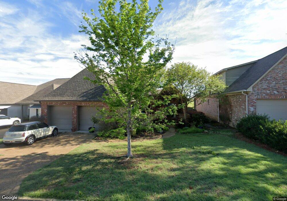
133 Southampton Cir Madison, MS 39110
Estimated Value: $458,000 - $625,000
3
Beds
4
Baths
2,800
Sq Ft
$196/Sq Ft
Est. Value
About This Home
This home is located at 133 Southampton Cir, Madison, MS 39110 and is currently estimated at $548,351, approximately $195 per square foot. 133 Southampton Cir is a home located in Madison County with nearby schools including Mannsdale Elementary School, Germantown Middle School, and Germantown High School.
Ownership History
Date
Name
Owned For
Owner Type
Purchase Details
Closed on
May 11, 2012
Sold by
Porter Kemper and Porter Sally E
Bought by
Porter Kemper
Current Estimated Value
Purchase Details
Closed on
Apr 18, 2008
Sold by
Mixon Tynes Properties Llc
Bought by
Porter Kemper and Porter Sally E
Purchase Details
Closed on
Feb 2, 2006
Sold by
Mixon Tynes Properties Llc
Bought by
Porter Kemper and Porter Sally E
Create a Home Valuation Report for This Property
The Home Valuation Report is an in-depth analysis detailing your home's value as well as a comparison with similar homes in the area
Home Values in the Area
Average Home Value in this Area
Purchase History
| Date | Buyer | Sale Price | Title Company |
|---|---|---|---|
| Porter Kemper | -- | None Available | |
| Porter Kemper | -- | First Guaranty Title Inc | |
| Porter Kemper | -- | Tcs Title Closing Svcs Llc |
Source: Public Records
Tax History Compared to Growth
Tax History
| Year | Tax Paid | Tax Assessment Tax Assessment Total Assessment is a certain percentage of the fair market value that is determined by local assessors to be the total taxable value of land and additions on the property. | Land | Improvement |
|---|---|---|---|---|
| 2025 | $2,738 | $34,170 | $0 | $0 |
| 2024 | $2,738 | $34,170 | $0 | $0 |
| 2023 | $3,209 | $34,170 | $0 | $0 |
| 2022 | $3,209 | $34,170 | $0 | $0 |
| 2021 | $2,998 | $32,758 | $0 | $0 |
| 2020 | $2,997 | $32,748 | $0 | $0 |
| 2019 | $2,997 | $32,748 | $0 | $0 |
| 2018 | $2,997 | $32,748 | $0 | $0 |
| 2017 | $2,940 | $32,181 | $0 | $0 |
| 2016 | $2,555 | $28,354 | $0 | $0 |
| 2015 | $2,441 | $28,354 | $0 | $0 |
| 2014 | $2,436 | $28,300 | $0 | $0 |
Source: Public Records
Map
Nearby Homes
- 132 Southampton Cir
- 284 Caroline Blvd
- 117 Links Cove
- 0 Caroline Pointe Lot 1408 Blvd
- 0 Caroline Pointe Lot 1410 Blvd
- 0 Caroline Pointe Lot 1405 Blvd
- 104 Azalea Cove
- 0 Caroline Pointe Lot 1412 Blvd
- 0 Caroline Pointe Lot 1416 Blvd
- 107 Belle Pointe
- 154 Belle Pointe
- 102 S Glen Dr
- 156 Cotton Wood Dr
- 0 Camden Ct Unit 4080616
- 157 Cotton Wood Dr
- 103 Maple Grove
- 108 Timber Dr
- 213 Cotton Wood Dr
- 110 Buckeye Dr
- 159 Beaufort Cir
- 135 Southampton Cir
- 131 Southampton Cir
- 137 Southampton Cir
- 129 Southampton Cir
- 134 Southampton Cir
- 130 Southampton Cir
- 127 Southampton Cir
- 126 Southampton Cir
- 125 Southampton Cir
- 123 Southampton Cir
- 243 Caroline Blvd
- 0 Southampton Cir Unit lot 8 1111188
- 0 Southampton Cir Unit 1124831
- 0 Southampton Cir Unit lot 20 1132475
- 0 Southampton Cir Unit Lot 19 1125170
- 0 Southampton Cir Unit lot 28 1124244
- 0 Southampton Cir Unit lot 27
- 239 Caroline Blvd
- 118 Southampton Cir
- 247 Caroline Blvd