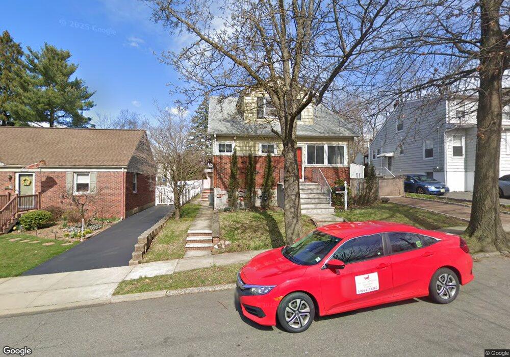
133 Thoma Ave Maywood, NJ 07607
Estimated Value: $605,000 - $717,000
4
Beds
2
Baths
1,732
Sq Ft
$392/Sq Ft
Est. Value
About This Home
This home is located at 133 Thoma Ave, Maywood, NJ 07607 and is currently estimated at $679,750, approximately $392 per square foot. 133 Thoma Ave is a home located in Bergen County with nearby schools including Maywood Avenue Elementary School, Memorial Elementary School, and Ben Porat Yosef.
Ownership History
Date
Name
Owned For
Owner Type
Purchase Details
Closed on
Jun 15, 2017
Sold by
Keith Preemyer and Keith Carol Preemyer
Bought by
Windelbrandt Edyta
Current Estimated Value
Home Financials for this Owner
Home Financials are based on the most recent Mortgage that was taken out on this home.
Original Mortgage
$280,000
Interest Rate
3.95%
Mortgage Type
New Conventional
Create a Home Valuation Report for This Property
The Home Valuation Report is an in-depth analysis detailing your home's value as well as a comparison with similar homes in the area
Home Values in the Area
Average Home Value in this Area
Purchase History
| Date | Buyer | Sale Price | Title Company |
|---|---|---|---|
| Windelbrandt Edyta | $350 | None Available |
Source: Public Records
Mortgage History
| Date | Status | Borrower | Loan Amount |
|---|---|---|---|
| Previous Owner | Windelbrandt Edyta | $280,000 |
Source: Public Records
Tax History Compared to Growth
Tax History
| Year | Tax Paid | Tax Assessment Tax Assessment Total Assessment is a certain percentage of the fair market value that is determined by local assessors to be the total taxable value of land and additions on the property. | Land | Improvement |
|---|---|---|---|---|
| 2025 | $10,883 | $537,100 | $293,000 | $244,100 |
| 2024 | $10,431 | $505,700 | $266,700 | $239,000 |
| 2023 | $10,034 | $484,500 | $254,600 | $229,900 |
| 2022 | $10,034 | $439,700 | $230,400 | $209,300 |
| 2021 | $9,943 | $408,500 | $207,000 | $201,500 |
| 2020 | $8,857 | $280,300 | $143,100 | $137,200 |
| 2019 | $8,707 | $279,800 | $143,100 | $136,700 |
| 2018 | $8,514 | $279,800 | $143,100 | $136,700 |
| 2017 | $8,377 | $279,800 | $143,100 | $136,700 |
| 2016 | $8,120 | $279,800 | $143,100 | $136,700 |
| 2015 | $7,896 | $279,800 | $143,100 | $136,700 |
| 2014 | $7,784 | $279,800 | $143,100 | $136,700 |
Source: Public Records
Map
Nearby Homes
- 47 Colling Ave
- 350 Maywood Ave
- 29 Colling Ave
- 25 Marinus St
- 50 Oak St
- 115 Parkway
- 49 E Pleasant Ave
- 644 Wyoming Ave
- 642 Spring Valley Rd
- 17 Oak St
- 37 Terrace Ave
- 137 Hartwich St
- 31 Chestnut St
- 175 Rochelle Ave Unit 110
- 175 Rochelle Ave Unit 321
- 175 Rochelle Ave
- 175 Rochelle Ave Unit 222
- 175 Rochelle Ave Unit 323
- 493 W Anderson St
- 483 Colonial Terrace Unit 10