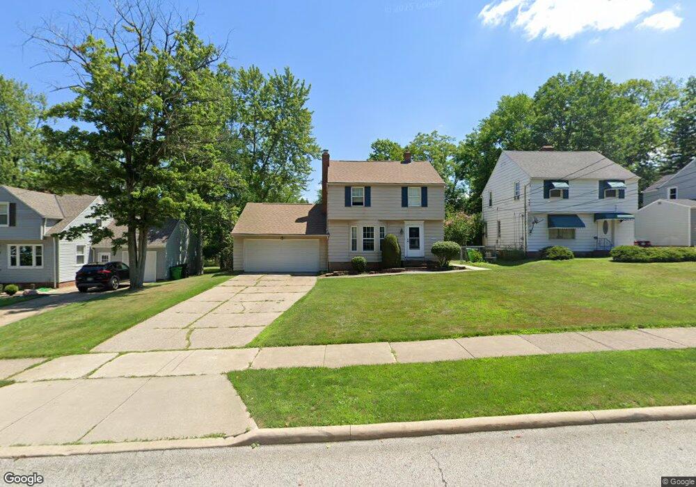
1335 Dorsh Rd Cleveland, OH 44121
Estimated Value: $189,000 - $240,000
3
Beds
2
Baths
1,448
Sq Ft
$149/Sq Ft
Est. Value
About This Home
This home is located at 1335 Dorsh Rd, Cleveland, OH 44121 and is currently estimated at $215,249, approximately $148 per square foot. 1335 Dorsh Rd is a home located in Cuyahoga County with nearby schools including Greenview Upper Elementary School, Sunview Elementary School, and Memorial Junior High School.
Ownership History
Date
Name
Owned For
Owner Type
Purchase Details
Closed on
Jan 13, 1999
Sold by
Pastori C Michael and Pastori Lisa L
Bought by
Crouse Cathleen J
Current Estimated Value
Home Financials for this Owner
Home Financials are based on the most recent Mortgage that was taken out on this home.
Original Mortgage
$107,362
Outstanding Balance
$24,966
Interest Rate
6.79%
Mortgage Type
FHA
Estimated Equity
$190,283
Purchase Details
Closed on
Feb 20, 1991
Sold by
Pastori C Michael
Bought by
Pastori C Michael
Purchase Details
Closed on
Apr 10, 1989
Sold by
Pastori C Michael
Bought by
Pastori C Michael
Purchase Details
Closed on
Jan 19, 1988
Sold by
Pastori Michael C
Bought by
Pastori C Michael
Purchase Details
Closed on
Dec 2, 1981
Sold by
Farr Richard M and Farr Dolores E
Bought by
Pastori Michael C
Purchase Details
Closed on
Jan 1, 1975
Bought by
Farr Richard M and Farr Dolores E
Create a Home Valuation Report for This Property
The Home Valuation Report is an in-depth analysis detailing your home's value as well as a comparison with similar homes in the area
Home Values in the Area
Average Home Value in this Area
Purchase History
| Date | Buyer | Sale Price | Title Company |
|---|---|---|---|
| Crouse Cathleen J | $120,000 | Ohio Title Corp | |
| Pastori C Michael | -- | -- | |
| Pastori C Michael | -- | -- | |
| Pastori C Michael | -- | -- | |
| Pastori Michael C | $68,000 | -- | |
| Farr Richard M | -- | -- |
Source: Public Records
Mortgage History
| Date | Status | Borrower | Loan Amount |
|---|---|---|---|
| Open | Crouse Cathleen J | $107,362 |
Source: Public Records
Tax History Compared to Growth
Tax History
| Year | Tax Paid | Tax Assessment Tax Assessment Total Assessment is a certain percentage of the fair market value that is determined by local assessors to be the total taxable value of land and additions on the property. | Land | Improvement |
|---|---|---|---|---|
| 2024 | $4,478 | $57,400 | $11,725 | $45,675 |
| 2023 | $4,171 | $43,890 | $8,890 | $35,000 |
| 2022 | $4,219 | $43,890 | $8,890 | $35,000 |
| 2021 | $4,186 | $43,890 | $8,890 | $35,000 |
| 2020 | $4,136 | $37,840 | $7,670 | $30,170 |
| 2019 | $3,782 | $108,100 | $21,900 | $86,200 |
| 2018 | $3,764 | $37,840 | $7,670 | $30,170 |
| 2017 | $4,379 | $40,950 | $7,280 | $33,670 |
| 2016 | $4,351 | $40,780 | $7,280 | $33,500 |
| 2015 | $4,205 | $40,780 | $7,280 | $33,500 |
| 2014 | $4,205 | $40,780 | $7,280 | $33,500 |
Source: Public Records
Map
Nearby Homes
- 4800 Farnhurst Rd
- 4650 Liberty Rd
- 4669 Liberty Rd
- 4695 Mayfield Rd Unit A
- 4685 Mayfield Rd Unit F
- 4705 Mayfield Rd Unit B
- 1512 Parkside Cir
- 1503 Oakmount Rd
- 4781 Dorshwood Rd
- 4866 Fairlawn Rd
- 4493 Telhurst Rd
- 4769 Edenwood Rd
- 4514 E Berwald Rd
- 1333 Clearview Rd
- 4591 Wilburn Dr
- 4410 Ardmore Rd
- 4561 Wilburn Dr
- 4406 Elmwood Rd
- 1387 Richmond Rd
- 1514 Garden Dr