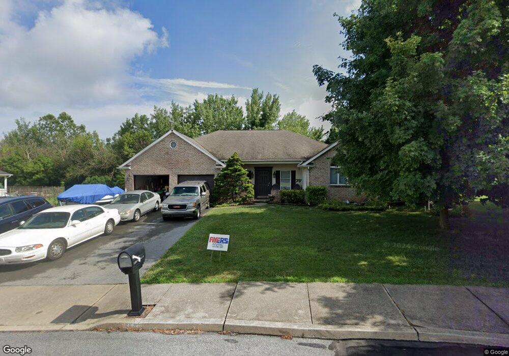
1338 Barrington Dr Northampton, PA 18067
Estimated Value: $466,000 - $543,000
4
Beds
4
Baths
3,133
Sq Ft
$163/Sq Ft
Est. Value
About This Home
This home is located at 1338 Barrington Dr, Northampton, PA 18067 and is currently estimated at $509,783, approximately $162 per square foot. 1338 Barrington Dr is a home located in Northampton County with nearby schools including Colonel John Siegfried Elementary School, Northampton Area Middle School, and Northampton Area High School.
Ownership History
Date
Name
Owned For
Owner Type
Purchase Details
Closed on
Apr 25, 2003
Sold by
Bodo Barry
Bought by
Smith Stanley
Current Estimated Value
Home Financials for this Owner
Home Financials are based on the most recent Mortgage that was taken out on this home.
Original Mortgage
$109,200
Outstanding Balance
$46,532
Interest Rate
5.64%
Mortgage Type
New Conventional
Estimated Equity
$463,251
Purchase Details
Closed on
Sep 1, 1996
Bought by
Bodo Barry O and Bodo Betty I
Create a Home Valuation Report for This Property
The Home Valuation Report is an in-depth analysis detailing your home's value as well as a comparison with similar homes in the area
Home Values in the Area
Average Home Value in this Area
Purchase History
| Date | Buyer | Sale Price | Title Company |
|---|---|---|---|
| Smith Stanley | $280,000 | -- | |
| Bodo Barry O | $179,500 | -- |
Source: Public Records
Mortgage History
| Date | Status | Borrower | Loan Amount |
|---|---|---|---|
| Open | Smith Stanley | $109,200 |
Source: Public Records
Tax History Compared to Growth
Tax History
| Year | Tax Paid | Tax Assessment Tax Assessment Total Assessment is a certain percentage of the fair market value that is determined by local assessors to be the total taxable value of land and additions on the property. | Land | Improvement |
|---|---|---|---|---|
| 2025 | $969 | $89,700 | $19,100 | $70,600 |
| 2024 | $7,177 | $89,700 | $19,100 | $70,600 |
| 2023 | $7,087 | $89,700 | $19,100 | $70,600 |
| 2022 | $6,998 | $89,700 | $19,100 | $70,600 |
| 2021 | $7,014 | $89,700 | $19,100 | $70,600 |
| 2020 | $6,924 | $89,700 | $19,100 | $70,600 |
| 2019 | $6,784 | $89,700 | $19,100 | $70,600 |
| 2018 | $6,689 | $89,700 | $19,100 | $70,600 |
| 2017 | $6,552 | $89,700 | $19,100 | $70,600 |
| 2016 | -- | $89,700 | $19,100 | $70,600 |
| 2015 | -- | $89,700 | $19,100 | $70,600 |
| 2014 | -- | $89,700 | $19,100 | $70,600 |
Source: Public Records
Map
Nearby Homes
- 1328 Adams St
- 1309 Adams St
- 426 E 12th St
- 624 E 8th St
- 119 Gray Dr
- 649 Walker Dr
- 642 Walker Dr
- 1339 Washington Ave
- 1529 Dewey Ave
- 1510 Washington Ave
- 1309 Newport Ave
- 1466 Main St
- 1809 Lincoln Ave
- 705 Main St
- 1613 Main St
- 4140 Pine Hurst Dr
- 325 Kingsbarns Ln
- 1740 Washington Ave
- 320 Bendelow Ln
- 314 Kingsbarns Ln
- 1336 Barrington Dr
- 1340 Barrington Dr
- 1339 Barrington Dr
- 1334 Barrington Dr
- 1342 Barrington Dr
- 1336 Kingston Ct
- 1337 Barrington Dr
- 1340 Kingston Ct
- 1332 Barrington Dr
- 1334 Kingston Ct
- 1342 Kingston Ct
- 1335 Barrington Dr
- 1332 Kingston Ct
- 1330 Barrington Dr
- 1337 Kingston Ct
- 1339 Kingston Ct
- 1333 Barrington Dr
- 1344 Kingston Dr
- 1335 Kingston Ct
- 1341 Kingston Ct