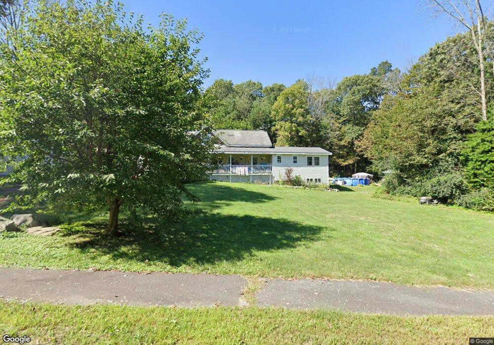
134 East St Wrentham, MA 02093
Estimated Value: $510,000 - $579,000
2
Beds
2
Baths
993
Sq Ft
$560/Sq Ft
Est. Value
About This Home
This home is located at 134 East St, Wrentham, MA 02093 and is currently estimated at $556,048, approximately $559 per square foot. 134 East St is a home located in Norfolk County with nearby schools including Delaney Elementary School, Charles E Roderick, and The Sage School.
Ownership History
Date
Name
Owned For
Owner Type
Purchase Details
Closed on
Sep 1, 2006
Sold by
Morlock Elaine
Bought by
Keating Michael R and Werning Tanya L
Current Estimated Value
Home Financials for this Owner
Home Financials are based on the most recent Mortgage that was taken out on this home.
Original Mortgage
$204,000
Interest Rate
6.83%
Mortgage Type
Purchase Money Mortgage
Purchase Details
Closed on
Dec 5, 2003
Sold by
Enegren Craig A and Enegren Donna M
Bought by
Morlock Elaine M
Home Financials for this Owner
Home Financials are based on the most recent Mortgage that was taken out on this home.
Original Mortgage
$228,000
Interest Rate
6.03%
Mortgage Type
Purchase Money Mortgage
Create a Home Valuation Report for This Property
The Home Valuation Report is an in-depth analysis detailing your home's value as well as a comparison with similar homes in the area
Home Values in the Area
Average Home Value in this Area
Purchase History
| Date | Buyer | Sale Price | Title Company |
|---|---|---|---|
| Keating Michael R | $255,000 | -- | |
| Morlock Elaine M | $240,000 | -- |
Source: Public Records
Mortgage History
| Date | Status | Borrower | Loan Amount |
|---|---|---|---|
| Open | Morlock Elaine M | $247,500 | |
| Closed | Keating Michael R | $204,000 | |
| Closed | Keating Michael R | $38,250 | |
| Previous Owner | Morlock Elaine M | $228,000 | |
| Previous Owner | Morlock Elaine M | $54,000 | |
| Previous Owner | Morlock Elaine M | $65,000 |
Source: Public Records
Tax History Compared to Growth
Tax History
| Year | Tax Paid | Tax Assessment Tax Assessment Total Assessment is a certain percentage of the fair market value that is determined by local assessors to be the total taxable value of land and additions on the property. | Land | Improvement |
|---|---|---|---|---|
| 2025 | $5,716 | $493,200 | $270,200 | $223,000 |
| 2024 | $5,444 | $453,700 | $270,200 | $183,500 |
| 2023 | $5,355 | $424,300 | $245,700 | $178,600 |
| 2022 | $5,033 | $368,200 | $221,100 | $147,100 |
| 2021 | $4,818 | $342,400 | $197,500 | $144,900 |
| 2020 | $4,694 | $329,400 | $180,300 | $149,100 |
| 2019 | $4,353 | $308,300 | $163,900 | $144,400 |
| 2018 | $4,299 | $301,900 | $163,900 | $138,000 |
| 2017 | $4,056 | $284,600 | $160,800 | $123,800 |
| 2016 | $3,894 | $272,700 | $156,100 | $116,600 |
| 2015 | $3,785 | $252,700 | $150,100 | $102,600 |
| 2014 | $3,725 | $243,300 | $144,400 | $98,900 |
Source: Public Records
Map
Nearby Homes
- 10 Nature View Dr
- 15 Nature View Dr
- 155 Clark Rd Unit 155
- 362 East St
- 319 Taunton St
- 1 Lorraine Metcalf Dr
- 270 Dedham St
- 131 Creek St Unit 7
- 11 Earle Stewart Ln
- Lot 3 - 14 Earle Stewart Ln
- Lot 1 - Blueberry 2 Car Plan at King Philip Estates
- Lot 8 - Blueberry 2 Car Plan at King Philip Estates
- Lot 5 - Hughes 2 car Plan at King Philip Estates
- Lot 6 - Blueberry 3 Car Plan at King Philip Estates
- Lot 2 - Camden 2 Car Plan at King Philip Estates
- Lot 7 - Cedar Plan at King Philip Estates
- Lot 4 - Hemingway 2 Car Plan at King Philip Estates
- Lot 3 - Blueberry 2 Car Plan at King Philip Estates
- 65 Pond St
- 120 Hawes St