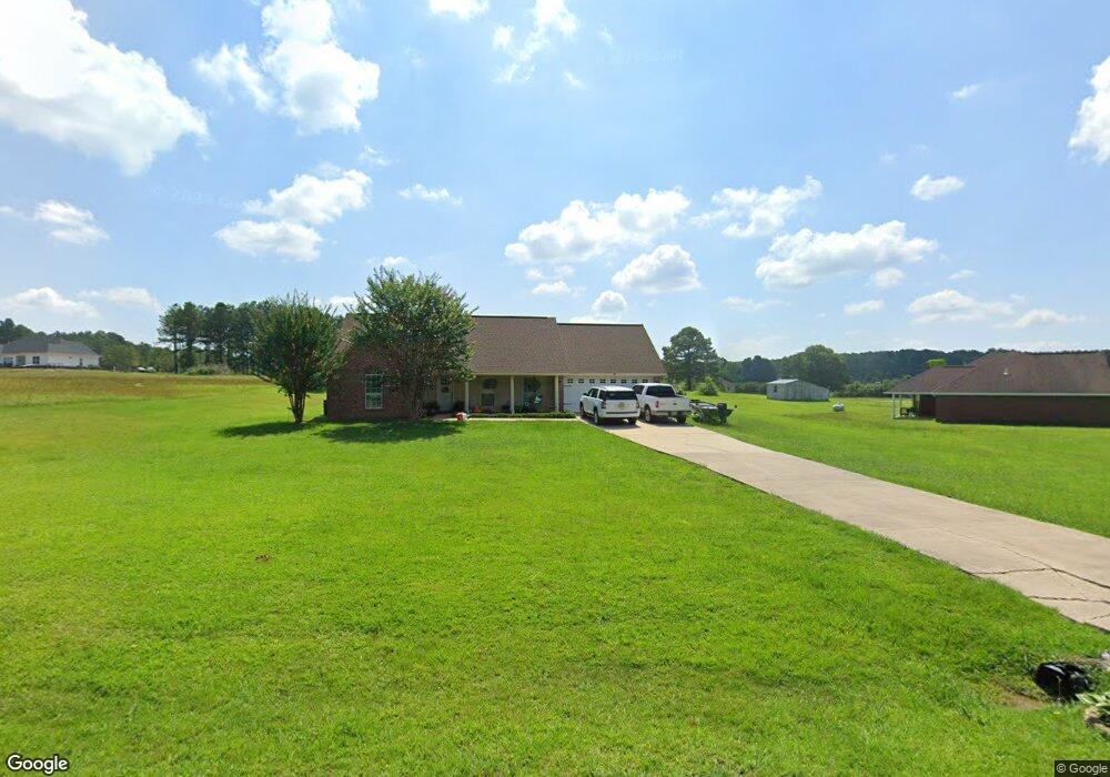
134 Plantation Point Dr N Philadelphia, MS 39350
Estimated Value: $132,000 - $273,000
--
Bed
2
Baths
2,017
Sq Ft
$106/Sq Ft
Est. Value
About This Home
This home is located at 134 Plantation Point Dr N, Philadelphia, MS 39350 and is currently estimated at $214,626, approximately $106 per square foot. 134 Plantation Point Dr N is a home located in Neshoba County.
Ownership History
Date
Name
Owned For
Owner Type
Purchase Details
Closed on
Jun 17, 2019
Sold by
Moss Tasha H and Moss Paul
Bought by
Long Jonathon M and Long Kristien
Current Estimated Value
Home Financials for this Owner
Home Financials are based on the most recent Mortgage that was taken out on this home.
Original Mortgage
$158,280
Outstanding Balance
$139,991
Interest Rate
4.5%
Mortgage Type
FHA
Estimated Equity
$74,635
Purchase Details
Closed on
May 29, 2009
Sold by
Lewis Justin A
Bought by
Lewis Tasha H
Create a Home Valuation Report for This Property
The Home Valuation Report is an in-depth analysis detailing your home's value as well as a comparison with similar homes in the area
Home Values in the Area
Average Home Value in this Area
Purchase History
| Date | Buyer | Sale Price | Title Company |
|---|---|---|---|
| Long Jonathon M | -- | -- | |
| Lewis Tasha H | -- | -- |
Source: Public Records
Mortgage History
| Date | Status | Borrower | Loan Amount |
|---|---|---|---|
| Open | Long Jonathon M | $158,280 |
Source: Public Records
Tax History Compared to Growth
Tax History
| Year | Tax Paid | Tax Assessment Tax Assessment Total Assessment is a certain percentage of the fair market value that is determined by local assessors to be the total taxable value of land and additions on the property. | Land | Improvement |
|---|---|---|---|---|
| 2025 | $1,351 | $15,386 | $0 | $0 |
| 2024 | $1,351 | $15,372 | $0 | $0 |
| 2023 | $1,280 | $14,271 | $0 | $0 |
| 2022 | $1,280 | $14,271 | $0 | $0 |
| 2021 | $1,284 | $14,271 | $0 | $0 |
| 2020 | $1,254 | $14,271 | $0 | $0 |
| 2019 | $1,203 | $13,742 | $0 | $0 |
| 2018 | $1,203 | $13,742 | $0 | $0 |
| 2017 | $1,174 | $13,742 | $0 | $0 |
| 2016 | $1,180 | $13,742 | $0 | $0 |
| 2015 | -- | $13,637 | $0 | $0 |
| 2014 | -- | $13,637 | $0 | $0 |
Source: Public Records
Map
Nearby Homes
- 138 Plantation Point Dr N
- 103 Gateway Dr
- 0 S Plantation Unit 25-813
- 0 S Plantation Unit 25-814
- 0 S Plantation Unit 25-812
- 0 Woodland Hills Dr
- 206 Woodbriar Ln
- 1012 Kosciusko Rd
- 904 Pecan Ave
- 0 Country Ln
- 708 Forest Park Cir
- 408 Hospital St
- 736 Forest Park Cir
- 738 Forest Park Cir
- 0 Columbus Ave
- 457 Pecan Ave
- 100 Highway 19
- 0 Mississippi 19
- 01 Mississippi 19
- 437C Pecan Ave
- 118 Plantation Point Dr N
- 132 Plantation Point Dr N
- 134 Plantation Dr
- 133 Plantation Point Dr N
- 142 Plantation Point Dr N
- 101 N Hill Dr
- 125 Plantation Point Dr N
- 119 Plantation Point Dr N
- 10281 Road 2618
- 117 Plantation Point Dr N
- 10750 Bia 0241
- 102 Pleasant Ridge Dr
- 106 Pleasant Ridge Rd
- 113 Plantation Point Dr N
- 105 Gateway Dr
- 112 Plantation Point Dr N
- 27 Plantation Point S
- 115 Plantation Point S
- 111 Plantation Point Dr N
- 10130 Road 2618