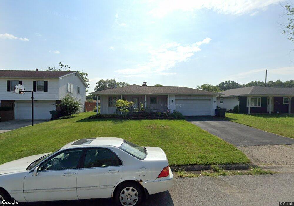
1340 E Chesfield Dr Columbus, OH 43204
Brookshire NeighborhoodEstimated Value: $241,851 - $313,000
3
Beds
2
Baths
1,500
Sq Ft
$177/Sq Ft
Est. Value
About This Home
This home is located at 1340 E Chesfield Dr, Columbus, OH 43204 and is currently estimated at $265,963, approximately $177 per square foot. 1340 E Chesfield Dr is a home located in Franklin County with nearby schools including Binns Elementary School, Wedgewood Middle School, and Briggs High School.
Ownership History
Date
Name
Owned For
Owner Type
Purchase Details
Closed on
Jan 20, 1999
Sold by
Baker William A and Baker Linda K
Bought by
Tho Chandara and Tho Narom K
Current Estimated Value
Home Financials for this Owner
Home Financials are based on the most recent Mortgage that was taken out on this home.
Original Mortgage
$81,600
Interest Rate
6.76%
Purchase Details
Closed on
Sep 24, 1991
Bought by
Baker William A and Baker Linda K
Purchase Details
Closed on
Mar 11, 1991
Purchase Details
Closed on
Sep 6, 1989
Create a Home Valuation Report for This Property
The Home Valuation Report is an in-depth analysis detailing your home's value as well as a comparison with similar homes in the area
Home Values in the Area
Average Home Value in this Area
Purchase History
| Date | Buyer | Sale Price | Title Company |
|---|---|---|---|
| Tho Chandara | $102,000 | Independent Title | |
| Baker William A | $82,000 | -- | |
| -- | $62,000 | -- | |
| -- | -- | -- |
Source: Public Records
Mortgage History
| Date | Status | Borrower | Loan Amount |
|---|---|---|---|
| Closed | Tho Chandara | $81,600 |
Source: Public Records
Tax History Compared to Growth
Tax History
| Year | Tax Paid | Tax Assessment Tax Assessment Total Assessment is a certain percentage of the fair market value that is determined by local assessors to be the total taxable value of land and additions on the property. | Land | Improvement |
|---|---|---|---|---|
| 2024 | $3,376 | $75,220 | $14,810 | $60,410 |
| 2023 | $3,333 | $75,220 | $14,810 | $60,410 |
| 2022 | $2,037 | $39,270 | $7,070 | $32,200 |
| 2021 | $2,040 | $39,270 | $7,070 | $32,200 |
| 2020 | $2,043 | $39,270 | $7,070 | $32,200 |
| 2019 | $2,077 | $34,230 | $6,160 | $28,070 |
| 2018 | $2,046 | $34,230 | $6,160 | $28,070 |
| 2017 | $2,151 | $34,230 | $6,160 | $28,070 |
| 2016 | $2,226 | $33,600 | $5,600 | $28,000 |
| 2015 | $2,021 | $33,600 | $5,600 | $28,000 |
| 2014 | $2,025 | $33,600 | $5,600 | $28,000 |
| 2013 | $1,175 | $39,515 | $6,580 | $32,935 |
Source: Public Records
Map
Nearby Homes
- 2856 Chesfield Dr
- 1248 Gresham Rd
- 2987 Daisy Ln
- 2929 Briggs Rd
- 1520 Fall Brook Rd
- 2547 Rosedale Ave
- 2743 Saint Joseph Ave
- 2610 Spaatz Ave
- 1037 Chestershire Rd
- 0 S Central Ave
- 2743 Bernadette Rd
- 903 S Harris Ave
- 2783-2785 Vanderberg Ave
- 1465 Tall Meadows Dr
- 3029 Rosedale Ave
- 1181 Onslow Dr
- 2436 Hardesty Dr S Unit 4
- 2687 Vanderberg Ave
- 898 Chestershire Rd
- 2362 Woodbrook Cir N Unit 81
- 1348 E Chesfield Dr
- 1332 E Chesfield Dr
- 1347 Bronwyn Ave
- 1339 Bronwyn Ave
- 2812 Briggston Ave
- 1359 Bronwyn Ave
- 1324 E Chesfield Dr
- 2825 Chesfield Dr
- 1331 Bronwyn Ave
- 1349 E Chesfield Dr
- 2814 Chesfield Dr
- 2838 Briggston Ave
- 1319 Bronwyn Ave
- 2833 Chesfield Dr
- 1307 Bronwyn Ave
- 2828 Chesfield Dr
- 2817 Briggston Ave
- 2846 Briggston Ave
- 1348 Bronwyn Ave