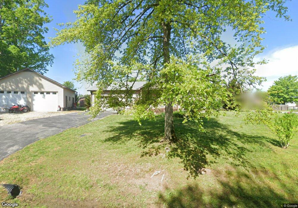
135 South Dr Cookeville, TN 38501
Estimated Value: $201,825 - $265,000
--
Bed
2
Baths
1,170
Sq Ft
$207/Sq Ft
Est. Value
About This Home
This home is located at 135 South Dr, Cookeville, TN 38501 and is currently estimated at $241,956, approximately $206 per square foot. 135 South Dr is a home located in Putnam County with nearby schools including Cane Creek Elementary School, Upperman Middle School, and Upperman High School.
Ownership History
Date
Name
Owned For
Owner Type
Purchase Details
Closed on
Feb 3, 2020
Sold by
Jordan Ricky John
Bought by
Wilson Johnny Wayne
Current Estimated Value
Purchase Details
Closed on
Feb 11, 2013
Sold by
Jordan Tabitha Lynn
Bought by
Jordan Ricky John
Purchase Details
Closed on
Oct 7, 2003
Sold by
Jordan Estelle L Living Tr
Bought by
John Jordan Rick and John Tabitha L
Home Financials for this Owner
Home Financials are based on the most recent Mortgage that was taken out on this home.
Original Mortgage
$37,744
Interest Rate
6.45%
Purchase Details
Closed on
Mar 3, 1998
Bought by
Jordan Estelle L Etvir Richard Jordan
Purchase Details
Closed on
Jan 15, 1988
Bought by
Elrod Dale E
Purchase Details
Closed on
Feb 26, 1987
Bought by
Gaw Oakley and Dellveneri Frederick A
Purchase Details
Closed on
Feb 28, 1978
Bought by
Carter Charles E and Carter Patricia
Create a Home Valuation Report for This Property
The Home Valuation Report is an in-depth analysis detailing your home's value as well as a comparison with similar homes in the area
Home Values in the Area
Average Home Value in this Area
Purchase History
| Date | Buyer | Sale Price | Title Company |
|---|---|---|---|
| Wilson Johnny Wayne | -- | -- | |
| Jordan Ricky John | -- | -- | |
| John Jordan Rick | -- | -- | |
| Jordan Estelle L Etvir Richard Jordan | $73,300 | -- | |
| Elrod Dale E | $44,500 | -- | |
| Gaw Oakley | -- | -- | |
| Carter Charles E | -- | -- |
Source: Public Records
Mortgage History
| Date | Status | Borrower | Loan Amount |
|---|---|---|---|
| Previous Owner | Carter Charles E | $37,744 |
Source: Public Records
Tax History Compared to Growth
Tax History
| Year | Tax Paid | Tax Assessment Tax Assessment Total Assessment is a certain percentage of the fair market value that is determined by local assessors to be the total taxable value of land and additions on the property. | Land | Improvement |
|---|---|---|---|---|
| 2024 | $980 | $36,850 | $5,750 | $31,100 |
| 2023 | $980 | $36,850 | $5,750 | $31,100 |
| 2022 | $911 | $36,850 | $5,750 | $31,100 |
| 2021 | $911 | $36,850 | $5,750 | $31,100 |
| 2020 | $612 | $36,850 | $5,750 | $31,100 |
| 2019 | $827 | $29,625 | $5,750 | $23,875 |
| 2018 | $771 | $28,250 | $5,750 | $22,500 |
| 2017 | $771 | $28,250 | $5,750 | $22,500 |
| 2016 | $771 | $28,250 | $5,750 | $22,500 |
| 2015 | $792 | $28,250 | $5,750 | $22,500 |
| 2014 | $727 | $25,918 | $0 | $0 |
Source: Public Records
Map
Nearby Homes
- 270 Locust Grove Rd
- 279 Willow Brook Dr
- 2911 Grand Ridge Dr
- 2136 W Broad St
- 500 N McBroom Chapel Rd
- 2.52 St
- 0 Corner of W Broad St & Tn Ave Unit RTC2794105
- 1957 W Broad St
- Lot 3 Miller
- 4131 Charlton Square
- 4060 Charlton Square
- 2.52 ac W Broad St
- 918 Faye Dr
- 1711 Creekside Dr
- 1775 Creekside Dr
- 553 County Farm Rd
- 4113 Buffalo Valley Rd
- 1520 Hawkins Crawford Rd
- 1408 Oak Grove Dr