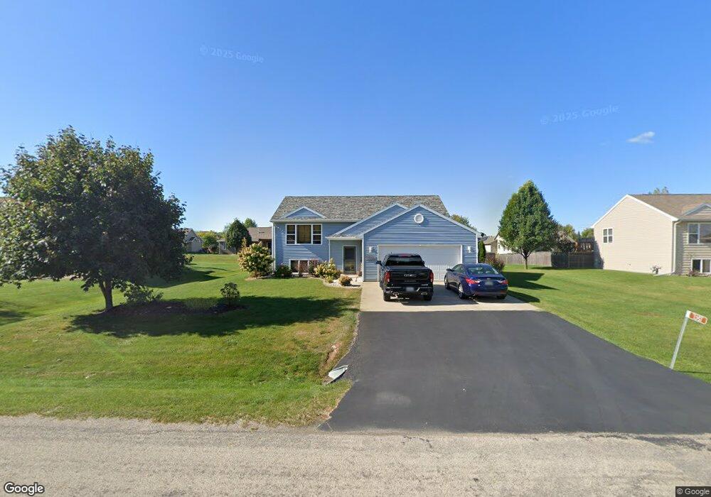
1351 Harvest Moon Dr Neenah, WI 54956
Estimated Value: $309,261 - $361,000
2
Beds
2
Baths
1,167
Sq Ft
$295/Sq Ft
Est. Value
About This Home
This home is located at 1351 Harvest Moon Dr, Neenah, WI 54956 and is currently estimated at $343,815, approximately $294 per square foot. 1351 Harvest Moon Dr is a home located in Winnebago County with nearby schools including Tullar Elementary School, Horace Mann Middle School, and Neenah Middle School.
Ownership History
Date
Name
Owned For
Owner Type
Purchase Details
Closed on
May 21, 2009
Sold by
Lindenwood Development Llc
Bought by
Olson Tyler C and Nowicki Karen M
Current Estimated Value
Home Financials for this Owner
Home Financials are based on the most recent Mortgage that was taken out on this home.
Original Mortgage
$134,174
Outstanding Balance
$84,774
Interest Rate
4.85%
Mortgage Type
FHA
Estimated Equity
$259,041
Purchase Details
Closed on
Jun 30, 2008
Sold by
Thompsons & Associates Land Development
Bought by
Lindenwood Adevelopment Llc
Create a Home Valuation Report for This Property
The Home Valuation Report is an in-depth analysis detailing your home's value as well as a comparison with similar homes in the area
Home Values in the Area
Average Home Value in this Area
Purchase History
| Date | Buyer | Sale Price | Title Company |
|---|---|---|---|
| Olson Tyler C | $136,700 | None Available | |
| Lindenwood Adevelopment Llc | $375,000 | None Available |
Source: Public Records
Mortgage History
| Date | Status | Borrower | Loan Amount |
|---|---|---|---|
| Open | Olson Tyler C | $134,174 |
Source: Public Records
Tax History Compared to Growth
Tax History
| Year | Tax Paid | Tax Assessment Tax Assessment Total Assessment is a certain percentage of the fair market value that is determined by local assessors to be the total taxable value of land and additions on the property. | Land | Improvement |
|---|---|---|---|---|
| 2024 | $3,327 | $204,200 | $38,300 | $165,900 |
| 2023 | $3,262 | $204,200 | $38,300 | $165,900 |
| 2022 | $3,333 | $204,200 | $38,300 | $165,900 |
| 2021 | $3,227 | $204,200 | $38,300 | $165,900 |
| 2020 | $3,440 | $204,200 | $38,300 | $165,900 |
| 2019 | $2,984 | $161,800 | $36,000 | $125,800 |
| 2018 | $2,888 | $161,800 | $36,000 | $125,800 |
| 2017 | $2,542 | $161,800 | $36,000 | $125,800 |
| 2016 | $2,563 | $161,800 | $36,000 | $125,800 |
| 2015 | $2,422 | $161,800 | $36,000 | $125,800 |
| 2014 | -- | $144,000 | $36,000 | $108,000 |
| 2013 | -- | $144,000 | $36,000 | $108,000 |
Source: Public Records
Map
Nearby Homes
- 1017 Westwind Dr
- 1160 Westwind Dr
- 0 Vassar Ln
- 985 Babcock St
- 940 Babcock St Unit 96
- 970 Manor Dr Unit 72
- 1112 Oxford Ct
- 1316 Wedgewood Ln
- 1372 Baytree Ln
- 1016 Gregory St
- 1516 Kingswood Dr
- 8404 Clayton Ave
- 1500 Hidden Acres Ln
- 982 Byrd Ave
- 980 Byrd Ave
- 0 Larsen Rd
- 929 Gay Dr Unit 931
- 1442 Baytree Ln
- 1133 Primrose Ct Unit 1135
- 1562 Lone Oak Dr
- 1347 Harvest Moon Dr
- 1355 Harvest Moon Dr
- 1350 Eagle Feather Trail
- 1343 Harvest Moon Dr
- 1344 Eagle Feather Trail
- 1332 Eagle Feather Trail
- 0 Eagle Feather Trail
- 1337 Harvest Moon Dr
- 1357 Eagle Feather Trail
- 1325 Harvest Moon Dr
- 1372 Eagle Feather Trail
- 0 Harvest Moon Dr
- 1315 Birch Bark Ln
- 0 Sundial Ln Unit 50044442
- 0 Sundial Ln Unit 20802473
- 0 Sundial Ln Unit 20802523
- 0 Sundial Ln Unit 20806840
- 0 Sundial Ln Unit 20903920
- 0 Sundial Ln Unit 50014246
- 0 Sundial Ln Unit 50078528