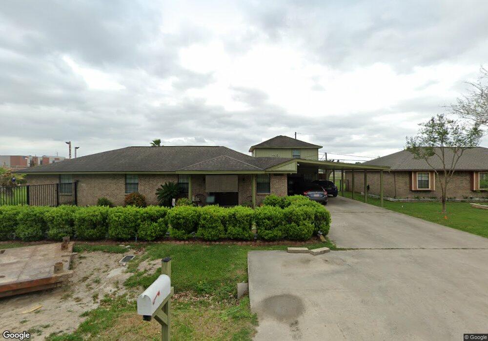
13526 Rockshire Dr Houston, TX 77039
East Aldine NeighborhoodEstimated Value: $258,222 - $329,000
3
Beds
2
Baths
1,820
Sq Ft
$157/Sq Ft
Est. Value
About This Home
This home is located at 13526 Rockshire Dr, Houston, TX 77039 and is currently estimated at $285,056, approximately $156 per square foot. 13526 Rockshire Dr is a home located in Harris County with nearby schools including Hinojosa EC/PK/K, Raymond Academy, and Mead Middle.
Ownership History
Date
Name
Owned For
Owner Type
Purchase Details
Closed on
Aug 29, 2007
Sold by
Rodriguez Gabriel and Rodriguez Norma E
Bought by
Iruegas Jose
Current Estimated Value
Home Financials for this Owner
Home Financials are based on the most recent Mortgage that was taken out on this home.
Original Mortgage
$32,400
Interest Rate
6.7%
Mortgage Type
Stand Alone Second
Create a Home Valuation Report for This Property
The Home Valuation Report is an in-depth analysis detailing your home's value as well as a comparison with similar homes in the area
Home Values in the Area
Average Home Value in this Area
Purchase History
| Date | Buyer | Sale Price | Title Company |
|---|---|---|---|
| Iruegas Jose | -- | Alamo Title Company |
Source: Public Records
Mortgage History
| Date | Status | Borrower | Loan Amount |
|---|---|---|---|
| Closed | Iruegas Jose | $32,400 | |
| Open | Iruegas Jose | $129,600 |
Source: Public Records
Tax History Compared to Growth
Tax History
| Year | Tax Paid | Tax Assessment Tax Assessment Total Assessment is a certain percentage of the fair market value that is determined by local assessors to be the total taxable value of land and additions on the property. | Land | Improvement |
|---|---|---|---|---|
| 2025 | $2,287 | $229,702 | $49,329 | $180,373 |
| 2024 | $2,287 | $244,509 | $49,329 | $195,180 |
| 2023 | $2,287 | $244,509 | $49,329 | $195,180 |
| 2022 | $3,128 | $177,797 | $34,713 | $143,084 |
| 2021 | $2,981 | $138,291 | $16,991 | $121,300 |
| 2020 | $3,141 | $138,291 | $16,991 | $121,300 |
| 2019 | $3,290 | $138,291 | $16,991 | $121,300 |
| 2018 | $1,627 | $138,291 | $18,270 | $120,021 |
| 2017 | $2,935 | $138,291 | $18,270 | $120,021 |
| 2016 | $2,668 | $119,522 | $18,270 | $101,252 |
| 2015 | $1,848 | $0 | $0 | $0 |
| 2014 | $1,848 | $101,426 | $16,808 | $84,618 |
Source: Public Records
Map
Nearby Homes
- 2710 Woodgate St
- 2703 Lauder Rd
- 2715 Toyah Ave
- 2611 Lauder Rd
- 0 Lauder Rd
- 2807 Verhalen Ave
- 2438 Balmorhea Ave
- 2434 Balmorhea Ave
- 3503 Debeney Dr
- 12123 Steeple Ln
- 4002 Charriton Dr
- 4422 Sandydale Ln
- 4542 Hollybrook Ln
- 1810 Connorvale Rd
- 13310 Robertcrest St Unit B
- 1826 Gault Rd
- 1916 Gault Rd
- 1720 Strawn Rd
- 1730 Strawn Rd
- 1725 Strawn Rd
- 13522 Rockshire Dr
- 1003 Vilana Ridge Land
- 13518 Rockshire Dr
- 2822 Ridgeland Ave
- 13534 Rockshire Dr
- 16214 Bluerock St
- 2823 Bluerock St
- 13514 Rockshire Dr
- 2818 Ridgeland Ave
- 2821 Ridgeland Ave
- 13510 Rockshire Dr
- 2814 Ridgeland Ave
- 2814 Ridgeland Ave
- 2815 Bluerock St
- 2819 Ridgeland Ave
- 2828 Woodgate St
- 2830 Woodgate St
- 13502 Rockshire Dr
- 2826 Woodgate St
- 2814 Bluerock St