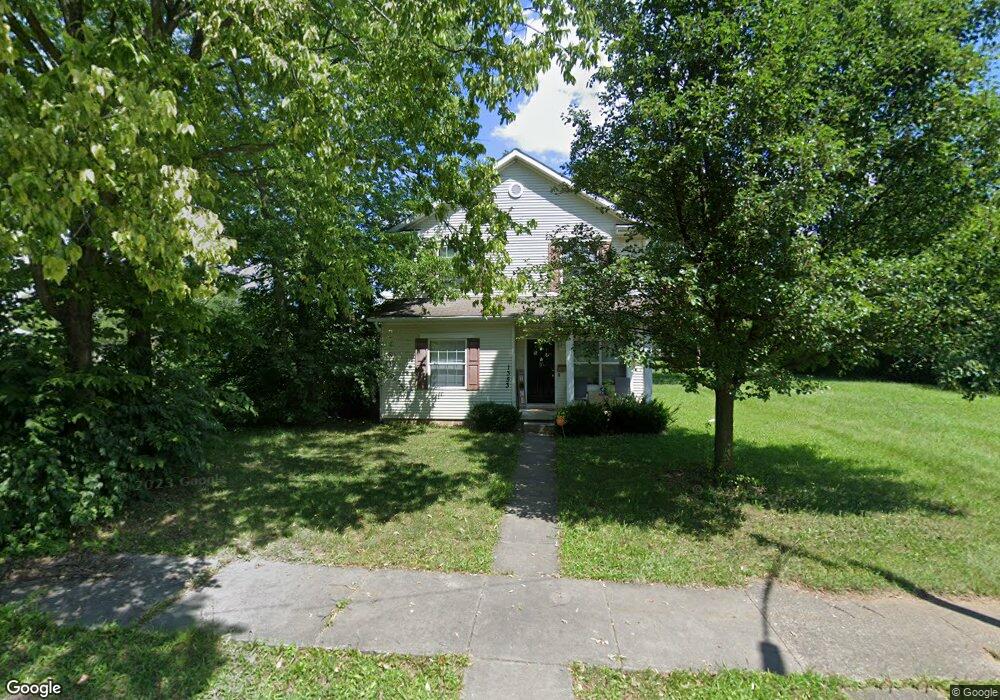
1353 W 1st St Dayton, OH 45402
Wolf Creek NeighborhoodEstimated Value: $75,000 - $197,000
4
Beds
2
Baths
1,456
Sq Ft
$86/Sq Ft
Est. Value
About This Home
This home is located at 1353 W 1st St, Dayton, OH 45402 and is currently estimated at $124,839, approximately $85 per square foot. 1353 W 1st St is a home located in Montgomery County with nearby schools including International School at Residence Park, Louise Troy Elementary, and Westwood Elementary.
Ownership History
Date
Name
Owned For
Owner Type
Purchase Details
Closed on
Sep 20, 2021
Sold by
City Forest Of Dayton Lp
Bought by
Jmjw Llc
Current Estimated Value
Home Financials for this Owner
Home Financials are based on the most recent Mortgage that was taken out on this home.
Original Mortgage
$1,575,000
Outstanding Balance
$1,433,133
Interest Rate
2.8%
Mortgage Type
Future Advance Clause Open End Mortgage
Estimated Equity
-$1,308,294
Purchase Details
Closed on
Nov 18, 2002
Sold by
The Progressive Wolf Creek Neighborhood
Bought by
Innerwest Community Development Corp
Create a Home Valuation Report for This Property
The Home Valuation Report is an in-depth analysis detailing your home's value as well as a comparison with similar homes in the area
Home Values in the Area
Average Home Value in this Area
Purchase History
| Date | Buyer | Sale Price | Title Company |
|---|---|---|---|
| Jmjw Llc | $2,100,000 | Hallmark Title | |
| Innerwest Community Development Corp | $20,000 | -- |
Source: Public Records
Mortgage History
| Date | Status | Borrower | Loan Amount |
|---|---|---|---|
| Open | Jmjw Llc | $1,575,000 |
Source: Public Records
Tax History Compared to Growth
Tax History
| Year | Tax Paid | Tax Assessment Tax Assessment Total Assessment is a certain percentage of the fair market value that is determined by local assessors to be the total taxable value of land and additions on the property. | Land | Improvement |
|---|---|---|---|---|
| 2024 | -- | $12,880 | $2,030 | $10,850 |
| 2023 | $0 | $12,880 | $2,030 | $10,850 |
| 2022 | $1,157 | $12,880 | $2,030 | $10,850 |
| 2021 | $1,152 | $12,880 | $2,030 | $10,850 |
| 2020 | $1,175 | $12,880 | $2,030 | $10,850 |
| 2019 | $1,268 | $12,410 | $2,030 | $10,380 |
| 2018 | $1,270 | $12,410 | $2,030 | $10,380 |
| 2017 | $1,241 | $12,410 | $2,030 | $10,380 |
| 2016 | $1,363 | $13,270 | $2,030 | $11,240 |
| 2015 | $2,279 | $13,270 | $2,030 | $11,240 |
| 2014 | $2,279 | $25,670 | $2,030 | $23,640 |
| 2012 | -- | $2,270 | $2,270 | $0 |
Source: Public Records
Map
Nearby Homes
- 149 Edison St
- 408 N Conover St
- 1527 W 1st St
- 1540 W 2nd St
- 235 Mercer Ave
- 1568 W 2nd St
- 1151 W 2nd St
- 1005 W Third St
- 1009 W Third St
- 997 W Third St
- The Aviator Plan at The Townes at Wright Dunbar
- 37 Mound St
- 66 Barnett St Unit 64
- 809 Faulkner Ave
- 817 Faulkner Ave
- 130 Mound St
- 132 Mound St
- 121 Gordon Ave
- 403 S Euclid Ave
- 401 S Euclid Ave Unit 403