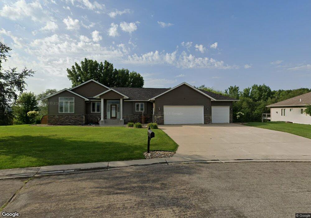
1361 Eastgate Rd Albert Lea, MN 56007
Estimated Value: $438,000 - $555,000
4
Beds
3
Baths
3,815
Sq Ft
$125/Sq Ft
Est. Value
About This Home
This home is located at 1361 Eastgate Rd, Albert Lea, MN 56007 and is currently estimated at $476,548, approximately $124 per square foot. 1361 Eastgate Rd is a home located in Freeborn County with nearby schools including Hawthorne Elementary School, Southwest Middle School, and Albert Lea Senior High School.
Ownership History
Date
Name
Owned For
Owner Type
Purchase Details
Closed on
Sep 28, 2020
Sold by
Peterswn Andrew C and Petersen Keli R
Bought by
Pesch David William and Pesch Candace Ann
Current Estimated Value
Home Financials for this Owner
Home Financials are based on the most recent Mortgage that was taken out on this home.
Original Mortgage
$412,000
Outstanding Balance
$366,452
Interest Rate
2.9%
Mortgage Type
VA
Estimated Equity
$110,096
Create a Home Valuation Report for This Property
The Home Valuation Report is an in-depth analysis detailing your home's value as well as a comparison with similar homes in the area
Home Values in the Area
Average Home Value in this Area
Purchase History
| Date | Buyer | Sale Price | Title Company |
|---|---|---|---|
| Pesch David William | $412,000 | None Available |
Source: Public Records
Mortgage History
| Date | Status | Borrower | Loan Amount |
|---|---|---|---|
| Open | Pesch David William | $412,000 |
Source: Public Records
Tax History Compared to Growth
Tax History
| Year | Tax Paid | Tax Assessment Tax Assessment Total Assessment is a certain percentage of the fair market value that is determined by local assessors to be the total taxable value of land and additions on the property. | Land | Improvement |
|---|---|---|---|---|
| 2025 | $2,588 | $480,200 | $59,200 | $421,000 |
| 2024 | $2,726 | $463,900 | $59,200 | $404,700 |
| 2023 | $2,612 | $478,300 | $59,200 | $419,100 |
| 2022 | $1,296 | $470,700 | $59,200 | $411,500 |
| 2021 | $3,604 | $370,700 | $59,200 | $311,500 |
| 2020 | $6,208 | $352,700 | $51,800 | $300,900 |
| 2019 | $6,210 | $355,300 | $51,800 | $303,500 |
| 2018 | $6,360 | $0 | $0 | $0 |
| 2016 | $5,764 | $0 | $0 | $0 |
| 2015 | $5,702 | $0 | $0 | $0 |
| 2014 | $5,778 | $0 | $0 | $0 |
| 2012 | $5,774 | $0 | $0 | $0 |
Source: Public Records
Map
Nearby Homes
- 1321 Garfield Ave
- 1200 Crestview Rd
- 705 Glenview Dr
- 1626 Keystone Dr
- 1020 Saint Jacob Ave
- 819 Pillsbury Ave
- 605 E Hawthorne St
- 611 Ulstad Ave
- 614 Garfield Ave
- 713 Minnesota Ave
- 313 Glenn Rd
- 505 Wayside Ave
- 602 Minnesota Ave
- 505 Pillsbury Ave
- 314 Burr Oak Dr
- TBD 2709 - 2715 Bridge Ave
- 613 & 615 Giles Place
- 618 & 620 Giles Place
- 209 Burr Oak Dr
- 902 Clausen Ave
- 1367 Eastgate Rd
- 1357 Eastgate Rd
- 1330 Eastgate Rd
- 1337 Eastgate Rd
- 1355 Eastgate Rd
- 1373 Eastgate Rd
- 1368 Eastgate Rd
- 1340 Eastgate Rd
- 1349 Eastgate Rd
- 1379 Eastgate Rd
- 1308 Eastgate Rd
- 1406 Crestview Rd
- 1410 Crestview Rd
- 1402 Crestview Rd
- 1414 Crestview Rd
- 1313 Eastgate Rd
- 1602 Garfield Ave
- 1606 Garfield Ave
- 1344 Crestview Rd
- 1610 Garfield Ave