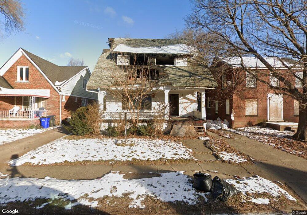
13629 Park Grove St Detroit, MI 48205
Franklin NeighborhoodEstimated Value: $100,000 - $141,000
--
Bed
1
Bath
1,695
Sq Ft
$71/Sq Ft
Est. Value
About This Home
This home is located at 13629 Park Grove St, Detroit, MI 48205 and is currently estimated at $120,500, approximately $71 per square foot. 13629 Park Grove St is a home located in Wayne County with nearby schools including Edward 'Duke' Ellington Conservatory of Music and Art, Charles L. Spain Elementary-Middle School, and Bates Academy.
Ownership History
Date
Name
Owned For
Owner Type
Purchase Details
Closed on
May 13, 2025
Sold by
Detroit Land Bank Authority
Bought by
Sanders Tazon
Current Estimated Value
Purchase Details
Closed on
Jan 13, 2016
Sold by
Wayne County Treasurer
Bought by
Detroit Land Bank Authority
Purchase Details
Closed on
Jun 25, 2012
Sold by
Davis Richard
Bought by
Davis Michael A
Purchase Details
Closed on
Jul 11, 2011
Sold by
County Of Wayne
Bought by
Davis Richard
Purchase Details
Closed on
Oct 7, 2008
Sold by
Waggoner James
Bought by
Precision Financial Llc
Create a Home Valuation Report for This Property
The Home Valuation Report is an in-depth analysis detailing your home's value as well as a comparison with similar homes in the area
Home Values in the Area
Average Home Value in this Area
Purchase History
| Date | Buyer | Sale Price | Title Company |
|---|---|---|---|
| Sanders Tazon | -- | None Listed On Document | |
| Detroit Land Bank Authority | -- | None Available | |
| Davis Michael A | $500 | None Available | |
| Davis Richard | $500 | None Available | |
| Precision Financial Llc | -- | None Available |
Source: Public Records
Tax History Compared to Growth
Tax History
| Year | Tax Paid | Tax Assessment Tax Assessment Total Assessment is a certain percentage of the fair market value that is determined by local assessors to be the total taxable value of land and additions on the property. | Land | Improvement |
|---|---|---|---|---|
| 2025 | -- | $0 | $0 | $0 |
| 2024 | -- | $0 | $0 | $0 |
| 2023 | $0 | $0 | $0 | $0 |
| 2022 | $0 | $0 | $0 | $0 |
| 2021 | $0 | $0 | $0 | $0 |
| 2020 | $2,136 | $0 | $0 | $0 |
| 2019 | $2,136 | $0 | $0 | $0 |
| 2018 | $0 | $0 | $0 | $0 |
| 2017 | $1,390 | $0 | $0 | $0 |
| 2016 | $240 | $13,900 | $0 | $0 |
| 2015 | $1,390 | $13,900 | $0 | $0 |
| 2013 | $1,936 | $19,361 | $0 | $0 |
| 2010 | -- | $28,386 | $974 | $27,412 |
Source: Public Records
Map
Nearby Homes
- 18088 Pelkey St
- 13715 Linnhurst St
- 13449 Greiner St
- 13540 Greiner St
- 18430 Alcoy St
- 18445 Alcoy St
- 13830 Eastwood St
- 13831 Seymour St
- 18096 Joann St
- 13218 Greiner St
- 14033 Glenwood St
- 14041 Glenwood St
- 14028 Faircrest St
- 13801 Fordham St
- 18488 Fairport St
- 18631 Fairport St
- 18430 Westphalia St
- 18418 Westphalia St
- 14241 Linnhurst St
- 19170 Schoenherr St
- 13637 Park Grove St
- 13621 Park Grove St
- 13611 Park Grove St
- 13643 Park Grove St
- 13601 Park Grove St
- 13651 Park Grove St
- 13628 Glenwood St
- 13618 Glenwood St
- 13636 Glenwood St
- 13610 Glenwood St
- 13644 Glenwood St
- 13661 Park Grove St
- 13626 Park Grove St
- 13602 Glenwood St
- 13620 Park Grove St
- 13636 Park Grove St
- 13652 Glenwood St
- 13610 Park Grove St
- 13644 Park Grove St
- 13600 Park Grove St