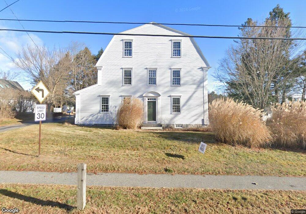
1365 Westbrook St Portland, ME 04102
Stroudwater NeighborhoodEstimated Value: $708,000 - $1,102,000
4
Beds
3
Baths
3,476
Sq Ft
$268/Sq Ft
Est. Value
About This Home
This home is located at 1365 Westbrook St, Portland, ME 04102 and is currently estimated at $932,933, approximately $268 per square foot. 1365 Westbrook St is a home located in Cumberland County with nearby schools including Amanda C Rowe School, King Middle School, and Levey Day School.
Ownership History
Date
Name
Owned For
Owner Type
Purchase Details
Closed on
Aug 31, 2009
Sold by
Andrew Mary Maddox
Bought by
Ellingsworth John R and Ellingsworth Christin A
Current Estimated Value
Home Financials for this Owner
Home Financials are based on the most recent Mortgage that was taken out on this home.
Original Mortgage
$299,250
Outstanding Balance
$195,509
Interest Rate
5.17%
Mortgage Type
FHA
Estimated Equity
$737,424
Create a Home Valuation Report for This Property
The Home Valuation Report is an in-depth analysis detailing your home's value as well as a comparison with similar homes in the area
Home Values in the Area
Average Home Value in this Area
Purchase History
| Date | Buyer | Sale Price | Title Company |
|---|---|---|---|
| Ellingsworth John R | -- | -- |
Source: Public Records
Mortgage History
| Date | Status | Borrower | Loan Amount |
|---|---|---|---|
| Open | Ellingsworth John R | $299,250 |
Source: Public Records
Tax History Compared to Growth
Tax History
| Year | Tax Paid | Tax Assessment Tax Assessment Total Assessment is a certain percentage of the fair market value that is determined by local assessors to be the total taxable value of land and additions on the property. | Land | Improvement |
|---|---|---|---|---|
| 2024 | $9,257 | $616,700 | $93,000 | $523,700 |
| 2023 | $8,887 | $616,700 | $93,000 | $523,700 |
| 2022 | $8,393 | $616,700 | $93,000 | $523,700 |
| 2021 | $8,011 | $616,700 | $93,000 | $523,700 |
| 2020 | $8,056 | $345,600 | $88,100 | $257,500 |
| 2019 | $8,056 | $345,600 | $88,100 | $257,500 |
| 2018 | $7,769 | $345,600 | $88,100 | $257,500 |
| 2017 | $7,482 | $345,600 | $88,100 | $257,500 |
| 2016 | $7,296 | $345,600 | $88,100 | $257,500 |
| 2015 | $7,130 | $345,600 | $88,100 | $257,500 |
| 2014 | $6,912 | $345,600 | $88,100 | $257,500 |
Source: Public Records
Map
Nearby Homes
- 1346 Westbrook St
- 2 Firefly St Unit 303
- 1 Firefly St Unit 402
- 1 Firefly St Unit 201
- 1 Firefly St Unit 303
- 1 Firefly St Unit 302
- 1 Firefly St Unit 403/103
- 1 Firefly St Unit 301
- 1 Firefly St Unit 401
- 1 Firefly St Unit 403
- 1 Firefly St Unit 202
- 1549 Westbrook St
- 16 Black Sparrow Dr
- 89 Cobb Ave
- 1542 Congress St
- 155 Owls Nest Rd
- 149 Owls Nest Rd
- 63A Capisic St
- 159 Bancroft St
- 7 Twin Knolls Ln
- 1375 Westbrook St
- 1353 Westbrook St
- 1347 Westbrook St
- 12 Penrith Rd
- 1366 Westbrook St
- 1380 Westbrook St
- 25 Penrith Rd
- 1339 Westbrook St
- 1393 Westbrook St
- 1376 Westbrook St
- 1331 Westbrook St
- 20 Penrith Rd
- 1388 Westbrook St
- 35 Penrith Rd
- 1338 Westbrook St
- 32 Penrith Rd
- 1408 Westbrook St
- 1327 Westbrook St
- 1405 Westbrook St
- 45 Penrith Rd