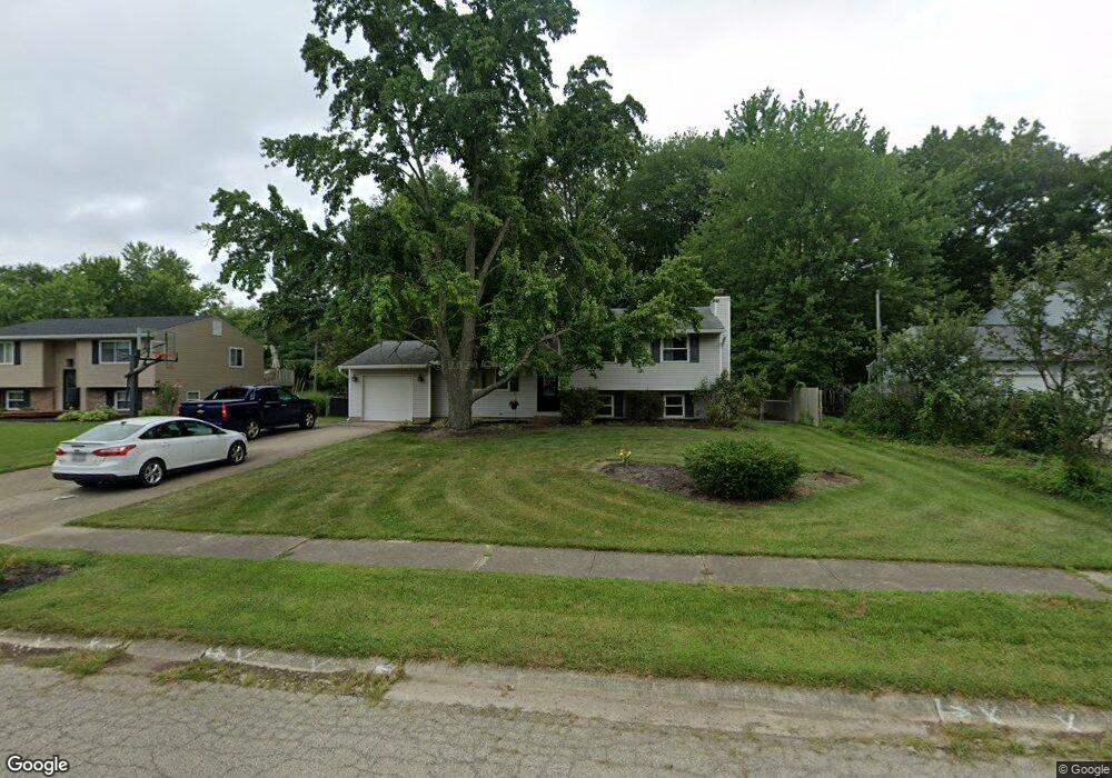
1366 Cottonwood Dr Milford, OH 45150
Estimated Value: $283,000 - $308,000
3
Beds
2
Baths
1,560
Sq Ft
$187/Sq Ft
Est. Value
About This Home
This home is located at 1366 Cottonwood Dr, Milford, OH 45150 and is currently estimated at $291,333, approximately $186 per square foot. 1366 Cottonwood Dr is a home located in Clermont County with nearby schools including Milford Senior High School, St. Andrew - St. Elizabeth Ann Seton School, and St. Mark's Lutheran School.
Ownership History
Date
Name
Owned For
Owner Type
Purchase Details
Closed on
Apr 8, 2002
Sold by
Wilson David W
Bought by
Chialastri Larry J Pamela R
Current Estimated Value
Home Financials for this Owner
Home Financials are based on the most recent Mortgage that was taken out on this home.
Original Mortgage
$127,787
Outstanding Balance
$53,200
Interest Rate
6.87%
Mortgage Type
FHA
Estimated Equity
$238,133
Purchase Details
Closed on
Apr 22, 1993
Create a Home Valuation Report for This Property
The Home Valuation Report is an in-depth analysis detailing your home's value as well as a comparison with similar homes in the area
Home Values in the Area
Average Home Value in this Area
Purchase History
| Date | Buyer | Sale Price | Title Company |
|---|---|---|---|
| Chialastri Larry J Pamela R | $128,797 | -- | |
| -- | $83,000 | -- |
Source: Public Records
Mortgage History
| Date | Status | Borrower | Loan Amount |
|---|---|---|---|
| Open | Chialastri Larry J Pamela R | $127,787 |
Source: Public Records
Tax History Compared to Growth
Tax History
| Year | Tax Paid | Tax Assessment Tax Assessment Total Assessment is a certain percentage of the fair market value that is determined by local assessors to be the total taxable value of land and additions on the property. | Land | Improvement |
|---|---|---|---|---|
| 2024 | $3,670 | $80,540 | $15,300 | $65,240 |
| 2023 | $3,708 | $80,540 | $15,300 | $65,240 |
| 2022 | $3,456 | $57,160 | $10,850 | $46,310 |
| 2021 | $3,460 | $57,160 | $10,850 | $46,310 |
| 2020 | $3,316 | $57,160 | $10,850 | $46,310 |
| 2019 | $2,845 | $46,550 | $10,080 | $36,470 |
| 2018 | $2,846 | $46,550 | $10,080 | $36,470 |
| 2017 | $2,802 | $46,550 | $10,080 | $36,470 |
| 2016 | $2,720 | $40,460 | $8,750 | $31,710 |
| 2015 | $2,651 | $40,460 | $8,750 | $31,710 |
| 2014 | $2,537 | $40,460 | $8,750 | $31,710 |
| 2013 | $2,404 | $37,170 | $10,500 | $26,670 |
Source: Public Records
Map
Nearby Homes
- 1382 Lela Ln
- 6049 Delfair Ln
- 1485 Foxtale Ct
- .6438 ac Buckwheat Rd
- .0288 ac Buckwheat Rd
- 6034 Delfair Ln
- 5852 Monassas Run Rd
- 5818 Jeb Stuart Dr
- 5975 Buckwheat Rd
- 5614 Water Mills Dr
- 5613 Water Mills Dr
- 5065 Cross Creek Ln
- 5942 Pinto Place
- 5811 Monassas Run Dr
- 1399 Wade Rd
- 1289 Woodville Pike
- 1201 Sorrel Ln
- 5778 Tall Oaks Dr
- 1281 Piedmont Dr
- 1290 Michael Ln
- 1364 Cottonwood Dr
- 1368 Cottonwood Dr
- 1362 Cottonwood Dr
- 1370 Cottonwood Dr
- 1365 Cottonwood Dr
- 1367 Cottonwood Dr
- 5906 Whippoorwill Hollow Dr
- 1363 Cottonwood Dr
- 1369 Cottonwood Dr
- 1360 Cottonwood Dr
- 5904 Whippoorwill Hollow Dr
- 1372 Cottonwood Dr
- 1361 Cottonwood Dr
- 1371 Cottonwood Dr
- 1481 Corbin Dr
- 5907 Whippoorwill Hollow Dr
- 1358 Cottonwood Dr
- 1359 Cottonwood Dr
- 1483 Corbin Dr
- 1373 Cottonwood Dr