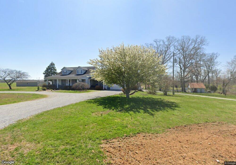
1367 Old Manchester Rd Morrison, TN 37357
Estimated Value: $448,000 - $741,000
--
Bed
4
Baths
3,492
Sq Ft
$172/Sq Ft
Est. Value
About This Home
This home is located at 1367 Old Manchester Rd, Morrison, TN 37357 and is currently estimated at $601,932, approximately $172 per square foot. 1367 Old Manchester Rd is a home located in Warren County with nearby schools including Morrison Elementary School and Warren County High School.
Ownership History
Date
Name
Owned For
Owner Type
Purchase Details
Closed on
Mar 6, 2017
Sold by
Bryan Wesley L
Bought by
Rudolph Philip E and Rudolph Miriam G
Current Estimated Value
Purchase Details
Closed on
Mar 30, 2006
Sold by
Foreman Catherine G
Bought by
Phillip Rudolph
Home Financials for this Owner
Home Financials are based on the most recent Mortgage that was taken out on this home.
Original Mortgage
$145,000
Interest Rate
6.2%
Create a Home Valuation Report for This Property
The Home Valuation Report is an in-depth analysis detailing your home's value as well as a comparison with similar homes in the area
Home Values in the Area
Average Home Value in this Area
Purchase History
| Date | Buyer | Sale Price | Title Company |
|---|---|---|---|
| Rudolph Philip E | $25,200 | -- | |
| Phillip Rudolph | $24,000 | -- | |
| Phillip Rudolph | $256,000 | -- |
Source: Public Records
Mortgage History
| Date | Status | Borrower | Loan Amount |
|---|---|---|---|
| Previous Owner | Phillip Rudolph | $145,000 |
Source: Public Records
Tax History Compared to Growth
Tax History
| Year | Tax Paid | Tax Assessment Tax Assessment Total Assessment is a certain percentage of the fair market value that is determined by local assessors to be the total taxable value of land and additions on the property. | Land | Improvement |
|---|---|---|---|---|
| 2024 | $2,196 | $111,625 | $15,125 | $96,500 |
| 2023 | $2,103 | $106,875 | $15,125 | $91,750 |
| 2022 | $2,103 | $106,875 | $15,125 | $91,750 |
| 2021 | $2,103 | $106,875 | $15,125 | $91,750 |
| 2020 | $1,708 | $106,875 | $15,125 | $91,750 |
| 2019 | $1,971 | $87,750 | $13,950 | $73,800 |
| 2018 | $1,708 | $86,850 | $13,950 | $72,900 |
| 2017 | $1,679 | $95,425 | $22,525 | $72,900 |
| 2016 | $1,613 | $80,950 | $8,050 | $72,900 |
| 2015 | $1,950 | $97,700 | $9,150 | $88,550 |
| 2014 | $1,642 | $82,550 | $9,150 | $73,400 |
| 2013 | $1,642 | $82,306 | $0 | $0 |
Source: Public Records
Map
Nearby Homes
- 631 W Maple St
- 0 Oak St
- 440 W Maple St
- 10157 Manchester Hwy
- 511 N Main St
- 120 Boyd St
- 431 S Fair St
- 1037 Mcafee Rd
- 0 Mcafee E Unit RTC2865293
- 231 Tom Johnson Rd
- 1694 Mcafee Rd
- 0 Ramsey Rd
- 0 Mcafee Rd
- 7807 McMinnville Hwy Unit 7807
- 240 Firefly Ln
- 0 Finger Bluff Rd
- 0 Caney Branch Rd
- 00 Marcrom Rd
- 0 Marcrom Rd
- 0 Nanny's Rd
- 22 Crompton St
- 121 E View Dr
- 1567 Old Manchester Rd
- 11900 Manchester Hwy
- 12232 Manchester Hwy
- 1103 Old Manchester Rd
- 10717 McMinnville Hwy Unit 10717
- 840 Old Manchester Rd
- 803 Old Manchester Rd
- 11469 Manchester Hwy
- 702 Old Manchester Rd
- 276 Smith Rd
- 334 Mcafee Ln
- 2083 Hickory Grove Rd
- 424 Mcafee Ln
- 2493 Ball Park Rd
- 10325 McMinnville Hwy
- 233 Smith Rd
- 220 Steve Bryan Ln
- 1030 Tic Tac Mill Rd