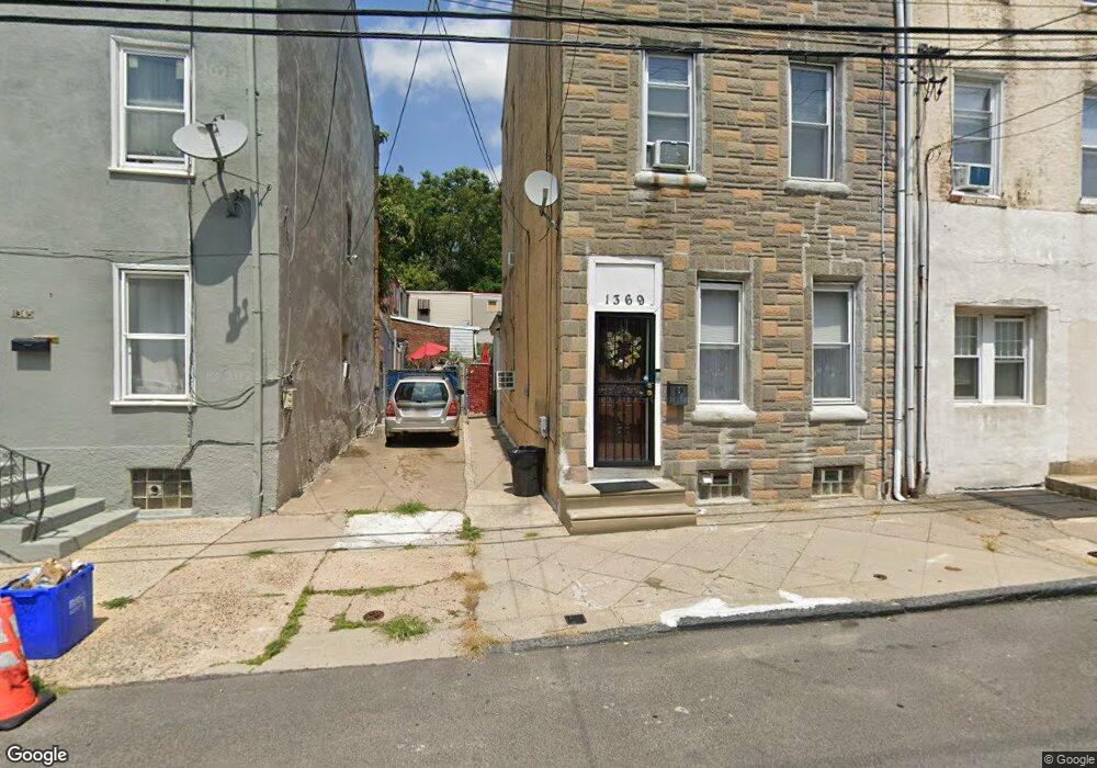
1369 Unity St Philadelphia, PA 19124
Frankford NeighborhoodEstimated Value: $105,000 - $253,000
4
Beds
1
Bath
1,820
Sq Ft
$92/Sq Ft
Est. Value
About This Home
This home is located at 1369 Unity St, Philadelphia, PA 19124 and is currently estimated at $167,879, approximately $92 per square foot. 1369 Unity St is a home located in Philadelphia County with nearby schools including John Marshall School, Harding Warren G Middle School, and Frankford High School.
Ownership History
Date
Name
Owned For
Owner Type
Purchase Details
Closed on
Jun 21, 2004
Sold by
Bank One Na
Bought by
Demarco Drew
Current Estimated Value
Purchase Details
Closed on
Oct 9, 2003
Sold by
James Barbara and Estate Of Richard F Leary
Bought by
Bankone Na and First Bank Of Chicago
Purchase Details
Closed on
Apr 28, 2000
Sold by
Ortiz Enrique
Bought by
Bank One National Assn and First Bank Of Chicago
Purchase Details
Closed on
Feb 27, 1997
Sold by
Dipentino Vincent P and Poritsky Neil T
Bought by
Ortiz Enrique C
Create a Home Valuation Report for This Property
The Home Valuation Report is an in-depth analysis detailing your home's value as well as a comparison with similar homes in the area
Home Values in the Area
Average Home Value in this Area
Purchase History
| Date | Buyer | Sale Price | Title Company |
|---|---|---|---|
| Demarco Drew | $26,000 | -- | |
| Bankone Na | -- | -- | |
| Bank One National Assn | $7,200 | -- | |
| Ortiz Enrique C | $41,000 | -- |
Source: Public Records
Tax History Compared to Growth
Tax History
| Year | Tax Paid | Tax Assessment Tax Assessment Total Assessment is a certain percentage of the fair market value that is determined by local assessors to be the total taxable value of land and additions on the property. | Land | Improvement |
|---|---|---|---|---|
| 2026 | $1,460 | $153,200 | $30,600 | $122,600 |
| 2025 | $1,460 | $153,200 | $30,600 | $122,600 |
| 2024 | $1,460 | $153,200 | $30,600 | $122,600 |
| 2023 | $1,460 | $104,300 | $20,860 | $83,440 |
| 2022 | $1,125 | $104,300 | $20,860 | $83,440 |
| 2021 | $1,125 | $0 | $0 | $0 |
| 2020 | $1,125 | $0 | $0 | $0 |
| 2019 | $1,081 | $0 | $0 | $0 |
| 2018 | $1,134 | $0 | $0 | $0 |
| 2017 | $1,134 | $0 | $0 | $0 |
| 2016 | $1,012 | $0 | $0 | $0 |
| 2015 | $1,207 | $0 | $0 | $0 |
| 2014 | -- | $90,100 | $23,600 | $66,500 |
| 2012 | -- | $5,664 | $1,079 | $4,585 |
Source: Public Records
Map
Nearby Homes
- 1417 Unity St
- 1419 Unity St
- 4461 Leiper St
- 4328 Leiper St
- 1424 Sellers St
- 1348 Sellers St
- 1337 Sellers St
- 1338-40 Sellers St
- 1361 Sellers St
- 1319 Church St
- 4742 Frankford Ave
- 4405 Frankford Ave
- 4431 Oakland St
- 4361 Frankford Ave
- 1208 Unity St
- 4283 Frankford Ave
- 4347 Paul St
- 1518 Overington St
- 4626 Pilling St
- 4628 Pilling St
- 1371 Unity St Unit 73
- 4402 Leiper St
- 4400 Leiper St
- 1365 Unity St
- 4404 Leiper St
- 4406 Leiper St
- 4408 Leiper St
- 1363 Unity St
- 4410 Leiper St
- 4417 Elizabeth St
- 4413 Elizabeth St
- 1354 Unity St
- 1348 Unity St
- 1346 Unity St
- 1344 Unity St
- 1352 Unity St
- 1350 Unity St
- 4419 Elizabeth St
- 1342 Unity St
- 1360 Unity St