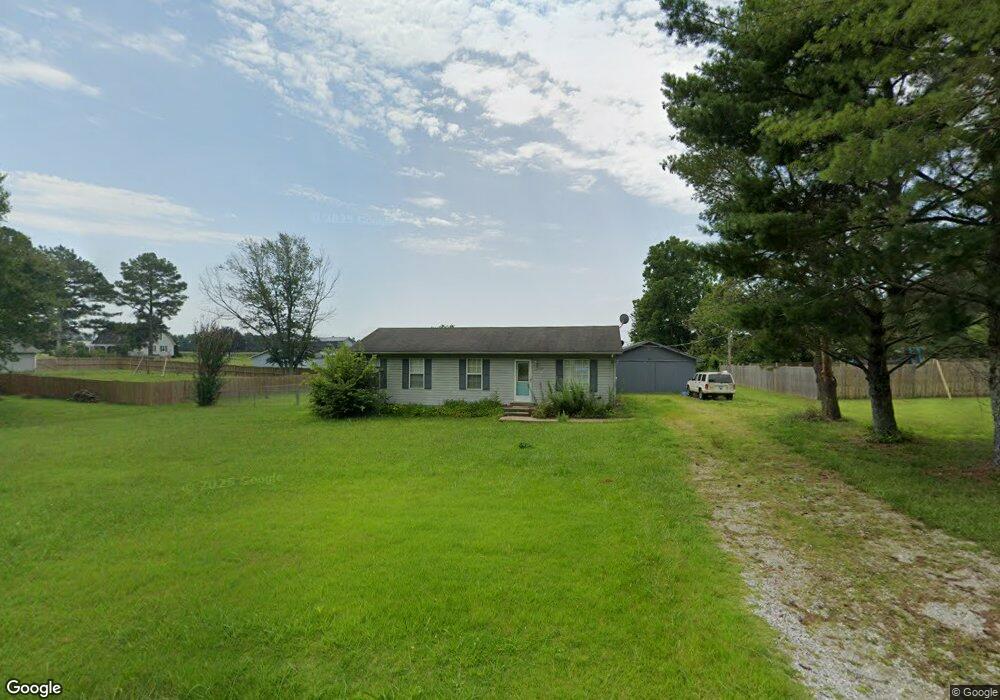
137 Michael Cir Lawrenceburg, TN 38464
Estimated Value: $199,000 - $243,000
--
Bed
2
Baths
1,056
Sq Ft
$203/Sq Ft
Est. Value
About This Home
This home is located at 137 Michael Cir, Lawrenceburg, TN 38464 and is currently estimated at $214,754, approximately $203 per square foot. 137 Michael Cir is a home located in Lawrence County with nearby schools including Ingram Sowell Elementary School, Lawrenceburg Public Elementary School, and David Crockett Elementary School.
Ownership History
Date
Name
Owned For
Owner Type
Purchase Details
Closed on
May 10, 2016
Sold by
Taylor Timothy Jacob
Bought by
Grigsby Wesley Clifton M and Grigsby Rachel Ann
Current Estimated Value
Home Financials for this Owner
Home Financials are based on the most recent Mortgage that was taken out on this home.
Original Mortgage
$80,000
Outstanding Balance
$63,346
Interest Rate
3.58%
Mortgage Type
Commercial
Estimated Equity
$151,408
Purchase Details
Closed on
Aug 12, 2015
Sold by
Taylor Timothy Jacob
Bought by
Taylor Timothy Jacob and Taylor Jessica Leanne
Home Financials for this Owner
Home Financials are based on the most recent Mortgage that was taken out on this home.
Original Mortgage
$130,400
Interest Rate
4.09%
Mortgage Type
New Conventional
Purchase Details
Closed on
Oct 22, 2012
Sold by
Cochran Sherel A
Bought by
Taylor Timothy Jacob
Home Financials for this Owner
Home Financials are based on the most recent Mortgage that was taken out on this home.
Original Mortgage
$70,500
Interest Rate
3.53%
Mortgage Type
Commercial
Purchase Details
Closed on
Aug 20, 2007
Sold by
Haslip Michelle
Bought by
Cochran Sherel A
Home Financials for this Owner
Home Financials are based on the most recent Mortgage that was taken out on this home.
Original Mortgage
$59,600
Interest Rate
6.7%
Purchase Details
Closed on
Mar 25, 2003
Sold by
Clanton Keith A and Clanton Alana A
Bought by
Haislip Michelle
Home Financials for this Owner
Home Financials are based on the most recent Mortgage that was taken out on this home.
Original Mortgage
$68,411
Interest Rate
5.82%
Purchase Details
Closed on
Feb 14, 1997
Sold by
Burgess Sharon A
Bought by
Clanton Keith A
Purchase Details
Closed on
Nov 9, 1994
Bought by
Burgess Sharon A
Purchase Details
Closed on
Mar 7, 1991
Bought by
Easter Timothy Allen and Easter Angela
Purchase Details
Closed on
Apr 9, 1988
Bought by
Hulen Van G
Create a Home Valuation Report for This Property
The Home Valuation Report is an in-depth analysis detailing your home's value as well as a comparison with similar homes in the area
Home Values in the Area
Average Home Value in this Area
Purchase History
| Date | Buyer | Sale Price | Title Company |
|---|---|---|---|
| Grigsby Wesley Clifton M | $80,000 | -- | |
| Taylor Timothy Jacob | -- | -- | |
| Taylor Timothy Jacob | $70,500 | -- | |
| Cochran Sherel A | $74,500 | -- | |
| Haislip Michelle | $69,000 | -- | |
| Clanton Keith A | $55,000 | -- | |
| Burgess Sharon A | $52,500 | -- | |
| Easter Timothy Allen | $38,500 | -- | |
| Hulen Van G | -- | -- |
Source: Public Records
Mortgage History
| Date | Status | Borrower | Loan Amount |
|---|---|---|---|
| Open | Grigsby Wesley Clifton M | $80,000 | |
| Previous Owner | Taylor Timothy Jacob | $130,400 | |
| Previous Owner | Taylor Timothy Jacob | $70,500 | |
| Previous Owner | Hulen Van G | $59,600 | |
| Previous Owner | Hulen Van G | $68,411 |
Source: Public Records
Tax History Compared to Growth
Tax History
| Year | Tax Paid | Tax Assessment Tax Assessment Total Assessment is a certain percentage of the fair market value that is determined by local assessors to be the total taxable value of land and additions on the property. | Land | Improvement |
|---|---|---|---|---|
| 2025 | $594 | $29,525 | $0 | $0 |
| 2024 | $594 | $29,525 | $5,000 | $24,525 |
| 2023 | $594 | $29,525 | $5,000 | $24,525 |
| 2022 | $594 | $29,525 | $5,000 | $24,525 |
| 2021 | $553 | $18,675 | $2,500 | $16,175 |
| 2020 | $553 | $18,675 | $2,500 | $16,175 |
| 2019 | $553 | $18,675 | $2,500 | $16,175 |
| 2018 | $553 | $18,675 | $2,500 | $16,175 |
| 2017 | $553 | $18,675 | $2,500 | $16,175 |
| 2016 | $553 | $18,675 | $2,500 | $16,175 |
| 2015 | $511 | $18,675 | $2,500 | $16,175 |
| 2014 | $505 | $18,425 | $2,500 | $15,925 |
Source: Public Records
Map
Nearby Homes
- 1950 Norton Rd
- 206 State Ave
- 380 Lanning Rd
- 2600 Clanton Rd
- 260 Wesley Chapel Rd
- 2073 Choates Creek Rd
- 1194 Harmony Way
- 729 Weakley Creek Rd
- 145 Lantz Rd
- 2342 Pulaski Hwy
- 111 Grandview Dr
- 786 Hillview Dr
- 79 Bishop Rd
- 2290 Grandview Dr
- 2024 Powdermill Hill Rd
- 2167 Powdermill Hill Rd
- 0 Lanning Rd
- 0 Lightfoot Ln
- 123 Quail Dr
- 33 Bishop Rd
- 137 1/2 Michael Cir
- 135 Michael Cir
- 110 Michael Cir
- 138 Michael Cir
- 114 Michael Cir
- 136 Michael Cir
- 140 Michael Cir
- 133 Michael Cir
- 139 Michael Cir
- 0 Michael Cir
- 116 Michael Cir
- 108 Michael Cir
- 134 Michael Cir
- 142 Michael Cir
- 167 Michael Cir
- 145 Michael Cir
- 131 Michael Cir
- 113 Michael Cir
- 106 Michael Cir
- 144 Michael Cir