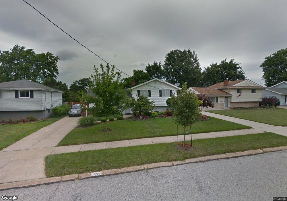
13738 Donald Dr Brookpark, OH 44142
Estimated Value: $233,811 - $260,000
3
Beds
1
Bath
1,452
Sq Ft
$169/Sq Ft
Est. Value
About This Home
This home is located at 13738 Donald Dr, Brookpark, OH 44142 and is currently estimated at $245,203, approximately $168 per square foot. 13738 Donald Dr is a home located in Cuyahoga County with nearby schools including Berea-Midpark Middle School, Berea-Midpark High School, and Huber Heights Preparatory Academy Parma Academy.
Ownership History
Date
Name
Owned For
Owner Type
Purchase Details
Closed on
Apr 3, 1999
Sold by
Mcintosh Thomas A
Bought by
Brown Timothy J and Hoover Brown Pamela S
Current Estimated Value
Home Financials for this Owner
Home Financials are based on the most recent Mortgage that was taken out on this home.
Original Mortgage
$119,939
Outstanding Balance
$29,992
Interest Rate
6.89%
Mortgage Type
FHA
Estimated Equity
$215,211
Purchase Details
Closed on
Apr 17, 1985
Sold by
Levine Kathryn M Carey
Bought by
Mcintosh Thomas A
Purchase Details
Closed on
May 29, 1981
Sold by
Telenko Thomas A and Telenko Carole A
Bought by
Levine Kathryn M Carey
Purchase Details
Closed on
Jan 1, 1975
Bought by
Telenko Thomas A and Telenko Carole A
Create a Home Valuation Report for This Property
The Home Valuation Report is an in-depth analysis detailing your home's value as well as a comparison with similar homes in the area
Home Values in the Area
Average Home Value in this Area
Purchase History
| Date | Buyer | Sale Price | Title Company |
|---|---|---|---|
| Brown Timothy J | $120,000 | -- | |
| Mcintosh Thomas A | $62,000 | -- | |
| Levine Kathryn M Carey | $62,000 | -- | |
| Telenko Thomas A | -- | -- |
Source: Public Records
Mortgage History
| Date | Status | Borrower | Loan Amount |
|---|---|---|---|
| Open | Brown Timothy J | $119,939 |
Source: Public Records
Tax History Compared to Growth
Tax History
| Year | Tax Paid | Tax Assessment Tax Assessment Total Assessment is a certain percentage of the fair market value that is determined by local assessors to be the total taxable value of land and additions on the property. | Land | Improvement |
|---|---|---|---|---|
| 2024 | $3,559 | $70,560 | $13,545 | $57,015 |
| 2023 | $3,219 | $52,850 | $10,290 | $42,560 |
| 2022 | $3,196 | $52,850 | $10,290 | $42,560 |
| 2021 | $3,178 | $52,850 | $10,290 | $42,560 |
| 2020 | $2,865 | $41,930 | $8,160 | $33,780 |
| 2019 | $2,779 | $119,800 | $23,300 | $96,500 |
| 2018 | $2,655 | $41,930 | $8,160 | $33,780 |
| 2017 | $2,754 | $38,540 | $6,860 | $31,680 |
| 2016 | $2,731 | $38,540 | $6,860 | $31,680 |
| 2015 | $2,442 | $38,540 | $6,860 | $31,680 |
| 2014 | $2,442 | $36,720 | $6,550 | $30,170 |
Source: Public Records
Map
Nearby Homes
- 13489 Havendale Dr
- 13602 Holland Rd
- 14055 Donald Dr
- 13971 Park Dr
- 6212 Elmdale Rd
- 14344 Fayette Blvd
- 13931 Franklyn Blvd
- 6321 W 130th St
- 6333 W 130th St
- 13879 Zaremba Dr
- 6274 Anita Dr
- 6330 Michael Dr
- 6369 Anita Dr
- 6359 Middlebrook Blvd
- 5677 Gateway Ln Unit E504
- 6413 Alexandria Dr
- 6566 Elmdale Rd
- 14340 Kingman Dr
- 15450 Holland Rd
- 13689 Pineview Ct
- 13760 Donald Dr
- 13716 Donald Dr
- 13782 Donald Dr
- 13694 Donald Dr
- 13689 Havendale Dr
- 13663 Havendale Dr
- 13739 Havendale Dr
- 13737 Donald Dr
- 13672 Donald Dr
- 13804 Donald Dr
- 13759 Donald Dr
- 13715 Donald Dr
- 13639 Havendale Dr
- 13781 Donald Dr
- 13763 Havendale Dr
- 13693 Donald Dr
- 13826 Donald Dr
- 13650 Donald Dr
- 13613 Havendale Dr
- 13803 Donald Dr