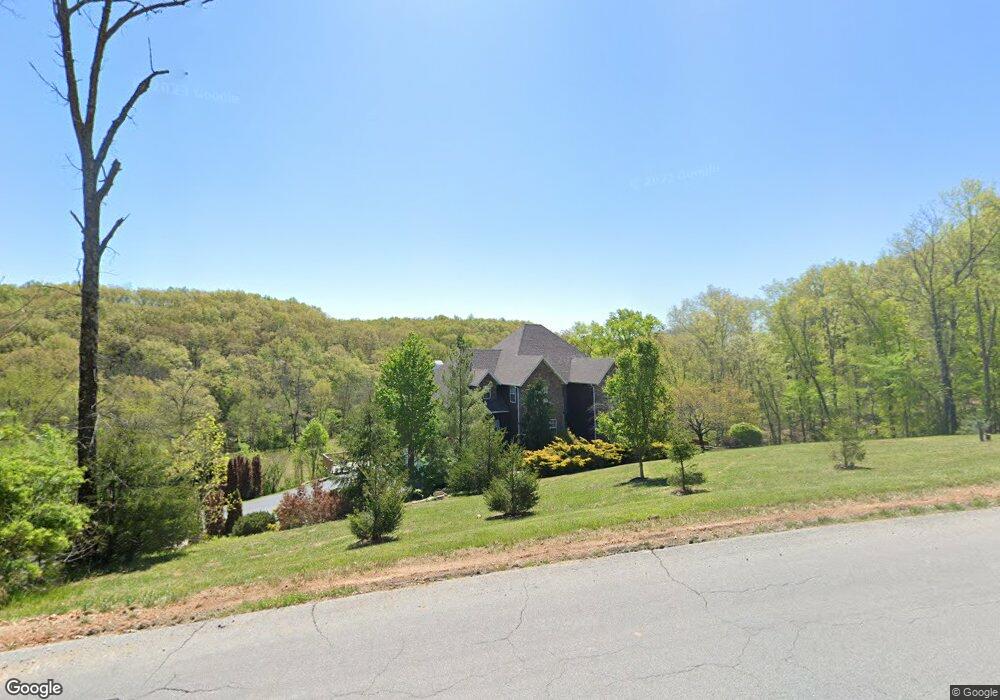
1374 N West Ridge Dr Strafford, MO 65757
Southeast Springfield NeighborhoodEstimated Value: $818,000 - $1,019,391
4
Beds
4
Baths
6,244
Sq Ft
$147/Sq Ft
Est. Value
About This Home
This home is located at 1374 N West Ridge Dr, Strafford, MO 65757 and is currently estimated at $918,696, approximately $147 per square foot. 1374 N West Ridge Dr is a home located in Greene County with nearby schools including Logan-Rogersville Primary School, Logan-Rogersville Elementary School, and Logan-Rogersville Upper Elementary School.
Ownership History
Date
Name
Owned For
Owner Type
Purchase Details
Closed on
Feb 15, 2006
Sold by
Jones Joe L and Jones Vivian N
Bought by
Harris Richard and Harris Christy
Current Estimated Value
Home Financials for this Owner
Home Financials are based on the most recent Mortgage that was taken out on this home.
Original Mortgage
$202,500
Interest Rate
6.05%
Mortgage Type
Purchase Money Mortgage
Purchase Details
Closed on
Apr 14, 2005
Sold by
Young Matthew G and Young Wendy L
Bought by
Jones Joe L and Jones Vivian N
Purchase Details
Closed on
Apr 13, 2005
Sold by
Young Matthew G and Young Wendy L
Bought by
Jones Joe L and Jones Vivian N
Create a Home Valuation Report for This Property
The Home Valuation Report is an in-depth analysis detailing your home's value as well as a comparison with similar homes in the area
Home Values in the Area
Average Home Value in this Area
Purchase History
| Date | Buyer | Sale Price | Title Company |
|---|---|---|---|
| Harris Richard | -- | Lincoln Evans Title Co Inc | |
| Harris Richard | -- | Lincoln-Evans Land Title Co | |
| Jones Joe L | -- | None Available | |
| Jones Joe L | -- | None Available |
Source: Public Records
Mortgage History
| Date | Status | Borrower | Loan Amount |
|---|---|---|---|
| Previous Owner | Harris Richard | $202,500 |
Source: Public Records
Tax History Compared to Growth
Tax History
| Year | Tax Paid | Tax Assessment Tax Assessment Total Assessment is a certain percentage of the fair market value that is determined by local assessors to be the total taxable value of land and additions on the property. | Land | Improvement |
|---|---|---|---|---|
| 2025 | $5,696 | $100,460 | $19,840 | $80,620 |
| 2024 | $5,696 | $96,180 | $11,340 | $84,840 |
| 2023 | $5,405 | $96,180 | $11,340 | $84,840 |
| 2022 | $5,230 | $90,680 | $11,340 | $79,340 |
| 2021 | $5,227 | $90,680 | $11,340 | $79,340 |
| 2020 | $5,356 | $90,440 | $11,340 | $79,100 |
| 2019 | $5,337 | $90,440 | $11,340 | $79,100 |
| 2018 | $4,917 | $90,400 | $11,340 | $79,060 |
| 2017 | $4,870 | $90,230 | $11,340 | $78,890 |
| 2016 | $4,845 | $90,230 | $11,340 | $78,890 |
| 2015 | $4,840 | $90,230 | $11,340 | $78,890 |
| 2014 | $4,136 | $81,300 | $11,340 | $69,960 |
Source: Public Records
Map
Nearby Homes
- 9386 E Maple Ridge Ln
- 807 S Stanford Dr
- 0 Woodlawn Cir
- 8890 E State Highway Ad
- 000 E State Highway Yy
- 7990 E Farm Road 116
- 1297 Missouri 125
- 9784 E Farm Road 104
- 1 Paradise Rd
- 802 S Sunmeadow Dr
- 511 S Redbud Ave
- 5786 N Farm Road 249
- 10087 E Farm Road 104
- 2991 N State Highway 125
- 600 Kiowa Ct
- 109 W Elm St
- Tract 8b N Farm Road 245
- Tract 1 N Farm Road 245
- Tract 8a N Farm Road 245
- Tract 2 N Farm Road 245
- 1374 Northwest Ridge
- 1498 N West Ridge Dr
- 9428 E Farm Road 128
- 9158 E Division St
- 9421 E Farm Road 128
- 1198 N West Ridge Dr
- 1381 N East Ridge Dr
- 9324 E Farm Road 128
- 1542 N West Ridge Dr
- 1469 N East Ridge Dr
- 1361 N Farm Road 245
- 1487 N East Ridge Dr
- 1293 N East Ridge Dr
- 9450 E Fireside Ln
- 1386 N East Ridge Dr
- 1523 N East Ridge Dr
- 9079 E Division St
- 1804 N Hearthstone Ln
- 1482 N East Ridge Dr
- 1716 N West Ridge Dr