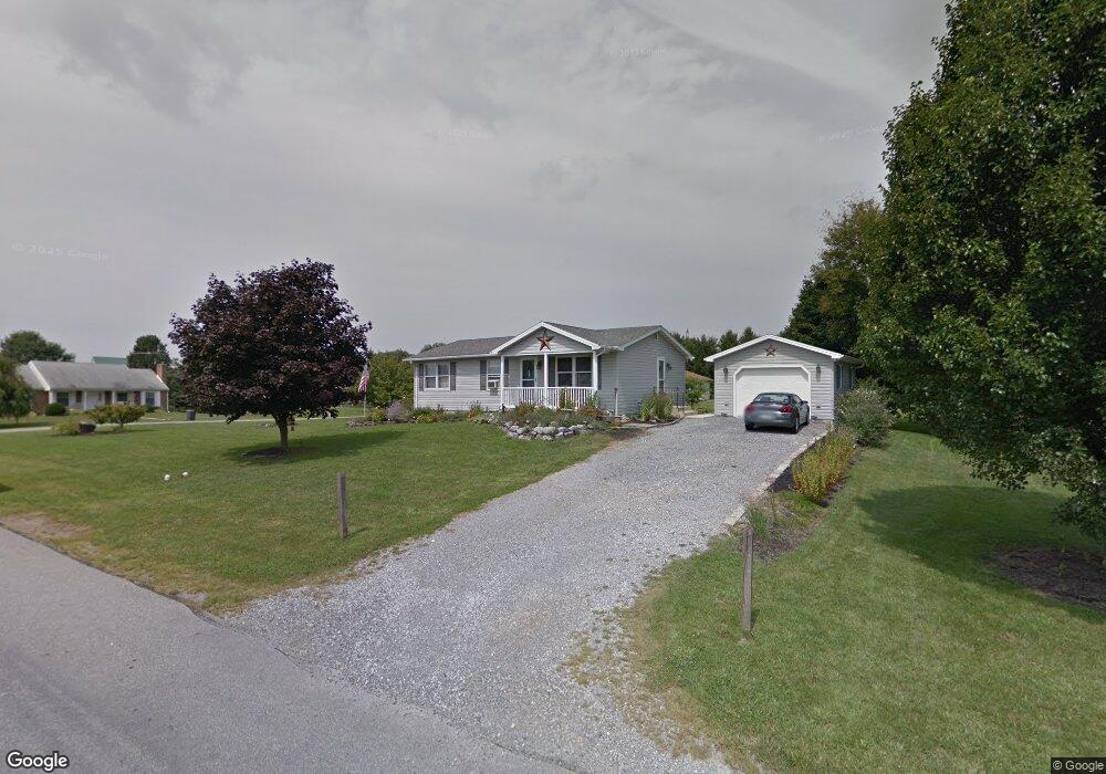
1375 Lisa Dr Greencastle, PA 17225
Estimated Value: $242,000 - $266,000
--
Bed
--
Bath
1,234
Sq Ft
$203/Sq Ft
Est. Value
About This Home
This home is located at 1375 Lisa Dr, Greencastle, PA 17225 and is currently estimated at $250,944, approximately $203 per square foot. 1375 Lisa Dr is a home located in Franklin County with nearby schools including Greencastle-Antrim Primary School, Greencastle-Antrim Elementary School, and Greencastle-Antrim Middle School.
Ownership History
Date
Name
Owned For
Owner Type
Purchase Details
Closed on
Jul 30, 2024
Sold by
Hade Bonnie J and Lindsey Robin L
Bought by
Atkinson Phillip Thomas and Schickel Sarah Denae
Current Estimated Value
Home Financials for this Owner
Home Financials are based on the most recent Mortgage that was taken out on this home.
Original Mortgage
$8,155
Interest Rate
6.86%
Mortgage Type
New Conventional
Create a Home Valuation Report for This Property
The Home Valuation Report is an in-depth analysis detailing your home's value as well as a comparison with similar homes in the area
Home Values in the Area
Average Home Value in this Area
Purchase History
| Date | Buyer | Sale Price | Title Company |
|---|---|---|---|
| Atkinson Phillip Thomas | $233,000 | Cla Title & Escrow |
Source: Public Records
Mortgage History
| Date | Status | Borrower | Loan Amount |
|---|---|---|---|
| Closed | Atkinson Phillip Thomas | $8,155 | |
| Open | Atkinson Phillip Thomas | $226,402 |
Source: Public Records
Tax History Compared to Growth
Tax History
| Year | Tax Paid | Tax Assessment Tax Assessment Total Assessment is a certain percentage of the fair market value that is determined by local assessors to be the total taxable value of land and additions on the property. | Land | Improvement |
|---|---|---|---|---|
| 2025 | $3,118 | $18,640 | $1,600 | $17,040 |
| 2024 | $2,829 | $18,640 | $1,600 | $17,040 |
| 2023 | $2,796 | $18,640 | $1,600 | $17,040 |
| 2022 | $2,796 | $18,640 | $1,600 | $17,040 |
| 2021 | $2,741 | $18,640 | $1,600 | $17,040 |
| 2020 | $2,670 | $18,640 | $1,600 | $17,040 |
| 2019 | $2,609 | $18,640 | $1,600 | $17,040 |
| 2018 | $2,581 | $18,640 | $1,600 | $17,040 |
| 2017 | $2,516 | $18,640 | $1,600 | $17,040 |
| 2016 | $534 | $18,640 | $1,600 | $17,040 |
| 2015 | $498 | $18,640 | $1,600 | $17,040 |
| 2014 | $498 | $18,640 | $1,600 | $17,040 |
Source: Public Records
Map
Nearby Homes
- 10135 Jasper Dr
- 20 Helens Dr
- 11765 Melrose Ave
- 12689 Williamsport Pike
- 707 Shook Ct W
- 10937 Grant Shook Rd
- 10925 Grant Shook Rd
- 281 Toms Ln
- 12976 Daybreak Ln
- 763 Joy Dr
- 1223 E Pebblebrook Dr
- 11498 Nicole Dr
- 2428 Pikeside Dr
- 642 Milnor Rd
- 270 Paradise View Dr
- 0 Molly Pitcher Hwy Unit PAFL178468
- 0 Molly Pitcher Hwy Unit PAFL2030380
- 460 Paradise View Dr
- 375 Carolle St
- 480 S Carlisle St
- 12350 Carol Ave
- 1378 Lisa Dr
- 12355 Randy Dr
- 12275 Randy Dr
- 1356 Lisa Dr
- 12451 Carol Ave
- 12518 Carol Ave
- 12381 Carol Ave
- 12501 Carol Ave
- 12321 Carol Ave
- 12415 Randy Dr
- 12523 Carol Ave
- 12215 Randy Dr
- 12280 Carol Ave
- 12241 Carol Ave
- 12540 Carol Ave
- 12525 Carol Ave
- 12356 Randy Dr
- 12220 Carol Ave
- 1338 Lisa Dr