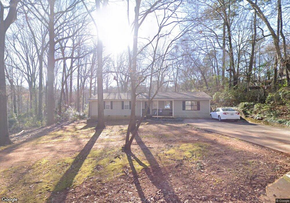
138 Hight Dr Watkinsville, GA 30677
Estimated Value: $337,000 - $386,000
3
Beds
2
Baths
1,692
Sq Ft
$210/Sq Ft
Est. Value
About This Home
This home is located at 138 Hight Dr, Watkinsville, GA 30677 and is currently estimated at $354,511, approximately $209 per square foot. 138 Hight Dr is a home located in Oconee County with nearby schools including Oconee County Elementary School, Oconee County Primary School, and Oconee County Middle School.
Ownership History
Date
Name
Owned For
Owner Type
Purchase Details
Closed on
Jun 19, 2025
Sold by
Zehna Frank Joseph
Bought by
Zehna Family Living Trust and Zehna Frank Joseph Sr Tr
Current Estimated Value
Purchase Details
Closed on
Dec 8, 2015
Sold by
Clover Street Properties L
Bought by
Zehna Frank Joseph and Zehna Stephanie B
Home Financials for this Owner
Home Financials are based on the most recent Mortgage that was taken out on this home.
Original Mortgage
$101,250
Interest Rate
4.01%
Mortgage Type
New Conventional
Purchase Details
Closed on
Jun 14, 2000
Sold by
Bishop Katie E
Bought by
Shannon Joshua W
Purchase Details
Closed on
Mar 31, 2000
Sold by
Frye Bryon D
Bought by
Bishop Katie E
Create a Home Valuation Report for This Property
The Home Valuation Report is an in-depth analysis detailing your home's value as well as a comparison with similar homes in the area
Home Values in the Area
Average Home Value in this Area
Purchase History
| Date | Buyer | Sale Price | Title Company |
|---|---|---|---|
| Zehna Family Living Trust | -- | -- | |
| Zehna Frank Joseph | -- | -- | |
| Shannon Joshua W | $102,000 | -- | |
| Bishop Katie E | $68,000 | -- |
Source: Public Records
Mortgage History
| Date | Status | Borrower | Loan Amount |
|---|---|---|---|
| Previous Owner | Zehna Frank Joseph | $101,250 |
Source: Public Records
Tax History Compared to Growth
Tax History
| Year | Tax Paid | Tax Assessment Tax Assessment Total Assessment is a certain percentage of the fair market value that is determined by local assessors to be the total taxable value of land and additions on the property. | Land | Improvement |
|---|---|---|---|---|
| 2024 | $2,508 | $104,640 | $26,000 | $78,640 |
| 2023 | $2,342 | $101,410 | $22,000 | $79,410 |
| 2022 | $2,185 | $89,618 | $22,000 | $67,618 |
| 2021 | $1,904 | $72,767 | $16,000 | $56,767 |
| 2020 | $1,777 | $67,094 | $16,000 | $51,094 |
| 2019 | $1,742 | $65,423 | $16,000 | $49,423 |
| 2018 | $1,596 | $58,764 | $16,000 | $42,764 |
| 2017 | $1,428 | $52,233 | $14,000 | $38,233 |
| 2016 | $1,325 | $48,274 | $14,000 | $34,274 |
| 2015 | $1,210 | $43,907 | $14,000 | $29,907 |
| 2014 | $1,196 | $42,455 | $14,000 | $28,455 |
| 2013 | -- | $45,476 | $15,000 | $30,476 |
Source: Public Records
Map
Nearby Homes
- 86 Cedar Dr
- 88 Cedar Dr
- 170 Elliot Cir
- 1036 Falling Leaf Ct Unit 2
- 1036 Falling Leaf Ct
- 1200 Paxton Ct
- 1511 Paxton Ct
- 1810 Paxton Ct
- 96 Morrison St Unit 53
- 92 Morrison St Unit 54
- 90 Morrison St Unit 55
- 96 Morrison St
- 90 Morrison St
- 2051 Simonton Bridge Rd
- 1010 Jeremy Dr
- 1001 Moreland Dr
- 70, 72 Colham Ferry Extension
- 1040 Thomas Ave
- 157 S Main St
- 194 New High Shoals Rd
- 136 Hight Dr
- 117 Bond Way
- 117 Bond Dr
- 104 Bond Dr
- 119 Bond Way
- 143 Hight Dr
- 141 Hight Dr
- 126 Hight Dr
- 137 Hight Dr
- 0 Hight Dr Unit 7504455
- 0 Hight Dr Unit 3247252
- 0 Hight Dr Unit 3170053
- 0 Hight Dr Unit 8646066
- 0 Hight Dr Unit 8435140
- 0 Hight Dr Unit 7347113
- 139 Hight Dr
- 135 Hight Dr
- 76 Cedar Dr
- 116 Bond Way
- 118 Bond Way