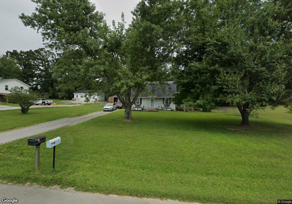
138 Michael Cir Lawrenceburg, TN 38464
Estimated Value: $125,106 - $226,000
--
Bed
1
Bath
780
Sq Ft
$238/Sq Ft
Est. Value
About This Home
This home is located at 138 Michael Cir, Lawrenceburg, TN 38464 and is currently estimated at $185,277, approximately $237 per square foot. 138 Michael Cir is a home located in Lawrence County with nearby schools including Ingram Sowell Elementary School, Lawrenceburg Public Elementary School, and David Crockett Elementary School.
Ownership History
Date
Name
Owned For
Owner Type
Purchase Details
Closed on
Aug 8, 2016
Sold by
Baxter Leigh Lashawn
Bought by
Baxter Leigh Lashawn and Baxter Joseph William
Current Estimated Value
Purchase Details
Closed on
Dec 2, 2009
Sold by
Smith Ryan Lankford
Bought by
Sweet Mitzi L
Purchase Details
Closed on
Oct 9, 2001
Sold by
Lawrenceburg Federal
Bought by
Smith Ryan L
Purchase Details
Closed on
Aug 17, 2001
Sold by
Tracy Clark
Bought by
Lawrenceburg Federal Bank
Purchase Details
Closed on
Nov 18, 1994
Bought by
Clark Tracy Lee and Clark Kristi
Purchase Details
Closed on
Oct 1, 1992
Bought by
Corneyy Alesia J
Purchase Details
Closed on
Feb 10, 1988
Bought by
Mcmasters William J
Create a Home Valuation Report for This Property
The Home Valuation Report is an in-depth analysis detailing your home's value as well as a comparison with similar homes in the area
Home Values in the Area
Average Home Value in this Area
Purchase History
| Date | Buyer | Sale Price | Title Company |
|---|---|---|---|
| Baxter Leigh Lashawn | -- | -- | |
| Sweet Mitzi L | $53,400 | -- | |
| Smith Ryan L | $49,500 | -- | |
| Lawrenceburg Federal Bank | $56,038 | -- | |
| Clark Tracy Lee | $47,500 | -- | |
| Corneyy Alesia J | $42,500 | -- | |
| Mcmasters William J | -- | -- |
Source: Public Records
Tax History Compared to Growth
Tax History
| Year | Tax Paid | Tax Assessment Tax Assessment Total Assessment is a certain percentage of the fair market value that is determined by local assessors to be the total taxable value of land and additions on the property. | Land | Improvement |
|---|---|---|---|---|
| 2025 | $444 | $22,075 | $0 | $0 |
| 2024 | $444 | $22,075 | $5,000 | $17,075 |
| 2023 | $444 | $22,075 | $5,000 | $17,075 |
| 2022 | $444 | $22,075 | $5,000 | $17,075 |
| 2021 | $427 | $14,425 | $2,500 | $11,925 |
| 2020 | $427 | $14,425 | $2,500 | $11,925 |
| 2019 | $427 | $14,425 | $2,500 | $11,925 |
| 2018 | $427 | $14,425 | $2,500 | $11,925 |
| 2017 | $427 | $14,425 | $2,500 | $11,925 |
| 2016 | $427 | $14,425 | $2,500 | $11,925 |
| 2015 | $395 | $14,425 | $2,500 | $11,925 |
| 2014 | $384 | $14,025 | $2,500 | $11,525 |
Source: Public Records
Map
Nearby Homes
- 1950 Norton Rd
- 206 State Ave
- 380 Lanning Rd
- 2600 Clanton Rd
- 260 Wesley Chapel Rd
- 2073 Choates Creek Rd
- 1194 Harmony Way
- 729 Weakley Creek Rd
- 145 Lantz Rd
- 2342 Pulaski Hwy
- 111 Grandview Dr
- 786 Hillview Dr
- 79 Bishop Rd
- 2290 Grandview Dr
- 2024 Powdermill Hill Rd
- 2167 Powdermill Hill Rd
- 0 Lanning Rd
- 0 Lightfoot Ln
- 123 Quail Dr
- 33 Bishop Rd
- 140 Michael Cir
- 136 Michael Cir
- 137 1/2 Michael Cir
- 137 Michael Cir
- 135 Michael Cir
- 134 Michael Cir
- 142 Michael Cir
- 139 Michael Cir
- 133 Michael Cir
- 167 Michael Cir
- 144 Michael Cir
- 132 Michael Cir
- 110 Michael Cir
- 1290 Norton Rd
- 145 Michael Cir
- 114 Michael Cir
- 108 Michael Cir
- 116 Michael Cir
- 131 Michael Cir
- 0 Michael Cir