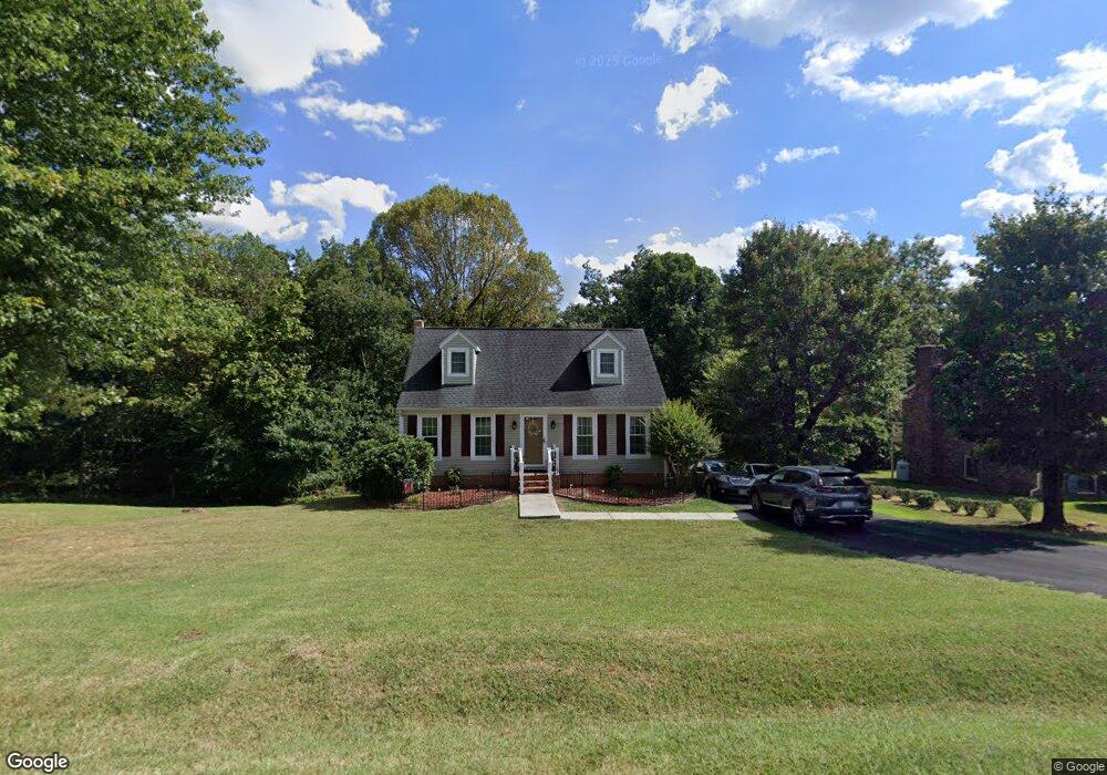
139 Scottsmill Rd Madison Heights, VA 24572
Estimated Value: $217,000 - $288,000
4
Beds
2
Baths
1,414
Sq Ft
$179/Sq Ft
Est. Value
About This Home
This home is located at 139 Scottsmill Rd, Madison Heights, VA 24572 and is currently estimated at $252,528, approximately $178 per square foot. 139 Scottsmill Rd is a home located in Amherst County with nearby schools including Madison Heights Elementary School, Monelison Middle School, and Amherst County High School.
Ownership History
Date
Name
Owned For
Owner Type
Purchase Details
Closed on
Apr 30, 2015
Sold by
Meade Ronald W and Meade Lorraine
Bought by
Meade Ronald W and Meade Ronald W
Current Estimated Value
Purchase Details
Closed on
Jul 16, 2009
Sold by
Eckstein Heath C
Bought by
Meade Ronald W
Home Financials for this Owner
Home Financials are based on the most recent Mortgage that was taken out on this home.
Original Mortgage
$152,653
Outstanding Balance
$100,589
Interest Rate
5.5%
Mortgage Type
New Conventional
Estimated Equity
$151,939
Purchase Details
Closed on
Aug 29, 2007
Sold by
Meade Ronald W
Bought by
Eckstein Heath C
Home Financials for this Owner
Home Financials are based on the most recent Mortgage that was taken out on this home.
Original Mortgage
$123,250
Interest Rate
9.87%
Mortgage Type
New Conventional
Create a Home Valuation Report for This Property
The Home Valuation Report is an in-depth analysis detailing your home's value as well as a comparison with similar homes in the area
Home Values in the Area
Average Home Value in this Area
Purchase History
| Date | Buyer | Sale Price | Title Company |
|---|---|---|---|
| Meade Ronald W | -- | None Available | |
| Meade Ronald W | -- | Southern Title Ins Corp | |
| Eckstein Heath C | -- | Advantage Title & Closing Ll |
Source: Public Records
Mortgage History
| Date | Status | Borrower | Loan Amount |
|---|---|---|---|
| Open | Meade Ronald W | $152,653 | |
| Closed | Eckstein Heath C | $123,250 |
Source: Public Records
Tax History Compared to Growth
Tax History
| Year | Tax Paid | Tax Assessment Tax Assessment Total Assessment is a certain percentage of the fair market value that is determined by local assessors to be the total taxable value of land and additions on the property. | Land | Improvement |
|---|---|---|---|---|
| 2025 | $909 | $149,000 | $25,000 | $124,000 |
| 2024 | $909 | $149,000 | $25,000 | $124,000 |
| 2023 | $909 | $149,000 | $25,000 | $124,000 |
| 2022 | $909 | $149,000 | $25,000 | $124,000 |
| 2021 | $909 | $149,000 | $25,000 | $124,000 |
| 2020 | $909 | $149,000 | $25,000 | $124,000 |
| 2019 | $892 | $146,200 | $31,000 | $115,200 |
| 2018 | $892 | $146,200 | $31,000 | $115,200 |
| 2017 | $892 | $146,200 | $31,000 | $115,200 |
| 2016 | $892 | $146,200 | $31,000 | $115,200 |
| 2015 | $819 | $146,200 | $31,000 | $115,200 |
| 2014 | $819 | $146,200 | $31,000 | $115,200 |
Source: Public Records
Map
Nearby Homes
- 127 Scottsmill Rd
- 145 Scottsmill Rd
- 142 Scottsmill Rd
- 119 Scottsmill Rd
- 153 Scottsmill Rd
- 144 Scottsmill Rd
- 165 Scottsmill Rd
- 137 Moorman Dr
- 156 Scottsmill Rd
- 125 Moorman Dr
- 145 Moorman Dr
- 158 Scottsmill Rd
- 117 Moorman Dr
- 153 Moorman Dr
- 168 Scottsmill Rd
- 175 Scottsmill Rd
- 115 Moorman Dr
- 167 Moorman Dr
- 128 Moorman Dr
- 140 Moorman Dr