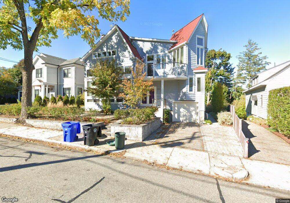
139 Summit Ave Brookline, MA 02446
Washington Square NeighborhoodEstimated Value: $1,851,000 - $3,515,000
4
Beds
2
Baths
2,281
Sq Ft
$1,281/Sq Ft
Est. Value
About This Home
This home is located at 139 Summit Ave, Brookline, MA 02446 and is currently estimated at $2,921,711, approximately $1,280 per square foot. 139 Summit Ave is a home located in Norfolk County with nearby schools including Michael Driscoll, Brookline High School, and Boston Green Academy Horace Mann Charter School.
Ownership History
Date
Name
Owned For
Owner Type
Purchase Details
Closed on
Dec 3, 2012
Sold by
Boer Laurent J
Bought by
Boer Laurent J and Boer Maria
Current Estimated Value
Purchase Details
Closed on
Jul 11, 2011
Sold by
Verhulst James D and Verhulst Catharina A
Bought by
Presently Laurent J
Home Financials for this Owner
Home Financials are based on the most recent Mortgage that was taken out on this home.
Original Mortgage
$965,000
Interest Rate
3%
Mortgage Type
Purchase Money Mortgage
Create a Home Valuation Report for This Property
The Home Valuation Report is an in-depth analysis detailing your home's value as well as a comparison with similar homes in the area
Home Values in the Area
Average Home Value in this Area
Purchase History
| Date | Buyer | Sale Price | Title Company |
|---|---|---|---|
| Boer Laurent J | -- | -- | |
| Presently Laurent J | $1,365,000 | -- |
Source: Public Records
Mortgage History
| Date | Status | Borrower | Loan Amount |
|---|---|---|---|
| Previous Owner | Presently Laurent J | $965,000 |
Source: Public Records
Tax History Compared to Growth
Tax History
| Year | Tax Paid | Tax Assessment Tax Assessment Total Assessment is a certain percentage of the fair market value that is determined by local assessors to be the total taxable value of land and additions on the property. | Land | Improvement |
|---|---|---|---|---|
| 2025 | $30,212 | $3,061,000 | $1,408,600 | $1,652,400 |
| 2024 | $28,632 | $2,930,600 | $1,353,900 | $1,576,700 |
| 2023 | $25,731 | $2,580,800 | $1,177,400 | $1,403,400 |
| 2022 | $25,046 | $2,457,900 | $1,121,300 | $1,336,600 |
| 2021 | $23,161 | $2,363,400 | $1,078,200 | $1,285,200 |
| 2020 | $19,537 | $2,067,400 | $937,500 | $1,129,900 |
| 2019 | $17,116 | $1,826,700 | $892,900 | $933,800 |
| 2018 | $15,996 | $1,690,900 | $758,400 | $932,500 |
| 2017 | $15,761 | $1,595,200 | $715,400 | $879,800 |
| 2016 | $15,534 | $1,490,800 | $668,600 | $822,200 |
| 2015 | $13,615 | $1,274,800 | $520,700 | $754,100 |
| 2014 | $13,772 | $1,209,100 | $473,400 | $735,700 |
Source: Public Records
Map
Nearby Homes
- 29 Mason Terrace
- 59 Mason Terrace Unit 61
- 188 Mason Terrace Unit 188
- 186 Mason Terrace Unit 186
- 150+152 Jordan Rd
- 1600 Beacon St Unit 607
- 66 Summit Ave
- 138 Mason Terrace Unit 1
- 4 Fairbanks St Unit 2
- 200 Winchester St Unit 1
- 15 Short St Unit 4
- 648 Washington St Unit 7
- 626 Washington St Unit 3
- 589-591 Washington St
- 1471 Beacon St Unit 7
- 1471 Beacon St Unit 1
- 757 Washington St Unit 2
- 57 University Rd Unit 3
- 108 Columbia St Unit 1
- 47 Winchester St Unit 2
- 141 Summit Ave
- 133 Summit Ave
- 132 Summit Ave
- 142 Summit Ave
- 121 Summit Ave
- 126 Summit Ave Unit 128
- 128 Summit Ave
- 149 Summit Ave
- 42 Jordan Rd
- 38 Jordan Rd
- 153 Summit Ave
- 52 Jordan Rd
- 124 Summit Ave Unit 2 & 3
- 122 Summit Ave Unit 124
- 122 Summit Ave
- 124 Summit Ave
- 122 Summit Ave Unit 1
- 124 Summit Ave Unit 1
- 124 Summit Ave
- 122 Summit Ave