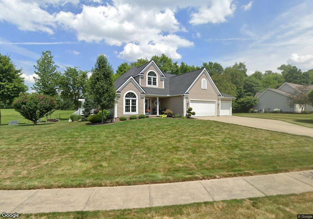
1390 Cheverton Ave Louisville, OH 44641
Estimated Value: $315,000 - $380,697
3
Beds
3
Baths
2,116
Sq Ft
$162/Sq Ft
Est. Value
About This Home
This home is located at 1390 Cheverton Ave, Louisville, OH 44641 and is currently estimated at $341,924, approximately $161 per square foot. 1390 Cheverton Ave is a home located in Stark County with nearby schools including Louisville High School and St. Thomas Aquinas High School & Middle School.
Ownership History
Date
Name
Owned For
Owner Type
Purchase Details
Closed on
Aug 22, 2003
Sold by
Mckinley Development Co
Bought by
Walters Timothy W and Walters Darla J
Current Estimated Value
Home Financials for this Owner
Home Financials are based on the most recent Mortgage that was taken out on this home.
Original Mortgage
$146,000
Outstanding Balance
$73,723
Interest Rate
6.44%
Mortgage Type
Purchase Money Mortgage
Estimated Equity
$268,201
Create a Home Valuation Report for This Property
The Home Valuation Report is an in-depth analysis detailing your home's value as well as a comparison with similar homes in the area
Home Values in the Area
Average Home Value in this Area
Purchase History
| Date | Buyer | Sale Price | Title Company |
|---|---|---|---|
| Walters Timothy W | $45,900 | -- |
Source: Public Records
Mortgage History
| Date | Status | Borrower | Loan Amount |
|---|---|---|---|
| Open | Walters Timothy W | $146,000 |
Source: Public Records
Tax History Compared to Growth
Tax History
| Year | Tax Paid | Tax Assessment Tax Assessment Total Assessment is a certain percentage of the fair market value that is determined by local assessors to be the total taxable value of land and additions on the property. | Land | Improvement |
|---|---|---|---|---|
| 2025 | -- | $124,080 | $43,260 | $80,820 |
| 2024 | -- | $124,080 | $43,260 | $80,820 |
| 2023 | $3,753 | $87,360 | $25,620 | $61,740 |
| 2022 | $3,760 | $87,360 | $25,620 | $61,740 |
| 2021 | $3,770 | $87,360 | $25,620 | $61,740 |
| 2020 | $3,216 | $80,930 | $23,070 | $57,860 |
| 2019 | $3,229 | $79,210 | $23,910 | $55,300 |
| 2018 | $3,148 | $79,210 | $23,910 | $55,300 |
| 2017 | $2,773 | $67,310 | $18,730 | $48,580 |
| 2016 | $2,830 | $67,310 | $18,730 | $48,580 |
| 2015 | $2,838 | $67,310 | $18,730 | $48,580 |
| 2014 | $762 | $60,900 | $16,940 | $43,960 |
| 2013 | $1,385 | $60,900 | $16,940 | $43,960 |
Source: Public Records
Map
Nearby Homes
- 910 Crosswyck Cir
- 1170 Winding Ridge Ave
- 316 E Reno Dr
- 5474 Ravenna Ave
- 428 Honeycrisp Dr NE
- 3047 Mcintosh Dr NE
- 432 Honeycrisp Dr NE
- 2962 Mcintosh Dr NE
- 2963 Mcintosh Dr NE
- 430 Honeycrisp Dr NE
- 2957 Mcintosh Dr NE
- 0 Michigan Blvd
- 325 Lincoln Ave
- 524 Glenbar St
- 614 Reno Dr
- 300 Kennedy St
- 0 Glenbar St
- 0 Brookridge Ave
- 308 Superior St
- 2015 E Main St
- 1387 Cheverton Ave
- 1368 Cheverton Ave
- 1379 Cheverton Ave
- 0 Cheverton Unit 3293569
- 1371 Cheverton Ave
- 39 S/L Cheverton Ave
- 1348 Cheverton Ave
- 1393 Cheverton Ave
- 1353 Cheverton Ave
- 1334 Cheverton Ave
- 911 E Reno Dr
- 923 E Reno Dr
- 903 Reno Dr
- 1009 E Reno Dr
- 1019 Reno Dr
- 1019 E Reno Dr
- 1103 Reno Dr
- 1103 E Reno Dr
- 825 E Reno Dr
- 1322 Cheverton Ave