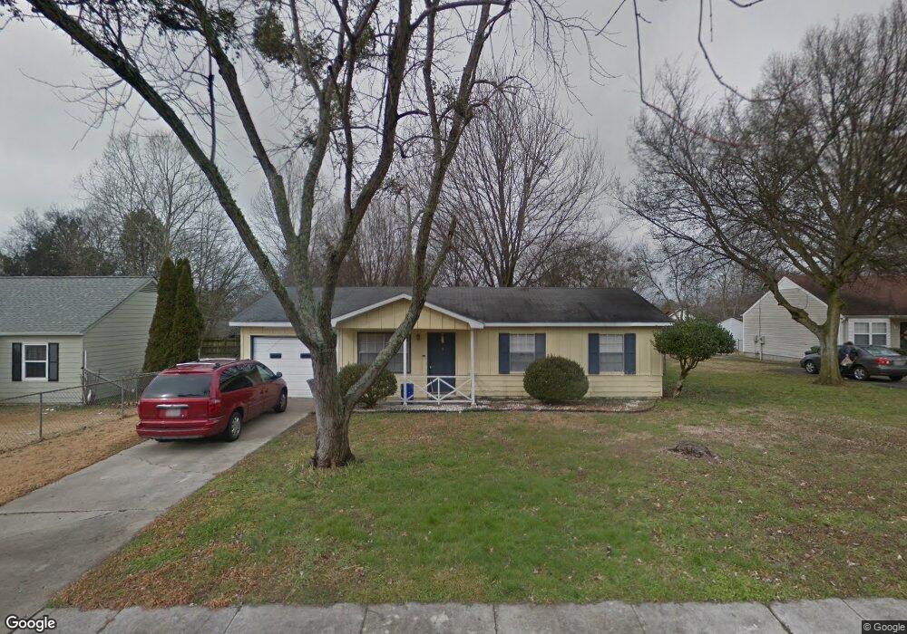
13922 Hurstland Dr SW Huntsville, AL 35803
Farley Community NeighborhoodEstimated Value: $181,000 - $192,000
--
Bed
--
Bath
988
Sq Ft
$186/Sq Ft
Est. Value
About This Home
This home is located at 13922 Hurstland Dr SW, Huntsville, AL 35803 and is currently estimated at $184,055, approximately $186 per square foot. 13922 Hurstland Dr SW is a home with nearby schools including Farley Elementary School, Challenger Middle School, and Virgil Grissom High School.
Ownership History
Date
Name
Owned For
Owner Type
Purchase Details
Closed on
Jul 11, 2025
Sold by
Steele James E and Steele Jennifer L
Bought by
Kornegay Kate
Current Estimated Value
Home Financials for this Owner
Home Financials are based on the most recent Mortgage that was taken out on this home.
Original Mortgage
$186,714
Outstanding Balance
$186,400
Interest Rate
6.89%
Mortgage Type
FHA
Estimated Equity
-$2,345
Create a Home Valuation Report for This Property
The Home Valuation Report is an in-depth analysis detailing your home's value as well as a comparison with similar homes in the area
Home Values in the Area
Average Home Value in this Area
Purchase History
| Date | Buyer | Sale Price | Title Company |
|---|---|---|---|
| Kornegay Kate | -- | None Listed On Document | |
| Kornegay Kate | -- | None Listed On Document |
Source: Public Records
Mortgage History
| Date | Status | Borrower | Loan Amount |
|---|---|---|---|
| Open | Kornegay Kate | $186,714 | |
| Closed | Kornegay Kate | $186,714 |
Source: Public Records
Tax History Compared to Growth
Tax History
| Year | Tax Paid | Tax Assessment Tax Assessment Total Assessment is a certain percentage of the fair market value that is determined by local assessors to be the total taxable value of land and additions on the property. | Land | Improvement |
|---|---|---|---|---|
| 2024 | $874 | $15,320 | $3,260 | $12,060 |
| 2023 | $841 | $27,220 | $6,500 | $20,720 |
| 2022 | $1,351 | $23,300 | $5,000 | $18,300 |
| 2021 | $1,058 | $18,240 | $5,000 | $13,240 |
| 2020 | $914 | $15,760 | $4,000 | $11,760 |
| 2019 | $893 | $15,400 | $4,000 | $11,400 |
| 2018 | $889 | $15,320 | $0 | $0 |
| 2017 | $862 | $14,860 | $0 | $0 |
| 2016 | $862 | $14,860 | $0 | $0 |
| 2015 | $862 | $14,860 | $0 | $0 |
| 2014 | $831 | $14,320 | $0 | $0 |
Source: Public Records
Map
Nearby Homes
- 2408 Yorkshire Dr SW
- 13927 Wyandotte Dr SW
- 2337 Clovis Rd SW
- 14016 Creely Dr SW
- 14001 Whitehurst Cir SW
- 14009 Hermosa Dr SW
- 2422 Quail Ridge Ln SW
- 59 acre SW Green Cove Rd
- 12311 Bell Rd SW
- 3010 Grand Lake Way SW
- 12622 Holstein Ln SW
- 2121 S Meadows Dr
- 2420 Belltown Dr SW
- 2510 Celia Ct SW
- 2520 Quail Ridge Ln SW
- 15143 Lakeside Trail SW
- 2113 S Meadows Dr
- 15032 Lakeside Trail SW
- 15127 Lakeside Trail SW
- 2611 Ashtynn Place SW
- 13924 Hurstland Dr SW
- 13920 Hurstland Dr SW
- 13926 Hurstland Dr SW
- 13923 Mariellen Rd SW
- 13921 Mariellen Rd SW
- 13923 Hurstland Dr SW
- 13925 Mariellen Rd SW
- 13928 Hurstland Dr SW
- 13916 Hurstland Dr SW
- 13919 Mariellen Rd SW
- 13927 Mariellen Rd SW
- 13917 Hurstland Dr SW
- 13915 Hurstland Dr SW
- 13917 Mariellen Rd SW
- 13927 Hurstland Dr SW
- 13929 Mariellen Rd SW
- 13914 Hurstland Dr SW
- 13930 Hurstland Dr SW
- 13931 Mariellen Rd SW
- 13929 Hurstland Dr SW