Estimated Value: $615,000 - $718,000
5
Beds
5
Baths
3,571
Sq Ft
$182/Sq Ft
Est. Value
About This Home
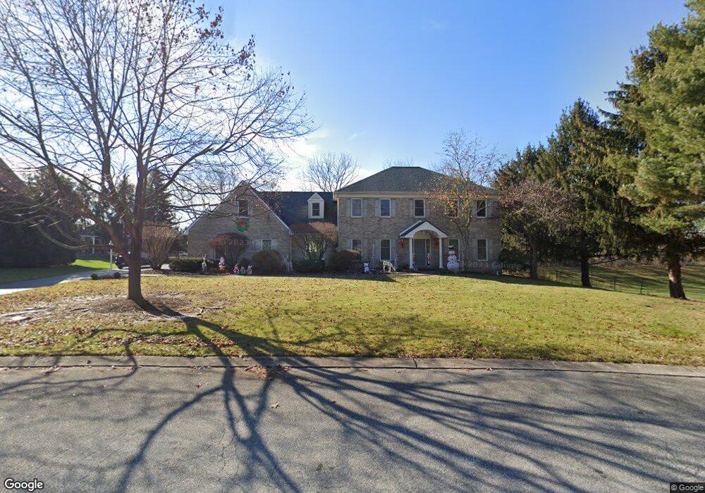
This home is located at 1395 Rosepointe Dr, York, PA 17404 and is currently estimated at $648,257, approximately $181 per square foot. 1395 Rosepointe Dr is a home located in York County with nearby schools including Central York High School, Christian School of York, and York Adventist Christian School.
Ownership History
Date
Name
Owned For
Owner Type
Purchase Details
Closed on
Jun 23, 2023
Sold by
Litsinger Jeffery B
Bought by
Besnoska Robert A and Litsinger Melanie M
Current Estimated Value
Home Financials for this Owner
Home Financials are based on the most recent Mortgage that was taken out on this home.
Original Mortgage
$120,000
Outstanding Balance
$116,768
Interest Rate
6.35%
Mortgage Type
New Conventional
Estimated Equity
$531,489
Purchase Details
Closed on
Oct 17, 1994
Sold by
Kauffman Gordon
Bought by
Litsinger Jeffery B and Litsinger Lesa A
Purchase Details
Closed on
Sep 2, 1992
Bought by
Kauffman Gordon
Create a Home Valuation Report for This Property
The Home Valuation Report is an in-depth analysis detailing your home's value as well as a comparison with similar homes in the area
Home Values in the Area
Average Home Value in this Area
Purchase History
| Date | Buyer | Sale Price | Title Company |
|---|---|---|---|
| Besnoska Robert A | $126,350 | None Listed On Document | |
| Besnoska Robert A | $126,350 | None Listed On Document | |
| Litsinger Jeffery B | $42,000 | -- | |
| Kauffman Gordon | $40,000 | -- |
Source: Public Records
Mortgage History
| Date | Status | Borrower | Loan Amount |
|---|---|---|---|
| Open | Besnoska Robert A | $120,000 | |
| Closed | Besnoska Robert A | $120,000 |
Source: Public Records
Tax History Compared to Growth
Tax History
| Year | Tax Paid | Tax Assessment Tax Assessment Total Assessment is a certain percentage of the fair market value that is determined by local assessors to be the total taxable value of land and additions on the property. | Land | Improvement |
|---|---|---|---|---|
| 2025 | $9,986 | $325,870 | $66,350 | $259,520 |
| 2024 | $9,701 | $325,870 | $66,350 | $259,520 |
| 2023 | $9,193 | $320,410 | $66,350 | $254,060 |
| 2022 | $9,045 | $320,410 | $66,350 | $254,060 |
| 2021 | $8,725 | $320,410 | $66,350 | $254,060 |
| 2020 | $8,725 | $320,410 | $66,350 | $254,060 |
| 2019 | $8,565 | $320,410 | $66,350 | $254,060 |
| 2018 | $8,379 | $320,410 | $66,350 | $254,060 |
| 2017 | $8,241 | $320,410 | $66,350 | $254,060 |
| 2016 | $0 | $320,410 | $66,350 | $254,060 |
| 2015 | -- | $320,410 | $66,350 | $254,060 |
| 2014 | -- | $320,410 | $66,350 | $254,060 |
Source: Public Records
Map
Nearby Homes
- 1350 Briargate Dr
- 1425 Brittany Dr
- 1300 Garrison Dr
- 1305 Detwiler Dr
- 2547 Hepplewhite Dr
- 1375 Detwiler Dr
- 1055 Wetherburn Dr
- 2553 Roosevelt Ave
- 937 Wetherburn Dr
- 929 Bedford Rd
- 1005 Gleneagles Dr
- 2711 Rosebay Dr
- 857 Willow Ridge Ct
- 1473 Windemere Place
- GALEN Plan at Fox Run Heights
- HENLEY Plan at Fox Run Heights
- PENWELL Plan at Fox Run Heights
- NEUVILLE Plan at Fox Run Heights
- 160 Bella Dr
- 170 Bella Dr
- 1383 Rosepointe Dr
- 1390 Rosepointe Dr
- 1382 Rosepointe Dr
- 1373 Rosepointe Dr
- 1250 Needham Cir E
- 1262 Needham Cir E
- 1372 Rosepointe Dr
- 1385 Briargate Dr
- 1238 Needham Cir E
- 1375 Briargate Dr
- 1363 Rosepointe Dr
- 1251 Needham Cir E
- 1365 Briargate Dr
- 1274 Needham Cir E
- 1275 Needham Cir E
- 1415 Rosepointe Dr
- 1362 Rosepointe Dr
- 1226 Needham Cir E
- 1227 Needham Cir E
- 1353 Rosepointe Dr