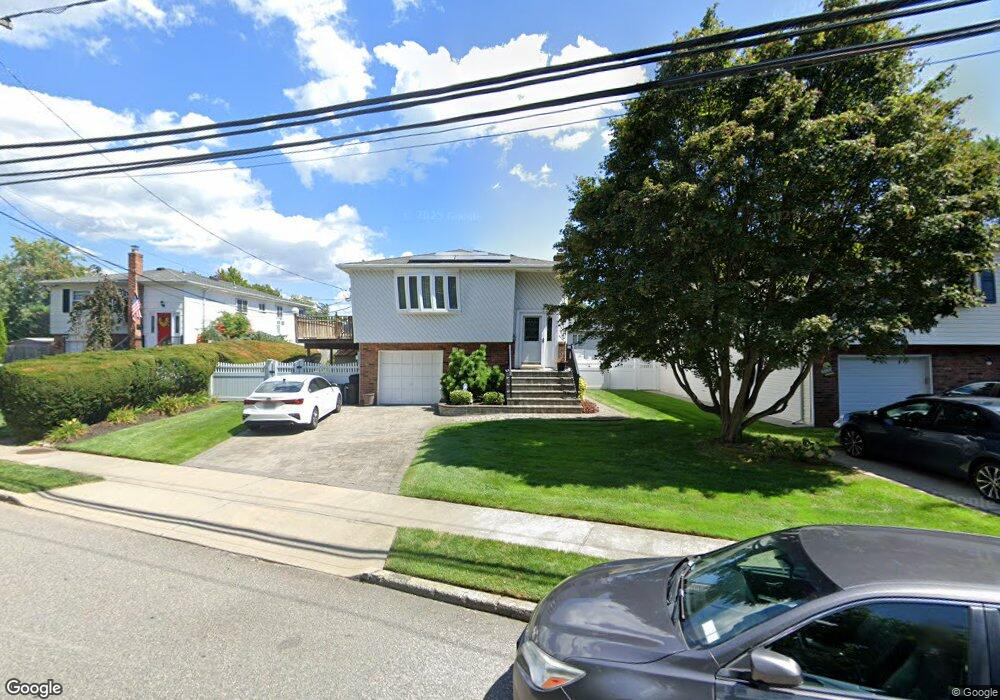
1395 Seamans Neck Rd Seaford, NY 11783
Estimated Value: $769,234 - $791,000
5
Beds
2
Baths
1,086
Sq Ft
$718/Sq Ft
Est. Value
About This Home
This home is located at 1395 Seamans Neck Rd, Seaford, NY 11783 and is currently estimated at $780,117, approximately $718 per square foot. 1395 Seamans Neck Rd is a home located in Nassau County with nearby schools including Seaford Middle School, Seaford Senior High School, and Maria Regina Elementary School.
Ownership History
Date
Name
Owned For
Owner Type
Purchase Details
Closed on
Jan 19, 2022
Sold by
Foresee Properties Llc
Bought by
1395 Seamans Neck Llc
Current Estimated Value
Purchase Details
Closed on
Apr 30, 2015
Sold by
Arnone Angela and Arnone Anthony
Bought by
Forsee Properties Llc
Purchase Details
Closed on
Mar 8, 2010
Sold by
Arnone Anthony
Bought by
Arnone Anthony
Purchase Details
Closed on
Mar 20, 2003
Sold by
Arnone Anthony
Purchase Details
Closed on
Feb 9, 1998
Sold by
Wu Chung Wei
Bought by
Arnone Anthony and Arnone Angela
Create a Home Valuation Report for This Property
The Home Valuation Report is an in-depth analysis detailing your home's value as well as a comparison with similar homes in the area
Home Values in the Area
Average Home Value in this Area
Purchase History
| Date | Buyer | Sale Price | Title Company |
|---|---|---|---|
| 1395 Seamans Neck Llc | -- | None Available | |
| Forsee Properties Llc | $410,000 | None Available | |
| Arnone Anthony | -- | -- | |
| -- | -- | -- | |
| Arnone Anthony | $195,000 | -- |
Source: Public Records
Tax History Compared to Growth
Tax History
| Year | Tax Paid | Tax Assessment Tax Assessment Total Assessment is a certain percentage of the fair market value that is determined by local assessors to be the total taxable value of land and additions on the property. | Land | Improvement |
|---|---|---|---|---|
| 2025 | $13,740 | $460 | $171 | $289 |
| 2024 | $3,453 | $458 | $170 | $288 |
| 2023 | $12,727 | $468 | $174 | $294 |
| 2022 | $12,727 | $468 | $174 | $294 |
| 2021 | $16,911 | $460 | $171 | $289 |
| 2020 | $11,703 | $588 | $521 | $67 |
| 2019 | $3,101 | $630 | $558 | $72 |
| 2018 | $7,852 | $656 | $0 | $0 |
| 2017 | $10,020 | $870 | $587 | $283 |
| 2016 | $14,381 | $870 | $587 | $283 |
| 2015 | $3,275 | $870 | $587 | $283 |
| 2014 | $3,275 | $870 | $587 | $283 |
| 2013 | $3,060 | $870 | $587 | $283 |
Source: Public Records
Map
Nearby Homes
- 3783 Charlotte Ct
- 3771 Jerusalem Ave
- 3737 Maxwell Dr
- 3694 Maxwell Dr
- 1441 Roth Rd
- 1475 Gaston St
- 1420 Poulson St
- 3773 Arthur Ave W
- 3914 Jerusalem Ave
- 3592 Southview Ave
- 1555 Henry Rd
- 3970 Worthmor Dr
- 3562 Southview Ave
- 1480 Adam Place
- 3902 Beechwood Place
- 3556 Centerview Ave
- 1427 Washington Ave
- 3975 Anne Dr
- 3860 Maplewood Dr
- 1605 Henry Rd
- 1401 Seamans Neck Rd
- 1389 Seamans Neck Rd
- 1370 Sidney Ct
- 1407 Seamans Neck Rd
- 1376 Sidney Ct
- 1366 Sidney Ct
- 1411 Seamans Neck Rd
- 1380 Sidney Ct
- 1362 Sidney Ct
- 1385 Sidney Ct
- 3751 Mill Rd
- 1384 Sidney Ct
- 3749 Mill Rd
- 3755 Mill Rd
- 1358 Sidney Ct
- 1425 Seamans Neck Rd
- 3767 Mill Rd
- 1391 Sidney Ct
- 3773 Mill Rd