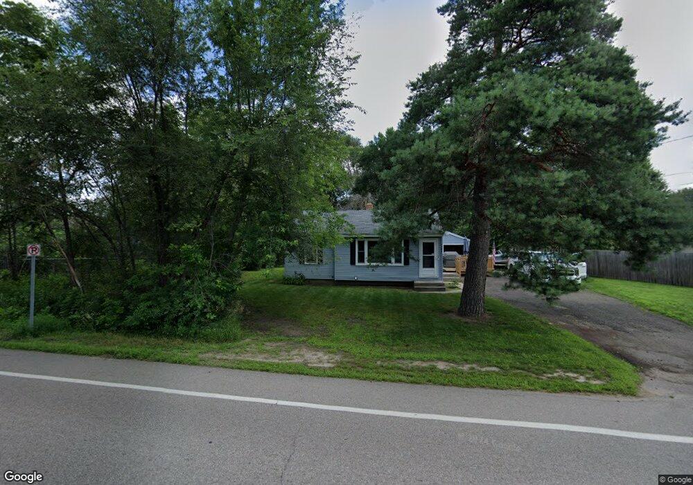
1397 County Road B E Saint Paul, MN 55109
Sherwood Glen NeighborhoodEstimated Value: $282,000 - $318,000
3
Beds
1
Bath
1,154
Sq Ft
$259/Sq Ft
Est. Value
About This Home
This home is located at 1397 County Road B E, Saint Paul, MN 55109 and is currently estimated at $298,577, approximately $258 per square foot. 1397 County Road B E is a home located in Ramsey County with nearby schools including Weaver Elementary School, John Glenn Middle School, and Presentation Of Mary School.
Ownership History
Date
Name
Owned For
Owner Type
Purchase Details
Closed on
Apr 28, 2015
Sold by
Gullickson Homes Inc
Bought by
Bergstrom James Allen
Current Estimated Value
Home Financials for this Owner
Home Financials are based on the most recent Mortgage that was taken out on this home.
Original Mortgage
$134,800
Interest Rate
3.82%
Mortgage Type
New Conventional
Purchase Details
Closed on
Jan 26, 2015
Sold by
Olson Donald Donald
Create a Home Valuation Report for This Property
The Home Valuation Report is an in-depth analysis detailing your home's value as well as a comparison with similar homes in the area
Home Values in the Area
Average Home Value in this Area
Purchase History
| Date | Buyer | Sale Price | Title Company |
|---|---|---|---|
| Bergstrom James Allen | $143,212 | Titlesmart Inc | |
| -- | $52,000 | -- |
Source: Public Records
Mortgage History
| Date | Status | Borrower | Loan Amount |
|---|---|---|---|
| Previous Owner | Bergstrom James Allen | $134,800 |
Source: Public Records
Tax History Compared to Growth
Tax History
| Year | Tax Paid | Tax Assessment Tax Assessment Total Assessment is a certain percentage of the fair market value that is determined by local assessors to be the total taxable value of land and additions on the property. | Land | Improvement |
|---|---|---|---|---|
| 2025 | $3,688 | $292,200 | $57,100 | $235,100 |
| 2023 | $3,688 | $269,900 | $57,100 | $212,800 |
| 2022 | $3,202 | $258,500 | $57,100 | $201,400 |
| 2021 | $3,198 | $227,700 | $57,100 | $170,600 |
| 2020 | $3,146 | $231,700 | $57,100 | $174,600 |
| 2019 | $2,604 | $214,700 | $57,100 | $157,600 |
| 2018 | $2,548 | $185,200 | $57,100 | $128,100 |
| 2017 | $2,388 | $177,500 | $57,100 | $120,400 |
| 2016 | $1,998 | $0 | $0 | $0 |
| 2015 | $1,818 | $140,900 | $52,400 | $88,500 |
| 2014 | $1,666 | $0 | $0 | $0 |
Source: Public Records
Map
Nearby Homes
- 1467 County Road B E
- 1496 Laurie Rd E
- 1509 Sandhurst Ave E
- 1247 Lealand Rd E
- 1940 Barclay St
- 1666 Laurie Rd E
- 1984 Prosperity Rd
- 2420 Hazelwood St
- 1201 Frost Ave
- 1869 Birmingham St
- 1870 Clarence St
- 1854 Barclay St
- 1937 Flandrau St
- 1849 Kennard St
- 1751 Clarence St
- 1018 Sextant Ave
- 1740 English St
- 1435 Price Ave
- 1779 Frank St
- 1856 Flandrau St
- 2181 Birmingham St
- 1407 County Road B E
- 2191 Birmingham St
- 2210 Ide Ct
- 1422 Sandhurst Dr E
- 2201 Birmingham St
- 2216 Ide Ct
- 1423 County Road B E
- 2205 Ide Ct
- 1423 Sandhurst Ave E
- 1428 Sandhurst Dr E
- 1423 Sandhurst Dr E
- 1429 County Road B E
- 1394 Laurie Rd E
- 1396 Laurie Rd E
- 2220 Ide Ct
- 1429 Sandhurst Dr E
- 1434 Sandhurst Dr E
- 2211 Ide Ct
- 1435 County Road B E