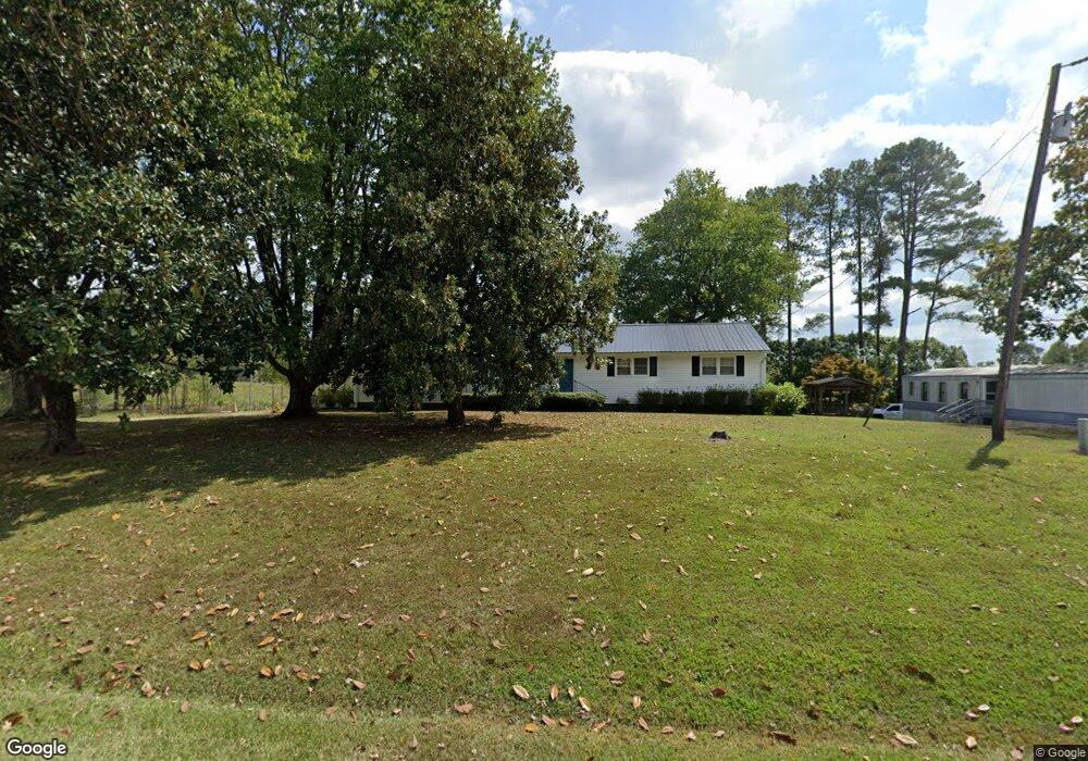
1398 Nc 561 Hwy Louisburg, NC 27549
Estimated Value: $259,000 - $366,232
4
Beds
2
Baths
1,878
Sq Ft
$176/Sq Ft
Est. Value
About This Home
This home is located at 1398 Nc 561 Hwy, Louisburg, NC 27549 and is currently estimated at $331,058, approximately $176 per square foot. 1398 Nc 561 Hwy is a home located in Franklin County with nearby schools including Louisburg Elementary School, Terrell Lane Middle School, and Louisburg High School.
Ownership History
Date
Name
Owned For
Owner Type
Purchase Details
Closed on
Sep 12, 2025
Sold by
Hudson Billy and Hudson Harold B
Bought by
Alford Isaac C and Alford Judy W
Current Estimated Value
Purchase Details
Closed on
Apr 20, 2022
Sold by
Hudson Harold B and Hudson Cathy
Bought by
Rabil Edmond
Purchase Details
Closed on
Sep 29, 2015
Sold by
Hudson Harold B and Hudson Carolyn H
Bought by
Schiffel Catherine H and Dower Laura H
Purchase Details
Closed on
Mar 11, 2009
Sold by
Hudson Harold B and Hudson Carolyn
Bought by
Alford Isaac C and Alford Judy
Create a Home Valuation Report for This Property
The Home Valuation Report is an in-depth analysis detailing your home's value as well as a comparison with similar homes in the area
Home Values in the Area
Average Home Value in this Area
Purchase History
| Date | Buyer | Sale Price | Title Company |
|---|---|---|---|
| Alford Isaac C | -- | None Listed On Document | |
| Rabil Edmond | -- | Norman Larry E | |
| Rabil Edmond | -- | Norman Larry E | |
| Schiffel Catherine H | -- | None Available | |
| Alford Isaac C | -- | None Available |
Source: Public Records
Tax History Compared to Growth
Tax History
| Year | Tax Paid | Tax Assessment Tax Assessment Total Assessment is a certain percentage of the fair market value that is determined by local assessors to be the total taxable value of land and additions on the property. | Land | Improvement |
|---|---|---|---|---|
| 2025 | $1,859 | $290,280 | $107,980 | $182,300 |
| 2024 | $1,859 | $290,280 | $107,980 | $182,300 |
| 2023 | $1,301 | $134,990 | $35,660 | $99,330 |
| 2022 | $1,291 | $134,990 | $35,660 | $99,330 |
| 2021 | $1,305 | $134,990 | $35,660 | $99,330 |
| 2020 | $1,299 | $134,990 | $35,660 | $99,330 |
| 2019 | $1,285 | $134,990 | $35,660 | $99,330 |
| 2018 | $1,284 | $134,990 | $35,660 | $99,330 |
| 2017 | $857 | $79,510 | $31,470 | $48,040 |
| 2016 | $885 | $79,510 | $31,470 | $48,040 |
| 2015 | $881 | $79,510 | $31,470 | $48,040 |
| 2014 | $814 | $79,510 | $31,470 | $48,040 |
Source: Public Records
Map
Nearby Homes
- 376 T K Allen Rd
- 592 Perdues Rd
- 45 Leisure Ln
- 55 Leisure Ln
- 70 Leisure Ln
- 2329 N Carolina 561
- 109 Drew St
- 08 Tillery Dr
- 06 Tillery Dr
- 7.69 Acres N Carolina 561
- 23.20 Acre N Carolina 561
- 10.26 Acre N Carolina 561
- 11 Tillery Dr
- 09 Tillery Dr
- 0 Zinnia Ct Unit 10129898
- 0-0 Halifax Rd
- 491 Nc 56 Hwy E
- 126 Person St
- 311 Nc 56 Hwy E
- 125 Davis St
- 83 Perdues Rd
- 109 Perdues Rd
- 127 Perdues Rd
- 125 Perdues Rd
- 53 Perdues Rd
- 1435 Nc 561 Hwy
- 36 Thomas Way
- 129 Perdues Rd
- 1439 Nc 561 Hwy
- 0 Thomas Way Unit TR1681773
- 0 Thomas Way
- 44 Thomas Way
- 157 Perdues Rd
- 1471 Nc 561 Hwy
- 177 Perdues Rd
- 1483 Nc 561 Hwy
- 1287 Nc 561 Hwy
- 201 Perdues Rd
- 1499 Nc 561 Hwy
- 1503 Nc 561 Hwy