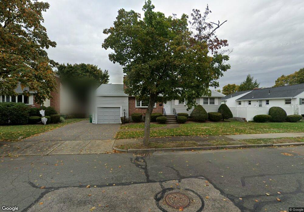
14 Anthony Rd Newtonville, MA 02460
Nonantum NeighborhoodEstimated Value: $1,156,000 - $1,335,369
3
Beds
2
Baths
1,298
Sq Ft
$929/Sq Ft
Est. Value
About This Home
This home is located at 14 Anthony Rd, Newtonville, MA 02460 and is currently estimated at $1,206,342, approximately $929 per square foot. 14 Anthony Rd is a home located in Middlesex County with nearby schools including Horace Mann Elementary School, F.A. Day Middle School, and Newton North High School.
Create a Home Valuation Report for This Property
The Home Valuation Report is an in-depth analysis detailing your home's value as well as a comparison with similar homes in the area
Home Values in the Area
Average Home Value in this Area
Tax History Compared to Growth
Tax History
| Year | Tax Paid | Tax Assessment Tax Assessment Total Assessment is a certain percentage of the fair market value that is determined by local assessors to be the total taxable value of land and additions on the property. | Land | Improvement |
|---|---|---|---|---|
| 2025 | $8,164 | $833,100 | $827,700 | $5,400 |
| 2024 | $7,894 | $808,800 | $803,600 | $5,200 |
| 2023 | $7,354 | $722,400 | $609,900 | $112,500 |
| 2022 | $7,037 | $668,900 | $564,700 | $104,200 |
| 2021 | $6,790 | $631,000 | $532,700 | $98,300 |
| 2020 | $6,588 | $631,000 | $532,700 | $98,300 |
| 2019 | $6,402 | $612,600 | $517,200 | $95,400 |
| 2018 | $11,326 | $541,600 | $468,500 | $73,100 |
| 2017 | $5,681 | $510,900 | $442,000 | $68,900 |
| 2016 | $5,434 | $477,500 | $413,100 | $64,400 |
| 2015 | $5,182 | $446,300 | $386,100 | $60,200 |
Source: Public Records
Map
Nearby Homes
- 1 Farwell Cir
- 177 Nevada St
- 3 Repton Cir Unit 3204
- 76 Harding St
- 191 Linwood Ave
- 57 Walnut St
- 76 Taft Ave Unit 1
- 76 Taft Ave
- 76 Taft Ave Unit 2
- 286 Nevada St Unit 286
- 282 Nevada St Unit 282
- 354 Linwood Ave Unit 1
- 321 Albemarle Rd
- 611 Watertown St Unit 14
- 10 Naviens Ln Unit 2
- 75 Cherry St
- 176 River St
- 32-34 Rossmere St
- 135 Grove St Unit 135
- 164 Grove St