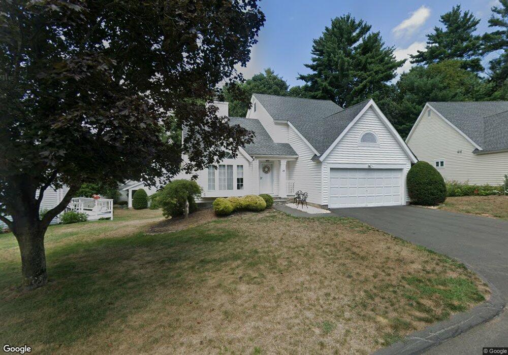
14 Southbridge Ct Simsbury, CT 06070
Estimated Value: $415,963 - $547,000
3
Beds
4
Baths
1,596
Sq Ft
$291/Sq Ft
Est. Value
About This Home
This home is located at 14 Southbridge Ct, Simsbury, CT 06070 and is currently estimated at $463,991, approximately $290 per square foot. 14 Southbridge Ct is a home located in Hartford County with nearby schools including Central School, Henry James Memorial School, and Simsbury High School.
Ownership History
Date
Name
Owned For
Owner Type
Purchase Details
Closed on
Jul 12, 2013
Sold by
Ibanez Carlos R
Bought by
Ibanez Carlos R and Ibanez Tatiana R
Current Estimated Value
Home Financials for this Owner
Home Financials are based on the most recent Mortgage that was taken out on this home.
Original Mortgage
$267,850
Outstanding Balance
$194,023
Interest Rate
3.83%
Estimated Equity
$269,968
Purchase Details
Closed on
Jun 21, 2005
Sold by
Goodrich Samuel B and Goodrich Kathlene J
Bought by
Ibanez Carlos R
Home Financials for this Owner
Home Financials are based on the most recent Mortgage that was taken out on this home.
Original Mortgage
$296,000
Interest Rate
5.78%
Purchase Details
Closed on
Dec 9, 1987
Sold by
Stratton Forest Ltd
Bought by
Rees Jack
Create a Home Valuation Report for This Property
The Home Valuation Report is an in-depth analysis detailing your home's value as well as a comparison with similar homes in the area
Home Values in the Area
Average Home Value in this Area
Purchase History
| Date | Buyer | Sale Price | Title Company |
|---|---|---|---|
| Ibanez Carlos R | -- | -- | |
| Ibanez Carlos R | $370,000 | -- | |
| Rees Jack | $243,000 | -- |
Source: Public Records
Mortgage History
| Date | Status | Borrower | Loan Amount |
|---|---|---|---|
| Open | Rees Jack | $267,850 | |
| Previous Owner | Rees Jack | $284,427 | |
| Previous Owner | Rees Jack | $296,000 | |
| Previous Owner | Rees Jack | $140,000 |
Source: Public Records
Tax History Compared to Growth
Tax History
| Year | Tax Paid | Tax Assessment Tax Assessment Total Assessment is a certain percentage of the fair market value that is determined by local assessors to be the total taxable value of land and additions on the property. | Land | Improvement |
|---|---|---|---|---|
| 2025 | $8,422 | $246,540 | $0 | $246,540 |
| 2024 | $8,212 | $246,540 | $0 | $246,540 |
| 2023 | $7,845 | $246,540 | $0 | $246,540 |
| 2022 | $6,859 | $177,560 | $0 | $177,560 |
| 2021 | $6,859 | $177,560 | $0 | $177,560 |
| 2020 | $6,586 | $177,560 | $0 | $177,560 |
| 2019 | $6,627 | $177,560 | $0 | $177,560 |
| 2018 | $6,674 | $177,560 | $0 | $177,560 |
| 2017 | $6,592 | $170,080 | $0 | $170,080 |
| 2016 | $6,313 | $170,080 | $0 | $170,080 |
| 2015 | $6,313 | $170,080 | $0 | $170,080 |
| 2014 | $6,317 | $170,080 | $0 | $170,080 |
Source: Public Records
Map
Nearby Homes
- 16 Stratton Forest Way
- 3 Stebbins Brook Ln
- 4 Stebbins Brook Ln
- 40 Firetown Rd Unit 39
- 1 West St Unit 206
- 48 Library Ln Unit 48
- 18 Meadowlark Rd
- 15 Sand Hill Rd
- 141 Firetown Rd
- 308 Hopmeadow St
- 25 Barry Ln
- 301 Bushy Hill Rd
- 3 Cobtail Way
- 15 Pinnacle Mountain Rd
- 9 Cobtail Way
- 10 Sachems Trail
- 26 Red Stone Dr
- 3 Minister Brook Dr
- 26 Winterset Ln
- 8 Quorn Hunt Rd
- 6 Southbridge Ct
- 12 Southbridge Ct
- 16 Southbridge Ct
- 32 Southbridge Ct
- 18 Southbridge Ct
- 10 Southbridge Ct
- 26 Southbridge Ct
- 8 Southbridge Ct
- 24 Southbridge Ct
- 34 Southbridge Ct
- 30 Southbridge Ct
- 28 Southbridge Ct
- 24 Southbridge Ct Unit 24
- 34 Southbridge Ct Unit 34
- 18 Southbridge Ct Unit 18
- 28 Southbridge Ct Unit 28
- 10 Southbridge Ct Unit 10
- 16 Southbridge Ct Unit 16
- 26 Southbridge Ct Unit 26
- 14 Southbridge Ct Unit 14